Tuesday, November 29, 2016

Heat, flies and double hutting - Denmark to Albany


From Denmark the Bibbulman Track requires a water crossing of the Inlet. The sandbar is open, and crossing there is somewhat hazardous and a lot longer route than paying for a ride across from the caravan park. But the boat ride costs $160, which for most walkers is too high a price to pay, so the usual method of crossing the inlet is to get a lift around by car. I am initially concerned about keeping to the "true" track, but since this route is merely the latest in a list of ways to get across (there used to be a cheaper boat option, the sandbar crossing has now been signposted, and getting a car around also seems to be legitimate) I decided to take the car.

Day 57 - Denmark to Nullaki (2.5 km)

It was a filthy hot day and not the sort of day to go exerting oneself walking a snake infested swamp just to prove a point. So I didn't. At 2:00 pm after yet another wonderful cooked breakfast and coffee at the many choices for cafes in Denmark, I got the hostel owner to drive me around to the other side of the inlet and I walked a few hot sweaty kilometres to the hut. I planned to start early the next morning.


Day 58 - Nullaki to Torbay ( 33.6 km)

Nullaki campsite was a March fly and mosquito infested hellhole. My saviour was my mosquito net, the only place of refuge from the biting demons. I was woken before dawn by the deafening whine of those little bastards so I dressed, hastily breakfasted and got the hell out of there by 5 am.

It hasn't been my practice to get up early on this walk, but with temperatures now rising in late November, and the arrival of the March flies, there's no longer any joy to be had mooching around a campsite having a leisurely breakfast with espresso coffee. Instead it's a single shot, a gulped down muesli and onwards to Albany ....

The walk from Nullaki to West Cape Howe campsite takes me a little over 4 hours. Not bad for 17 km. The vegetation is the same old dune heath, with some very healthy banksias not affected by dieback, but there are few views except back over the inlet to Denmark. 


It's a grey, overcast day, perfect for walking, so after scoffing 2 muesli bars at the hut and chasing away those green eyed monsters I decide that another 16.6 km needs to be walked to the next hut. It's only 9:30 am and those March flies are killing me!!


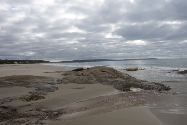
Walk it I do. The first 10 km is as boring as the last 17, but in the final 6 km comes beautiful views and pretty beaches. But I am whacked! Too whacked to walk down the hill then up again for a swim, I admire the azure waters and golden sand from a distance.


Torbay campsite is in a gorgeous location, overlooking some small islands and a huge bay with wind turbines turning in the distance, my destination for tomorrow.

Day 59 - Torbay to Sandpatch (24 km)

I am not attacked quite as ferociously here, so manage to enjoy my muesli and single shot espresso before breaking camp just after 6 am. It's going to be a warm one however.

Today I must cross the final inlet, after walking along the beach for a few kilometres. I am looking forward to wading across the small Torbay inlet, supposedly knee to waist deep depending on the tide. I am happy to see that the tide is quite low as I head off from Cosy Corner.


I am devastated to discover that the inlet is closed. No wading, no wet feet! Somehow I don't figure I could just take my shoes and socks off anyway. I walk off the beach and leave that opportunity behind!!


I arrive at Mutton Bird campsite at 9:30, and again scoff a muesli bar, sign the register and keep going. But not before being attacked by mosquitoes. It's only been 12 km, and there's 12 more to do, and the temperature is rising. I need to keep going.....


The walk now hugs the cliffs, looking down to some beautiful surf beaches, and up to the huge wind turbines that line this section of the coast. As they gently turn I am awed by nature and how we can harness it for our use.


The heat and lack of shade is getting to me. I am protected from the myriad bush flies by my face net, but I am no longer enjoying this walk at all. At last the observation deck at the end of the wind farm comes in to view and I stop for a while to watch dolphins surfing and to contemplate.


Another 3 km and I am at the campsite. I cook my final supper and go to bed before dark. I wake at 11 pm and notice how light it is, only to realise it is the light pollution from Albany.


Day 60 - Sandpatch to Albany (12.5 km)

It rains overnight, just like it rained on my first night. The flies and mozzies aren't so bad first thing so I have a leisurely cooked breakfast and two shots of coffee before farewelling my final hut and marching in to Albany.


I arrive at 9 am, almost in time to jump straight on the Perth bound bus, but I've yet to sign the final register or take the most important photo of all!


I did it! I walked 1000km from Kalamunda near Perth to Albany on the south coast. And it is possibly one of the best experiences of my life. 

I am elated, but sad it is over. For the last 60 days I've had little else to do but walk eat and sleep. I've met so many wonderful people, not only my fellow Bibbulman walkers, but tourists, locals, hostel owners, track volunteers and DPaW staff, who have all added to the experience of walking the Bibbulman Track.

Anyone can walk this track, there's even a wheelchair accessible section. It's 100% free, and not at all difficult, though tackling the whole thing does take some preparation.

But in the end, it really is as simple as hoisting a backpack on your back and putting one foot in front of the other....


Friday, November 25, 2016

Remnants of Gondwanaland - Walpole to Denmark


The stretch of coastline around Walpole was where the ancient landmass of Gondwana split. Australia moved northwards and Antarctica migrated to the South Pole. The same rocks as you see in this region can be seen in Antarctica, and some of the vegetation harks back to those ancient wet rainforests.


My rest day in Walpole was spent being entertained in the morning with a boat cruise run by the quite amazing Gary Muir. His enthusiasm for nature conservation, his incredible knowledge of history, geology, anthropology, botany and environmental science is augmented by his extremely entertaining presentation. Think Steve Irwin but with brains, a really extensive knowledge, and not an egotistical bogan. 


Gary also runs a wildlife reserve which is helping to protect the native quoll (Australia's native cat) from feral cats and foxes, and has designed cleaning stations to prevent the spread of Phytopthera species, a water mould found in soil which causes root rot and plant death. In WA we get dieback, which particularly affects banksia species, in North America another Phytopthera  causes sudden oak death which is devastating their remaining native oak trees. There's no effective treatment, so preventing it's spread through cleaning of shoes and vehicle tyres is the current strategy.

So enough about Walpole. Off on the track....

Day 48 - Walpole to Frankland River (17.6 km)

With the week forecast to be cooler temperatures I didn't leave until 9am. The first part of the track meandered down to Coalmine Beach on the Inlet through an area that had recently had a prescribed burn. Fuel load reduction through regular prescribed burning is a strategy used to prevent devastating bushfires, but walking through a recently burnt area is pretty depressing..


From Coalmine Beach the track crosses the highway and heads in to the Tingle forests. These giant trees are a remnant of the great Gondwana rainforests, but have adapted to the dryer climate and are amazingly fire resistant. Their huge bases can get their middles burned out, but because the sap flows close to the bark surface, they survive and keep growing. This one was burnt out in 1939!


The beauty of the Bibbulman Track through this section is it passes right by the tourist attractions, so you don't miss out! In fact the walk gives you a greater exposure to these massive giants of the tree world.


Frankland River hut is by a lovely river, which I share with a school group. There are many different school groups walking the track in sections, it's great to see so many kids getting to experience such a wonderful resource for free.


Day 49 - Frankland River to Giants ( 13.7 km)

A short day walking through the Tingle Forests, through the Valley of the Giants to the Treetop Walk. I've done the walk before (highly recommended) so I just have an ice cream before finishing the final couple of kilometres to the hut. I pass a team from DPaW clearing fallen trees and debris from the track and stop to thank them for their efforts. We are so fortunate to have this long distance track which is generally well maintained and costs absolutely nothing.

I am joined at the hut by the same school group and another End to Ender, Claire, who isn't exactly the most sociable creature, and is yet another of the crazies who get up before dawn and walk close to 12 hours most days. When you walk slowly like me you don't get to meet the others walking at a similar pace, because you never catch up to them, and they don't catch up to you. You read about the ones ahead of you, and the fast walkers tell you about the ones behind you, but mostly you meet the double and triple hutters. They are nice people, just time and destination driven. I realise I am neither. I am primarily a journeywoman.

Day 50 - Giants to Rame Head (18.5 km)

I got up early, assisted by being woken up before dawn by Claire, who was gone before 5am. I left at 7. The walk left the Tingle forests behind, crossing the highway back to the coast, passing through stands of she-oaks, jarrah and red flowering gum.


And then it was back into the sand dunes.


Most of the way to the coast the track followed swales rather than ridges, which are much shadier with peppermint groves, kangaroo paws, scaevola and other flowering shrubs.


Then just before the beach the ridges afforded some gorgeous views.


I had lunch at Conspicuous Cliffs before hitting the beach, which was soft sand and quite hard going. Then there was a long long climb, with many switchbacks, up behind and past the Cliffs to Rame Head and the hut. The views!!


I got to Rame Head before 1 pm, and resisted the urge to continue a further 12 km to Peaceful Bay. I was rewarded with some unique wildlife encounters, including the resident tiger snake and a kangaroo and joey. All seemed accustomed to human presence and as long as I threatened neither, no one was harmed. Feeling comfortable about spending a night alone with a venomous reptile is a new achievement to add to my résumé!!


Day 51 - Rame Head to Peaceful Bay (12.4 km)

After breakfast and bravely walking past Mrs Snake to wash my dishes whilst she sunbaked, I packed and bid her farewell ( she literally lifted her head and gave me a little farewell nod) and was on my way. The walk was short, over dunes and down to the beach, around some rocks where whale bones had washed ashore, and along the beaches to Peaceful Bay.


I had very tasty fresh fish and chips, picked up my food drop, then checked in at the chalets for the night. Binge watched the Food Channel on TV all evening!

I am eating really well on the Track, but have still  lost a substantial amount of weight, and have become somewhat obsessed with food. I have heard that this is pretty normal, and am very happy with my slimmer physique.

Day 52 - Peaceful Bay to Boat Harbour (24 km)


Up early and out the door at 6 am as I was expecting the day to be long and difficult. It's a rather circuitous route out of town, skirting the rubbish tip in order to avoid walking through a swamp or having to walk along the sealed road. Once on the route heading east, it was a good one and a half hours to the boatshed.


In order to continue eastward there are a number of inlets to cross. And to cross Irwin Inlet you paddle a canoe. Pretty cool hey? Once across you often need to tow another canoe back across so there are adequate numbers of canoes on both sides, so it's not uncommon to paddle the inlet three times. With no wind it was very relaxing.


From the boatshed on the eastern shore the track goes through an ecosystem of rolling hills, low vegetation and a large kangaroo population. It resembles parklands, and has been given the name "The Showgrounds ". It was indeed beautiful, although the flowers were past their prime.


As the track neared the beach the sanddunes got steeper and softer, and then suddenly you descended to Quarram  Beach.


From here the track followed the beach, occasionally climbing up and over some rocks and back to the beach again.


From Middle Quarram Beach it was back into the dunes again. Up and down, up and down, soft sand, hard sand, some steps on the really steep dunes, others quite slippery with precipitous drops.


I got to the hut around 2pm. Surprisingly I felt great, and what I'd expected to be a really tough day didn't tax me too much after all. I am obviously getting fitter and stronger.


I am joined at the hut by Andrew, a sectional End to Ender, who although nice enough is the first sleaze ball I have met the entire trip. I am extremely thankful when at 5:30 another 2 walkers turn up and I don't have to confront Andrew regarding his behaviour, as he immediately curbs it and goes off to bed. I enjoy a pleasurable evening chatting to Chris and Alexa whilst scoffing their gingernut biscuits!

Day 53 - Boat Harbour to Parry Beach (12.7 km)

Today I indulged myself by doing something known as "half hutting " where you don't even walk between 2 huts in one day. I'd been to Parry Beach before, and had decided to enjoy a night camped in the peppermint trees by the beach before heading further east. Plus I planned a lazy beach day for tomorrow.


The walk from Boat Harbour hut skirts the very pretty Boat Harbour beach before climbing over a headland to the next beach and then climbing a staircase into an apocalyptic landscape. 


The area from here to Parry Beach has been entirely denuded by a prescribed burn about 3 weeks ago. It is extremely depressing walking, and tough without any shade.


I get to Parry Beach by 11:30 and set myself up in the hikers shelter near the rear toilet block. The caretakers really look after the Bibbulman walkers, offering me tea and scones, and even freshly caught fish fillets. I also chat to other campers, who similarly ply me with tea and biscuits! I am reminded of Hazel, who used to do the rounds of the campers at Coronation Beach for pats and snacks!


Day 54 - Parry Beach to William Bay (8.9 km)

The ultimate indulgence of half hutting is to walk 7km along a beach and spend the next 3 hours swimming, sun baking, rock hopping, reading and having lunch. Once the sun gets too much it's up the big sandy hill to the hut, with great views back to Greens Pool from the granite tors.


It's also a great spot to watch the sunset, which I share with Megan, who is walking the Walpole to Denmark section having just completed her second year medical exams.


Day 55 - William Bay to Denmark (21.5 km)

We are both up early, woken by the birds and the pesky March flies. I leave at 6:30, Megan having left even earlier. The walk is lovely along the dunes and down to the beach at Lights Beach, where I see a huge flock of black cockatoos up close and a few too many tiger snakes!


From Lights Beach the Track begins to head inland and across the highway to climb over Monkey Rock and Mt Hallowell. I meet some rock climbers, scare a few more tiger snakes, and take some cheesy selfies from the summit.


Then it's downhill in to Denmark, the walk in to town being somewhat tedious skirting residential housing as the midday temperature rises. The tourist office is inconveniently situated out on the highway, so it's a bit of a detour to sign the Bibbulman register. The saving grace is an awesome handmade chocolate shop which also sells homemade ice cream. Orange marmalade ice cream and a glorious chocolate treat and I'm sanguine about the extra half a km I've had to walk!


A meal and a beer at the local pub goes down a treat. And then it's time to work out how to get across the inlet.

That's next!