Back in Wanaka for the annual PRANZ meetup, Karen shared with me the schedule for the local tramping club. I don't actually belong to the Upper Clutha Tramping Club, but Karen is a long term member and I've attended a few meetings, been on one tramp before with them, and even given a talk to them about the Bibbulmun Track.
She highlighted an upcoming four day trip to Lake Nerine, starting and ending at the Routeburn Shelter. We would climb over Sugarloaf Pass to the Rocks Burn, follow that up to Park Pass, then sidle and climb towards a bunch of tarns above Lake Nerine. From Lake Nerine we would make our way to North Col, and descend into the north branch of the Routeburn, and back out to the shelter from Routeburn Flats. I contacted the trip leader and signed up for the trip.
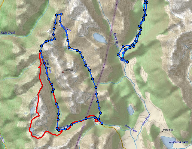 |
| The blue loop in the centre with the dots |
This was a trip in the alpine zone, through glaciated terrain and possibly snow. There would be sidles across snow grass and scree, so I wanted to use my tramping boots. But my boots were giving me really huge blisters on my heels, which I'd suffered through on my tramp
up the Cobb.
I'd had the boots for over two years before they started giving me blisters. Straight out of the box I'd taken them on the North West Circuit without any issues whatsoever. I'd started using trail shoes for quite a few trips after Iain had sung their praises on the Great Ocean Walk and only used the boots for more technical trips. And then last year on the Molesworth circuit, the blisters began.
I tried heel lifts, different sock combinations, strapping hot spots and new insoles. My lacing technique wasn't the problem, there was simply too much movement around my ankles. Had my feet shrunk or my boots stretched? In desperation I decided to try hiker's wool, which is simply sheep's wool that you can pack around the hot spot. I packed a shit load of wool around my heels, laced up my boots and went for a three hour tramp to Sawyer Burn Hut up the northern part of Lake Hawea. And eureka, it worked!
Nice tramp too, but the hut is in such a depressing location...
 |
| Lake Hawea, Isthmus Peak on right |
 |
| Looking straight down Lake Hawea |
 |
| A lot of sidling to get to Sawyer Burn Hut |
 |
| Rugged peaks around there |
 |
| Sawyer Burn Hut, probably perched on the only flat ground for miles. The climb down to the creek to get water was pretty steep |
 |
| Sawyer Burn |
 |
| Looking across to the other side of Lake Hawea |
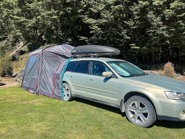
Blister prevention sorted and with the weather forecast for the next week being so good, I headed over to Glenorchy early and camped at Lake Sylvan campsite for a couple of nights. No point wasting such glorious weather.
 |
| Flashcamping at Lake Sylvan campsite |
 |
| Mt Earnslaw |
 |
| Lower Routeburn looking up towards Sugarloaf from the swing bridge at campsite |
The next day I walked to Lake Sylvan, the water level being quite low, and then left the manicured track for the marked route to the Rockburn. Those walking the Five Passes take this route, crossing the bridge over the Rockburn and continuing up the Dart to the Beans Burn. I was only going as far as the bridge.
 |
| Low water levels at Lake Sylvan |
 |
| The view down from the bridge, zoomed! |
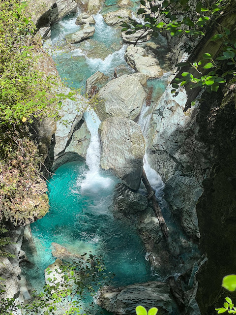
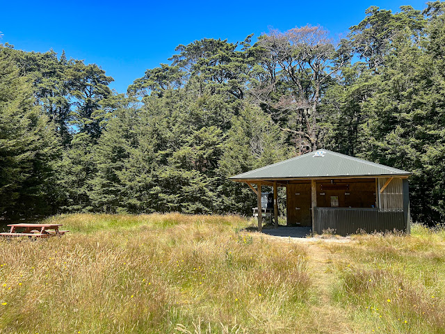
The bridge crosses The Chasm, a narrow gorge on the Rockburn that makes for a very scenic paddle. It's a very long way down from the bridge, and there's no river access from there, so I headed back downstream to the Dart River Jet shelter, where I had a cuppa and lunch.
 |
| Dart River Jet shelter |
 |
| Lower Rockburn about to enter the Dart |
 |
| I think I should get sponsored by them! |
Then I inflated my packraft and paddled upstream into the extremely photogenic gorge, which I had all to myself.
Then it's an easy float/paddle down the Rockburn to the Dart and a downstream float along the braided river back to the campsite, which is just a quick stroll across paddocks. I had asked permission to walk across the private grazing land the day before.
The next morning, having packed up and ready to drive out to the Routeburn Shelter, I found my car wouldn't start due to a flat battery. After trying to contact Inge via my Inreach (unsuccessfully) I walked back towards the road and luckily found someone with jumper leads who got my car going and I managed to join the rest of the group without losing any time.
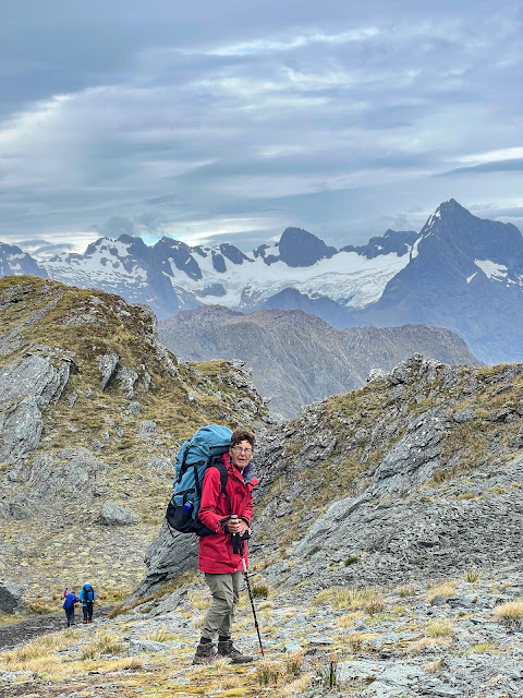
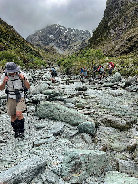
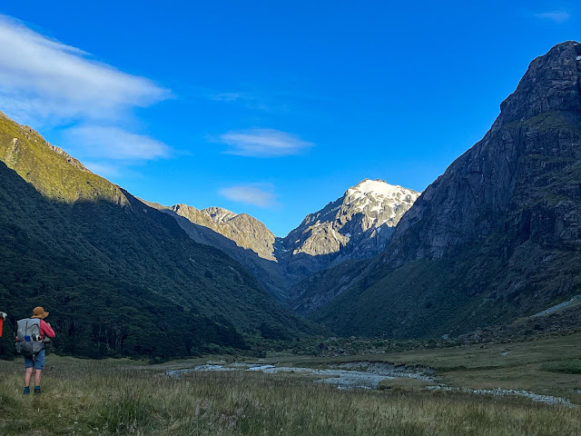
There were nine of us on the trip. Inge, trip leader, and her husband Neil, Jan, Ruth, Chris, Lynette, Jane, Gerry and me. I'd met Jan before on the other club tramp I'd done, the others were all new, though some remembered me from club meetings, or the time I met them on Big Hill when I was walking out from the Motatapu Track.
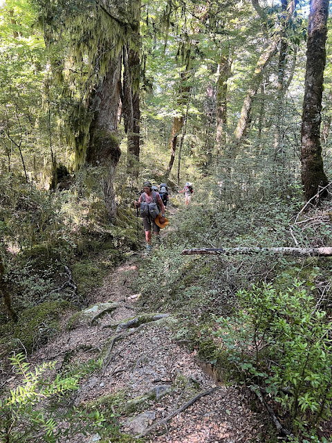
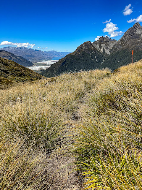
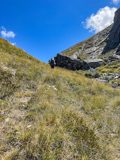
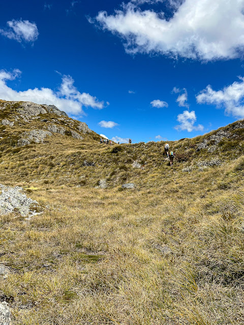
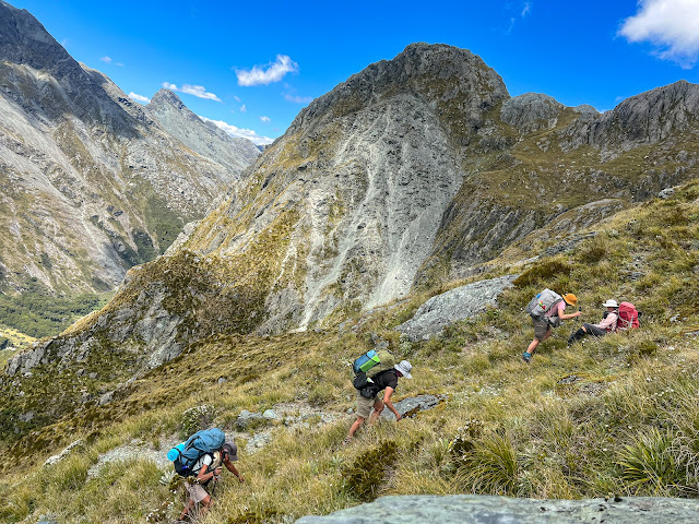
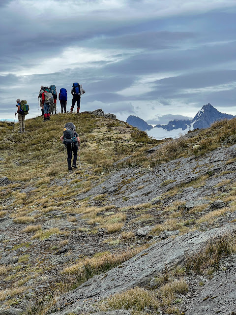
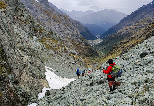
We headed off about 9:45, the initial part being along the well manicured Routeburn Track. After 20 minutes we turned right to begin our climb over Sugarloaf Pass, and we were immediately back onto a typical NZ tramping track. It's probably my biggest criticism of the Great Walks: that the contrast between them and the rest of the track system is so marked. Yes Great Walks are a great entry point into multi-day tramping, but the step from them to "normal" tramping is rather large, and I think a lot of people aren't quite prepared for that. Well that's what I gather from reading a few online tramping forums....
 |
| Jan with her new Aarn pack. She was eager to get some help setting it up for a more comfortable fit. |
 |
| Sugarloaf Stream |
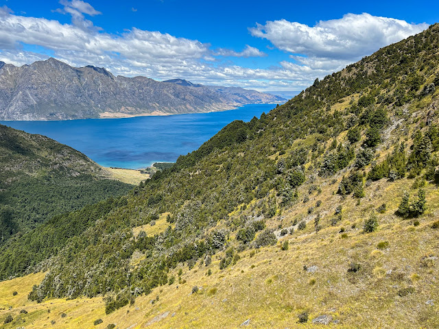
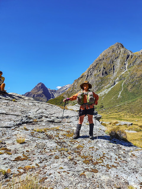
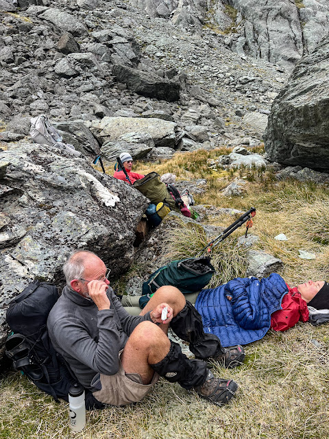
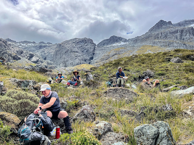
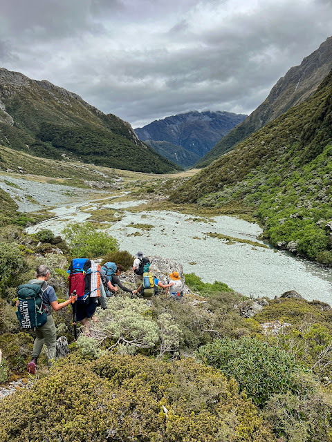
The climb up to Sugarloaf Pass is steep at times, but pretty easy, especially when you aren't the slowest in the group and you choose to go tail end charlie so you can stop anywhere you like and take photos. Poor Neil suffered the most and needed to take lots of rests, but we made the saddle by lunchtime where we stopped to enjoy the views.
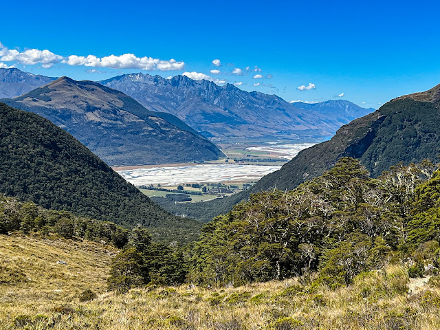 |
| View down to the Dart and Glenorchy from halfway up Sugarloaf Pass |
 |
| Neil struggling up the hill, me being tail end Charlie |
 |
| Looking back |
 |
| Looking ahead |
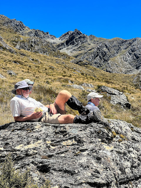 |
| Neil and Jane having a well deserved breather and lunch at Sugarloaf Pass |
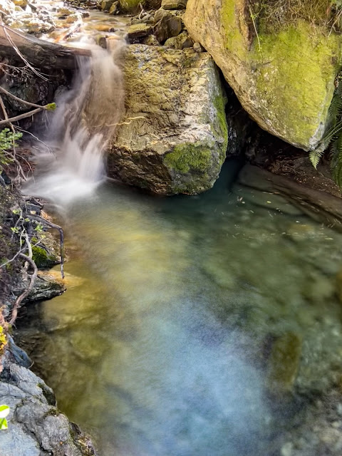
Then it's a much steeper descent to the Rockburn.
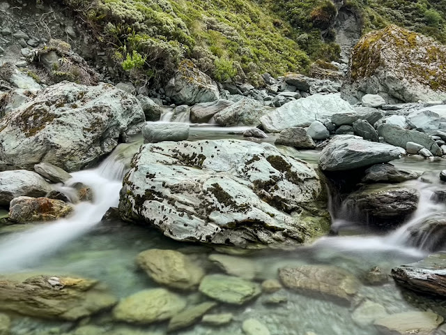
 |
| Beautifully clear waters of Rockburn |
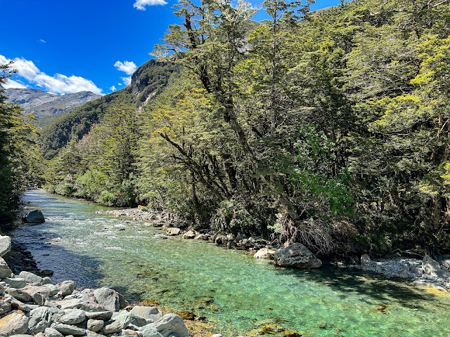
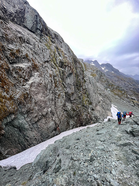
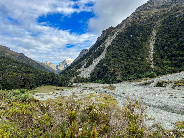
Once down at the river we followed a marked track beside the river all the way. There were some interesting rock overhangs, a few small slips to cross, a bit of rock scrambling, and a suspension bridge got us over to the true right not far from Theatre Flat.
 |
| How much further? |
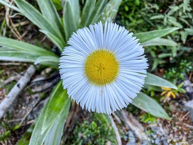 |
| Mountain daisy |
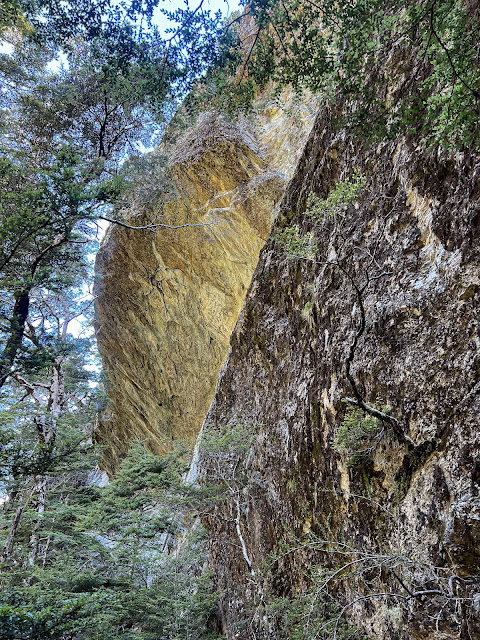 |
| Rock overhang |
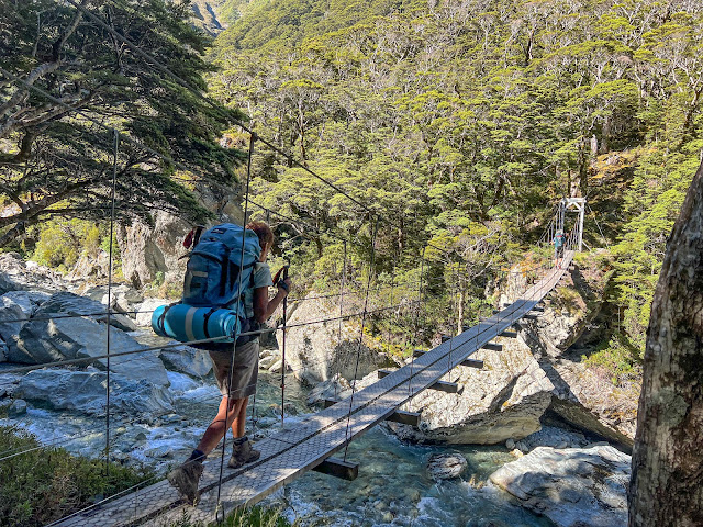 |
| Lynette crossing the Rockburn |
 |
| Nice to have a bridge! |
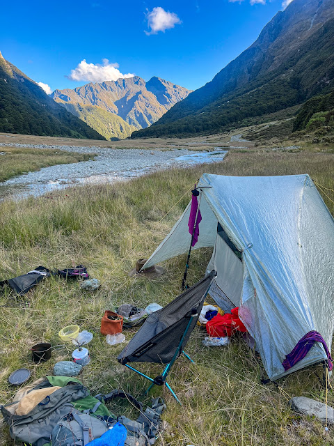
We set up camp on the flats near the river, having a refreshing dip before dinner, joining Inge in a yoga session and then hitting the sack.
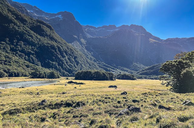 |
| The crew deciding where to put their tents. Lake Nerine is nestled up in amongst those mountains above. |
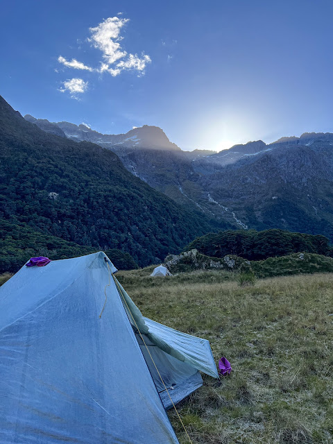 |
| My new Tarptent's first night. |
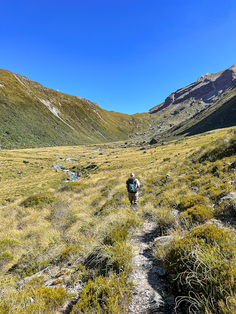
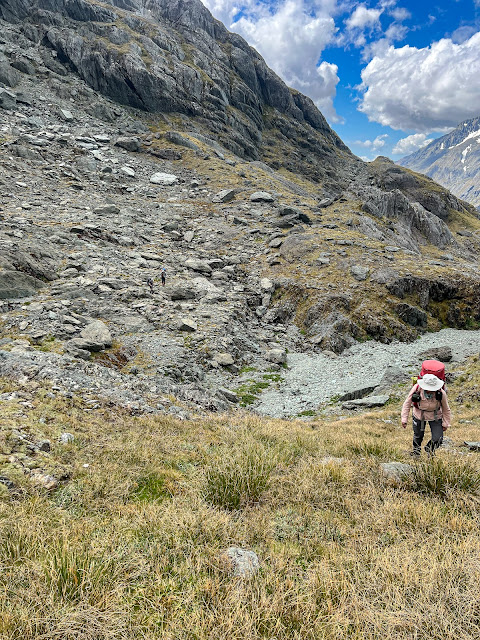
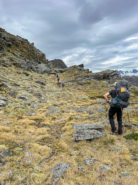
We set off the next morning at 8 am. From Theatre Flat there is no official marked track, but there's a well used path following a trapline, and in fact quite a few orange triangles heading upriver, until they too stop and we are left with a footpad and a cairned route. I had downloaded a GPX route onto my phone as the next marked track we would encounter would be somewhere down the far end of the north branch of the Routeburn in two days' time.
 |
| Park Pass in background, doesn't look that steep..... |
 |
| This picture cracks me up!! |
 |
| Not yet at the pass, looking down at where we have come from. Theatre Flat is around the corner out of view |
 |
| Almost there |
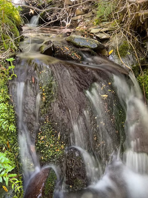
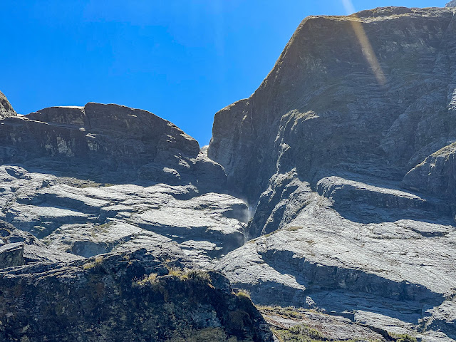
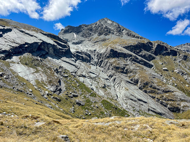
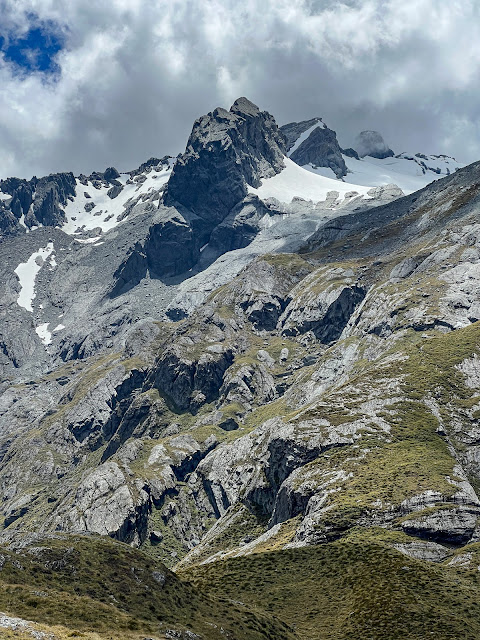
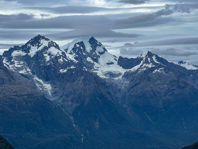
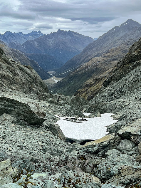
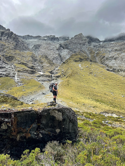
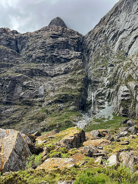
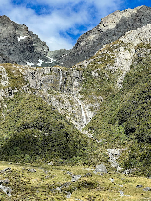
The route up to Park Pass wasn't difficult to find, following the river and then tussock covered ridges to the Pass. The glacier and the rock terraces below it were impressive.
 |
| Can you see the water spray? |
 |
| Glacial action is astounding isn't it? |
 |
| Different view from further along after the pass |
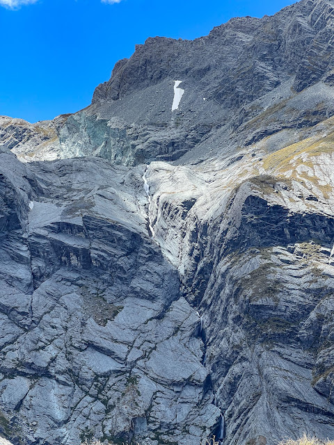 |
| Waterfall coming from the lake at the bottom of Park Pass Glacier, but we didn't see the actual lake |
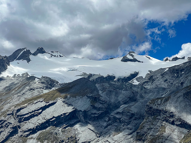 |
| Park Pass Glacier |
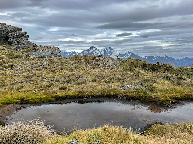
We dropped down to a nearby tarn for lunch.
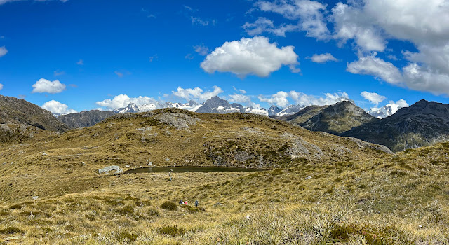 |
| Lunch tarn, south of the pass |
 |
| More glacier topped peaks in the background |
 |
| Leaving our lunch tarn at Park Pass behind us |
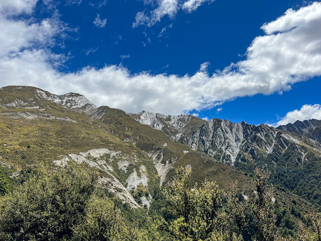
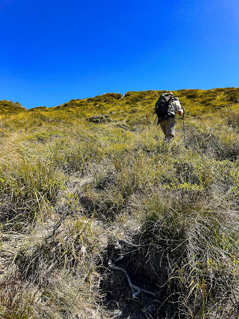
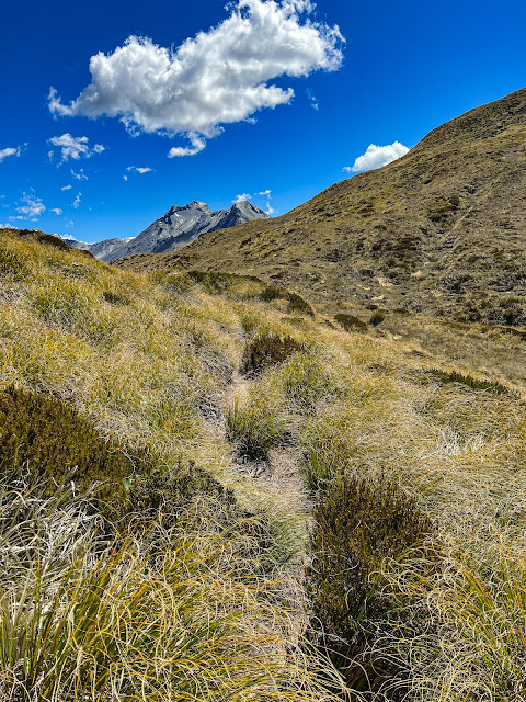
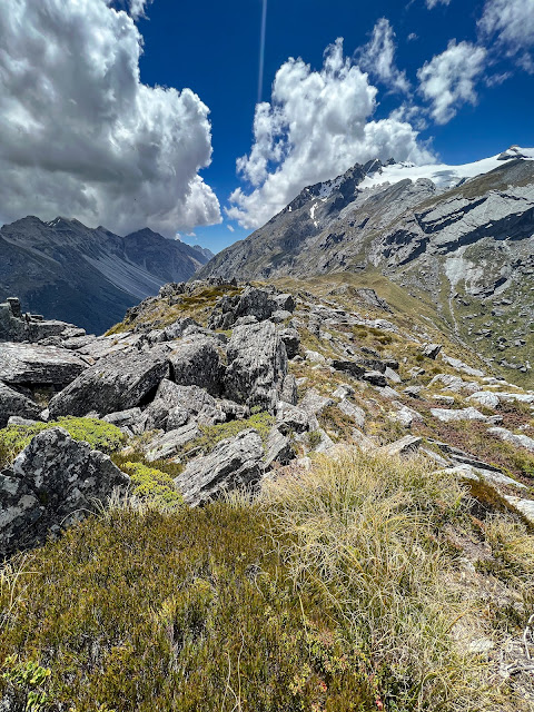
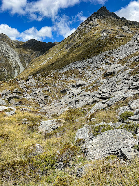
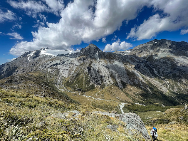
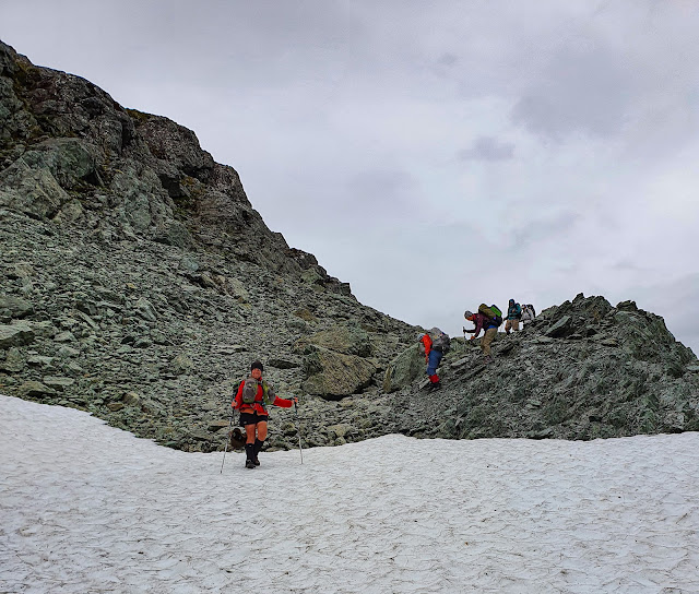
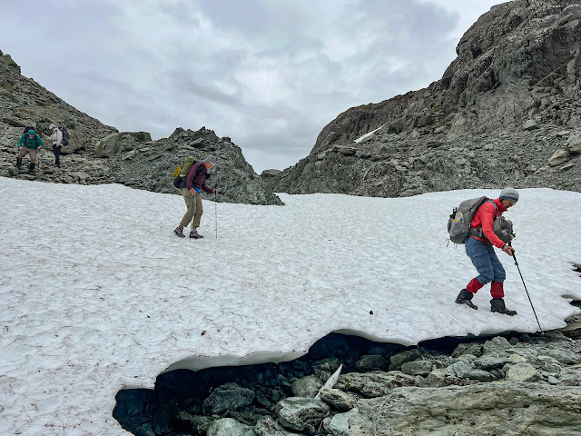
Then the real climb of the day began. First we followed the ridgeline before beginning a sidle up to some spectacular tarns high above Lake Nerine. We didn't quite get our sidle line correct, ending up a bit low, so we had to do a bit of vertical tussock climbing to get onto the correct altitude, where we rejoined the cairned route up to the tarns.
 |
| Follow the ridgeline |
 |
| Looking back down to Park Pass and glacier |
 |
| A bit further along the ridge looking back |
 |
| From here we needed to sidle up to that saddle middle top of picture |
 |
| Almost there, we have just regained the track after a bit of hauling ourselves uphill holding onto the tussocks |
 |
| A beautiful view of where we have been, but doesn't show how steep it was |
 |
| I can't remember if this was part of the route or just some pretty scenery |
 |
| Still some snow high up |
 |
| Final climb up to the tarns |
The tarns were spectacular. Did I say that already?
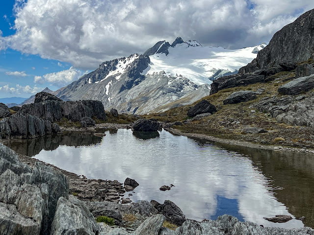 |
| The tarns outlets drop down into the Rockburn, Park Pass Glacier is across the valley |
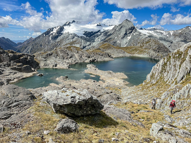 |
| My favourite shot of the trip, climbing up away from the tarns towards Lake Nerine |
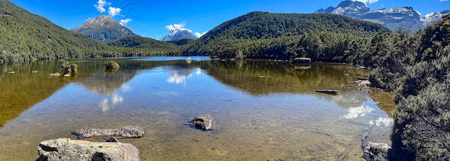
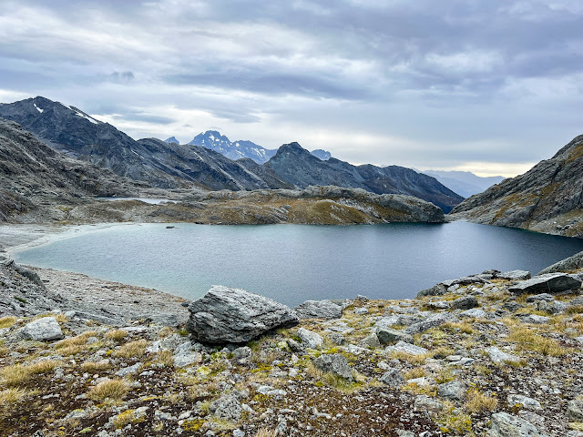
There we disturbed a solo walker enjoying the serenity, who claimed it was her favourite spot and that she'd been there a number of times before. The route from the tarns to Lake Nerine wasn't obvious so we asked her which way to go, but she couldn't remember!! We debated amongst ourselves and then watched where she went, deciding to at least begin following the line she was taking.
We'd almost caught up to her, because we took a more direct route, when someone spied some cairns up to the left, indicating an easier route through the rocks, and through a notch as described in Moir. So we took that instead. The girl later reappeared a bit ahead of us, and then headed off further uphill, so really, as long as you were headed in the right direction it looked like there were lots of options.
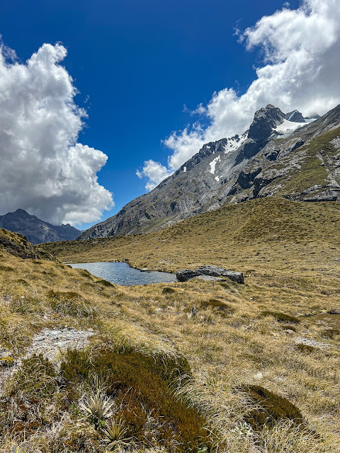
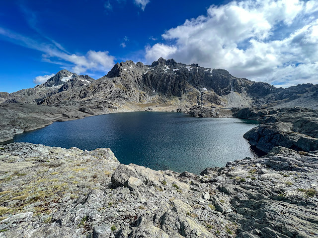
Once we gained the saddle we could see two cairned routes. One the girl had taken, uphill, the other began to descend through rocky slippery terrain to a large tarn below, which turned out to be immediately adjacent to Lake Nerine. The maps we were using aren't that detailed, so we were a bit confused at first. Was it or wasn't it Lake Nerine?
Ruth and I headed up the way the girl had taken but then ran out of cairns, and the girl had disappeared, so we returned to the descent route instead. It was pretty steep, and although a bit crumbly, actually wasn't that bad. Though when I took a photo of our line from the bottom I'm quite amazed we all made it down unscathed.
And then just before we got to the bottom, the girl reappeared yet again, having found a different route down, although again not any faster than us. From the bottom of the descent we traversed above the tarn and crossed a small spit of ground and were at last at Lake Nerine.
 |
| Unnamed lake next to Lake Nerine, which we couldn't actually see from where we were before the descent |
 |
| Looking back at unnamed lake from spit of land between lakes |
 |
| Same lake, we descended to it from that saddle top left |
 |
| Zoomed to show where we came down, top left to bottom right then sidled above the lower rocks to get across. I know.... |
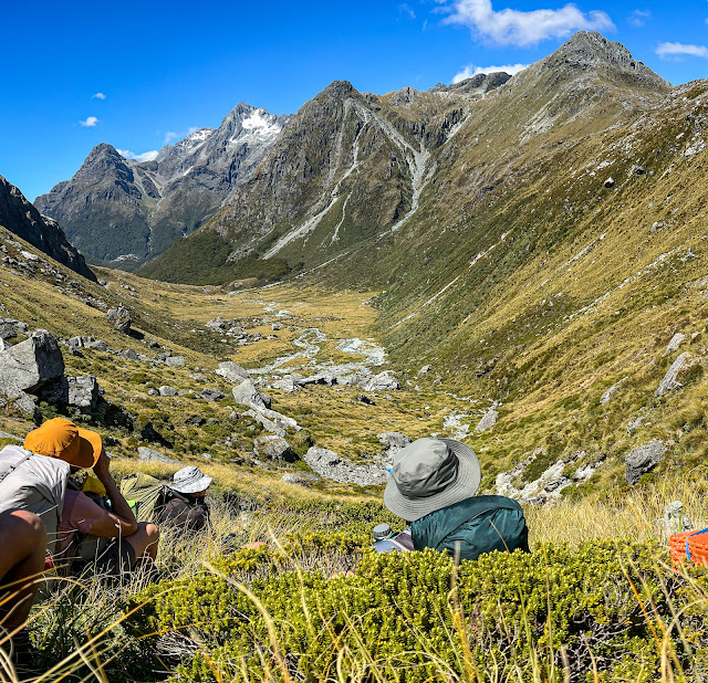
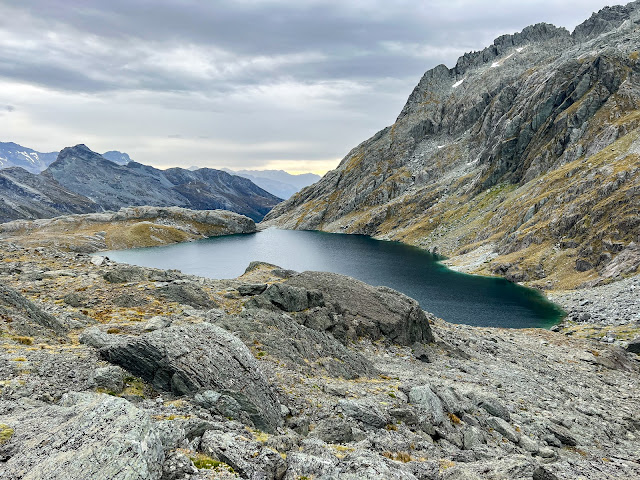
Some of us chose to camp down near the lake, others choosing to camp in the more protected spot between the two lakes. There were a few rock walls along the shore that had been built by previous campers, but I found a spot a little back from the shore behind a large boulder that provided quite a good windbreak. The ground was pretty hard and there was a strong breeze blowing, but there was no shortage of big rocks to secure down our tents!
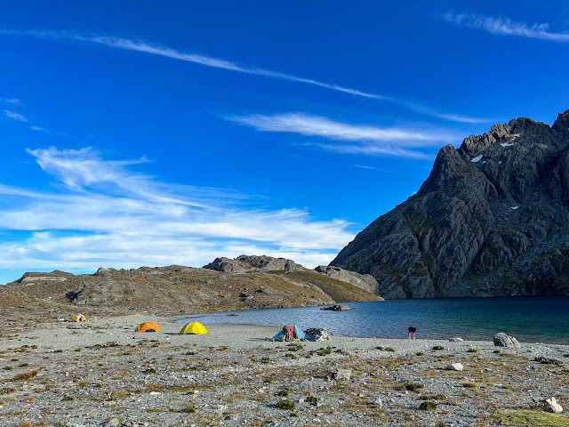 |
| Lake Nerine, unnamed lake is behind those rocks in background left side |
The solo walker, after taking yet another strange route to get to the shore of Lake Nerine, headed off, choosing to camp elsewhere rather than joining a bunch of Wanaka trampers. A young couple turned up an hour or so after us and set up camp, having walked all the way from the Routeburn Shelter that day! I am definitely in the slow tramping camp, fast packing being an activity I would never aspire to, even if I had the fitness for it. As expected they planned to walk back to the shelter along our intended route the next day. Our four day trip into two! They're welcome to it!!
 |
| Can you see my shadow selfie? |
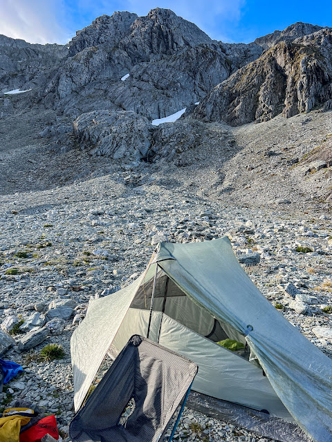
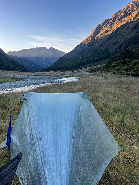
The night was windy, but I slept well on my nice comfy air mattress, despite being camped on shingle. I'm extremely happy with my new Tarptent, which is double skin, weighs 620g and actually has more internal room than my old 2 man Vango tent. The internal floor space is enough for my mattress and a few necessary items like clothes and personal items, with two roomy vestibules for my pack, cooking gear, my chair (yes, my chair!), and boots. The head space is considerably bigger than my Vango, and the inner doesn't touch the fly anywhere, so there's zero risk of getting wet from condensation. It uses my trekking poles which is one reason it's so lightweight.
 |
| Without rocks holding it down it probably would have blown away |
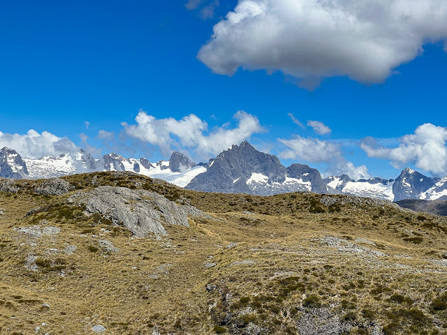
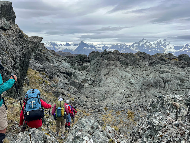
Day 3 we again left at 8am, those fast packers leaving well before us. It was a bit drizzly and overcast, but the overnight wind had eased. We climbed up away form the Lake onto the Serpentine Range, where we encountered spectacular views across the Hollyford Valley to the Darrens. Fond memories looking across to Mts Tutoko and Madeline of our trip on the
Hollyford Pyke last year....
 |
Climbing out from Lake Nerine. Camping beach to left, unnamed lake peaking out in background
|
 |
| Last view of Lake Nerine |
 |
| Dropping down into the gulch on the other side |
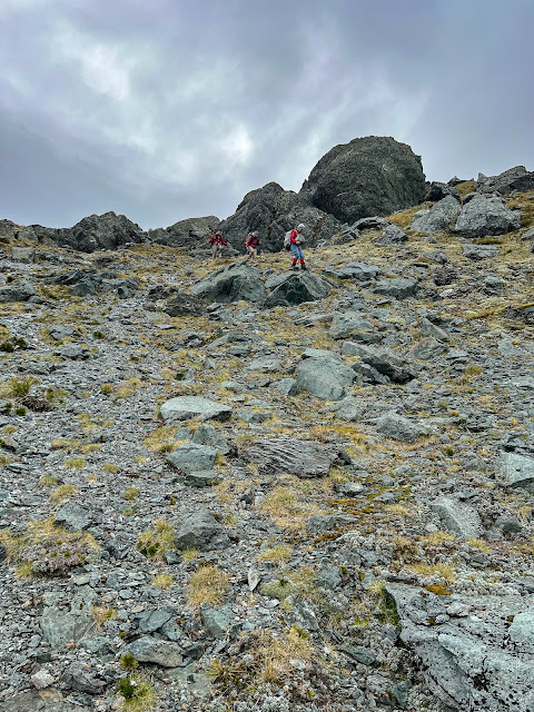
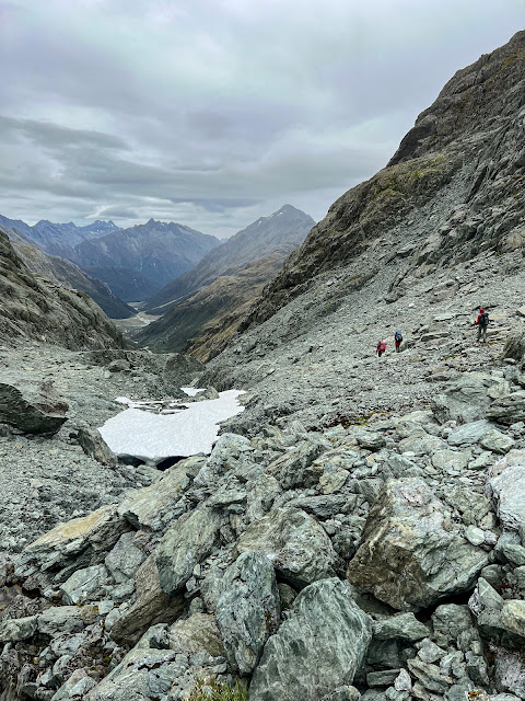
We sidled along the low route, the one I'd downloaded on my phone and a much easier route than the high route, to North Col, where we stopped for our midmorning break. From there we would descend into the north branch of the Routeburn.
 |
| Jan, Ruth and Inge |
 |
| Lynette, Darran Mountains almost stealing the show |
 |
| Gerry contemplating yet another climbing sidle |
 |
| Pretty little tarn with Madeline and Tutoko showing off in the background |
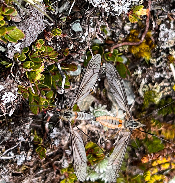 |
| A bit of macro, some dragonflies getting intimate |
 |
| A breather? Or admiring the view? |
 |
| That view! Mts Tutoko and Madeline |
 |
| Still sidling |
 |
| Neil, Inge, Ruth and Jan taking a break before tackling the descent of North Col |
North Col normally carries snow all year round, and when Inge had been there two weeks previously there had been a lot more snow. With another two weeks of warm dry weather even more snow had melted and there was very little snow left on the col. This made the descent pretty easy.
 |
| A long way to go |
 |
| Not much snow left |
 |
| The only bit of snow we had to cross |
 |
| Easy peasy |
 |
| Down |
 |
| Down |
We spent the rest of the day descending the Routeburn north branch. It's quite a narrow river valley and there's no marked track so it's no walk in the park. There were a few river crossings and some decent bushbashing. We stopped for lunch by the river and a few hardy souls went for a very bracing swim. Some people just read their book!
 |
| No shortage of places to take a break |
 |
| Jane modelling this time |
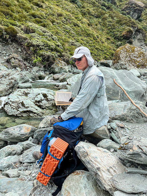 |
| Sunsmart book reading |
 |
| Looks far too cold for a swim.... |
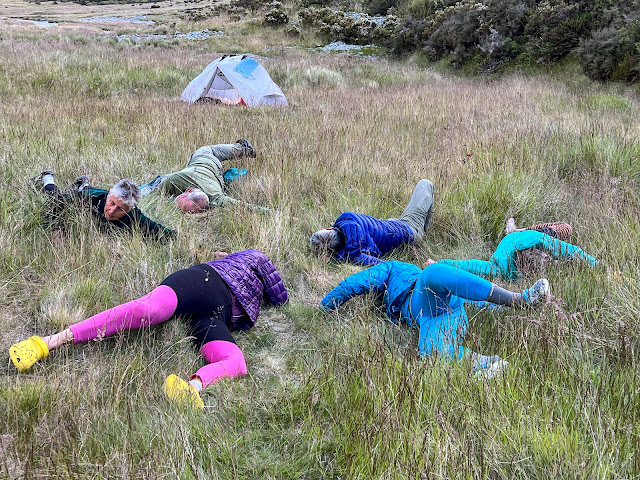
After some more dodgy route finding we at last found ourselves on one of the grassy flats where we could set up camp, have a wash, do some yoga, and commune with the hungry sandflies. Note to self: when camping, don't forget to bring the face net. Although sandflies don't really cause much post bite itchiness for me, getting them in my eyes is just plain unpleasant!
 |
| I went the easy way, crossing the river a few times and getting wet feet. Gerry led another dry foot crew who stayed on river right, but had gnarly rock scrambles. |
 |
| A narrow track we found through the brambly bush |
 |
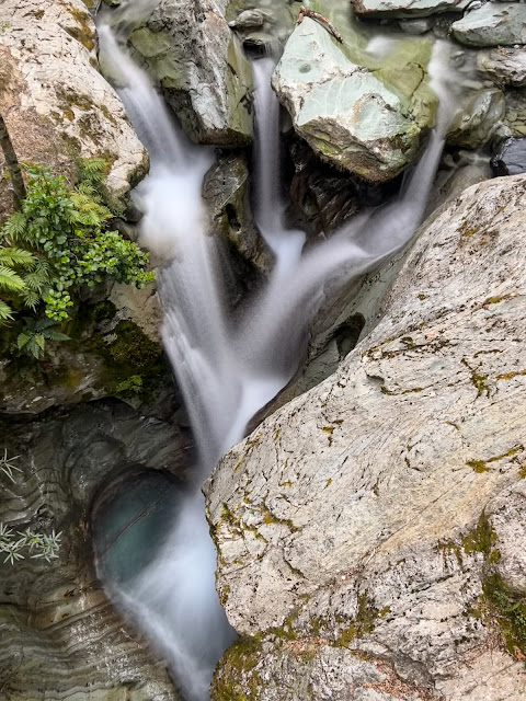
| Literally hundreds of waterfalls in Routeburn North Branch |
 |
| Who's a messy camper then? Looking downriver, where we will head tomorrow |
 |
| The view from my chair (see previous photo) |
 |
| My second favourite photo of the trip: end of day yoga led by Inge |
Day 4, again off at 8am, it was an easy amble down valley to Routeburn Flats, where Fred got a hot bath and I got a cuppa, then along the Routeburn Track back to the shelter. And my car started first go!
 |
| Good morning! |
 |
| Looking back to North Col |
 |
| Further down the valley, North Col still visible in background |
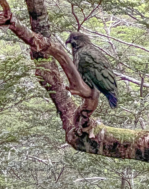 |
| A fat looking Kea on the Routeburn Track |
 |
| Bridal Veil Stream |
After lunch in Glenorchy it was back to Wanaka to get the car serviced and plan my next adventure.
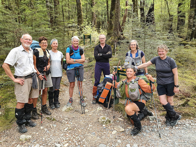 |
| The gang at the turnoff to Sugarloaf Pass on the Routeburn Track: Neil, Lynette, Chris, Ruth, Gerry, Jan, me (kneeling) and Jane. Inge took the photo |


