I'd been toying with getting a bike for some time. Mainly because there are quite a few long valleys with 4WD tracks that are a little boring to walk up and down but would probably be fun on a bike. Also, it's an alternative transport option if a loop section involves a road section, to leave a bike at one end to use to get back to the car.
I thought about getting a cheap as chips second hand mountain bike, but then found very little available that would fit my small frame. I've had some really bad experiences with bike frames that don't fit me, leading to sore shoulders, arms and neck. So I decided to purchase a new bike.
I didn't want an e-bike, because I also liked the idea of doing some touring, or more precisely, bikepacking. The difference being more streamlined bags packed along the frame of the bike and the option to get off the tarseal and explore the backroads. I'm not into technical mountain biking, and having tramped The Old Ghost Road, The Heaphy and The Paparoa Tracks, I'd still opt to walk them if given the choice. Cycling for me is about covering distances that might be a bit boring if you walked them, though boredom really is subjective...
An e-bike requires you to have regular access to a way to recharge the battery. They are also really heavy. So if you want to go on a multi-day ride you need to stay in places where you can recharge, usually every day. No wilderness camping with an e-bike...
So I decided to purchase a carbon gravel bike. Super light, but strong, and able to absorb bumps more comfortably than a lightweight aluminium bike. I didn't want a bomb proof steel bike because of the weight tradeoff. With tubeless tyres so I can alter the tyre pressure to make the ride more comfortable.
There are no shocks or suspension on a gravel bike, allowing you to mount travel bags easily. Due to supply chain issues in these COVID times, I ended up purchasing a Cannondale Topstone 6 which was pretty well the only bike around in my size. The guys at Bike It Now in Cromwell were awesome at helping me set it up for my body shape, changing out the stem for a shorter reach, adjusting the seat position, and setting the bike up to be tubeless.

After hitting the internet and purchasing a gaggle of bikepacking bags and some cycling shorts, I spent a few days working out how to actually pack the bike. I had all the camping gear, I just had to work out how to fit it all onto the bike.

Once I had sorted that out I decided to go for a short trip, and what couldn't be a better choice than the nearby Otago Central Rail Trail. A 3-4 day easy gravel cycle along an old decommissioned railway line from Clyde to Middlemarch.
It was late in the season and there were limited options for getting a shuttle ride back to Clyde. I rang around all the operators and at least 2 of them told me there were shuttles running on Friday, so I planned to leave from Clyde on Tuesday.
I drove down to Clyde and parked my car at the start of the trail. The guys in the bike hire place at the start of the trail, rather than sell me a shuttle ticket back, told me to email them my intentions. They were having an end of season celebration and didn't want to provide a service right there and then. Bit weird, but I just got on my bike and began pedalling.
The track to Alex is dead straight and flat. I considered stopping for a coffee at the cafe just next to the trail, but I'd only been cycling for 20 minutes so it seemed a bit early for a break. Through Alex and over the Manuherika Bridge the trail veered left to follow the Manuherika upstream, through typical Central Otago schist, thyme and tussock.

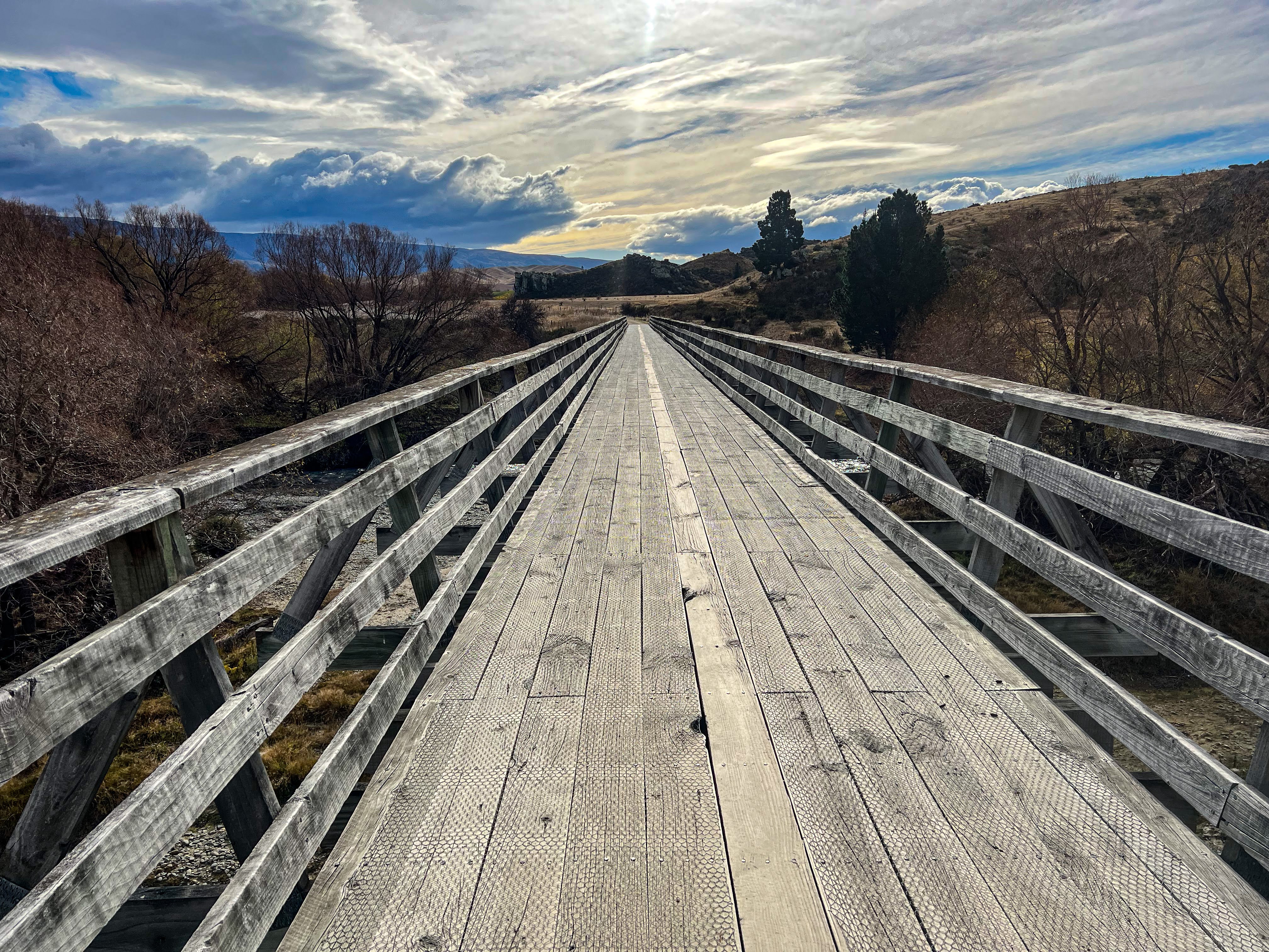
There were a couple of nice old wooden bridges along the way, and a few cute siding buildings to stop at en route. Once past the quirky Chatto Creek Tavern the track climbs up over a small hill and then it's downhill all the way into Omakau, where I camped the night at the local motor camp. A really nice spot with lovely grassy sites, a decent camp kitchen and an excellent hot shower in the clean modern amenities block.

After setting up my tent and having that lovely hot shower I walked up the road to the pub and had a meal and a beer before wandering home to my sleeping bag.


The next morning I noticed that I had rubbed the bottom of my saddlebag on the rear tyre. It had only damaged the protective plastic and not the dry bag itself, so I made sure to strap it up much tighter so there would be even more room between it and the rear wheel. The problem with being a shortie is that there isn't a lot of distance between the seat and the tyre so I can only use a smaller 10L bag, but if I stuff the bag well so it is as rigid as possible, and then cinch the compression straps hard, then it will ride high enough to stay away from the tyre. The Cannondale bikes have a bit of suspension built in to the way the frame is built so that may also have contributed to the rubbing. Suffice to say I had no more rubbing issues for the rest of the trip, and I later reinforced the area rubbed with a couple of layers of duct tape.

I had a late start, because in attempting to add a little more air into my front tyre I unscrewed the valve and lost all the air in the tyre. That's when I discovered how hard it is to reinflate a tubeless tyre by hand pump. I couldn't get enough pressure in the tyre to get it to seal around the bead, even after borrowing bigger foot pumps from other campers at the motor camp. In the end I walked the bike down to the local bike shop in Omakau and waited for their bike mechanic to drive over from Alex to help me out. He used the compressor to quickly inflate the tyre, which sealed immediately, and he sold me an adaptor I can use with the air compressors at petrol stations. That won't help me if I'm in the wop wops so I will need to add a CO2 inflator into my kit to cover that possibility. This trip sure was turning out to be a great experiment.
I pedalled out of Omakau around 11am, arriving in Lauder ready for lunch, but the local cafe was closed for the season. I wandered around to the local pub, where they made me a toasted sandwich and a coffee, then I set out again.

From Lauder the trail heads through Poolburn Gorge, across viaducts and through a couple of tunnels. I didn't have bike lights and ignored the notice suggesting I dismount for the first tunnel, to my own detriment, because a few seconds later I couldn't see a thing and promptly fell off my bike!! I walked the rest of the way until I could see the exit and had enough light to be able to continue riding without toppling over!!


The ride through the gorge is one of the more spectacular parts of the trail, but once through the second tunnel, which is shorter and doesn't turn a corner so is easy to cycle through without toppling over, you enter the wide Ida Valley and get your first taste of the spectacular Maniototo.


The trail heads north down the valley, is flat and fairly featureless, to Oturehua, home of Hayes Engineering, the very cute historic General Store and my camp for the night at Crows Nest Backpackers. I set up my tent on the lawn, had another lovely hot shower, then hit the pub for dinner. I actually brought enough meals to cook my own dinner each night, but I like supporting local businesses, especially if it means I don't have to cook.


The next morning, after a coffee or two courtesy of the coffee maker at the backpackers, I headed off a little later than planned after a squall of wind and rain hit. Luckily I had already packed up my tent when the squall hit, so I waited it out with a second cup of coffee and some toast courtesy of my host, then pedalled off once most of the bad weather had passed over.

 |
| Saturn, see https://www.railtales.nz/interplanaterycycletrail |
From Oturehua the trail climbs to it's highest point at Wedderburn and then it's downhill all the way to Ranfurly. I also had a tailwind. I passed a few cyclists pedalling the opposite direction and it certainly didn't look like they were having much fun at all.

At Ranfurly I stopped for lunch at a cafe, where I ate a very disappointing spinach and feta roll, and managed to at last confirm a seat back to Clyde from Middlemarch for myself and my bike. My emails had been misread by the person I had sent them to, and they had told me there were no shuttles for Friday. When I rang them up it turned out they had confused which shuttle I was after, and there was indeed a shuttle on Friday from Middlemarch, so I dutifully paid my money and learnt yet another lesson in this bikepacking caper. Which is if you are going to rely on bike shuttle services you need to 1. book ahead and 2. cycle during the tourist season so there is actually a shuttle service to book on!!!
From Ranfurly the trail continued straight and flat, through the mighty Maniototo, to cross the Taieri River at Waipiata. There was a pub and a campsite at the domain, but I intended to camp at the free campsite at Daisybank. This is another really picturesque part of the ride, as the trail passes through a gorged section of the Taieri.


I got to the campsite around 2pm, but I couldn't find anywhere sheltered enough for my tent, as my lightweight pegs continuously got pulled out by the gusty wind and collapsed the tent. A bit after 3 I decided I needed to up sticks and keep going. At least I had the wind behind me.
The next couple of hours saw me cycling madly along the trail, stopping a number of times to consider whether various sidings buildings would give me enough shelter from the wind for a free camp, but each time I just snacked on an energy bar and kept going. Hyde Tunnel, at the end of the gorge was whizzed through, and a cursory glance around Hyde revealed nothing open so on I went. There are no photos from this section, I just rode!
I arrived in Middlemarch just as it got dark, and managed to get the last room at the pub, the local camping place being closed for the season. After 86km that hot shower felt great, as did the massive pub meal and possibly 2 beers? The comfy bed was a bonus!
The next morning it was brutally cold, with snow on the hills and a chilly southerly blowing. It was then that I congratulated myself on pedalling all the way to Middlemarch, missing out on a chilly night in a tent and a nasty headwind on the final day.
Instead, I had another hot shower and then had a wee cycle around town before hitting the local cafe for a hot breakfast. After lingering a while over my coffee I left to wander more and await the shuttle pickup. Another two cyclists turned up, having stayed at the Waipiata pub and freezing themselves solid on the ride in to Middlemarch.


The shuttle arrived, loaded our bikes, then drove us back to Clyde.
It was a great first bikepacking trip. My bike performed well, I learnt a lot about tubeless tyre intricacies and how to load your bags properly. I realised I needed to upgrade my tent pegs to a sturdier design to cope with windy conditions, and that sometimes you need to dig deep and just keep trucking. TBH there were lots of places that I could have stopped and set up my tent, but knowing I could make it to Middlemarch before dark was really the only reason I didn't stop earlier.
BUT: It was really easy terrain, both in terms of cycling surface (hard gravel) and elevation gains and losses. Sure I'm fit, but it was literally the first time I had cycled a bike for more than an hour in years, so I was pleasantly surprised to have no saddle soreness. I wore my thermal Skins leggings with mountain bike shorts over the top and was very comfortable, even a little too warm at times. A merino thermal, fleece jersey and my rain jacket completed the upper body layers, with the addition of a neck buff which is a mandatory piece of kit when cycling to cut down on wind chill.
With a few additions and modifications I feel ready to take on some more bikepacking adventures, but with winter approaching my options locally are limited. There's always next year...