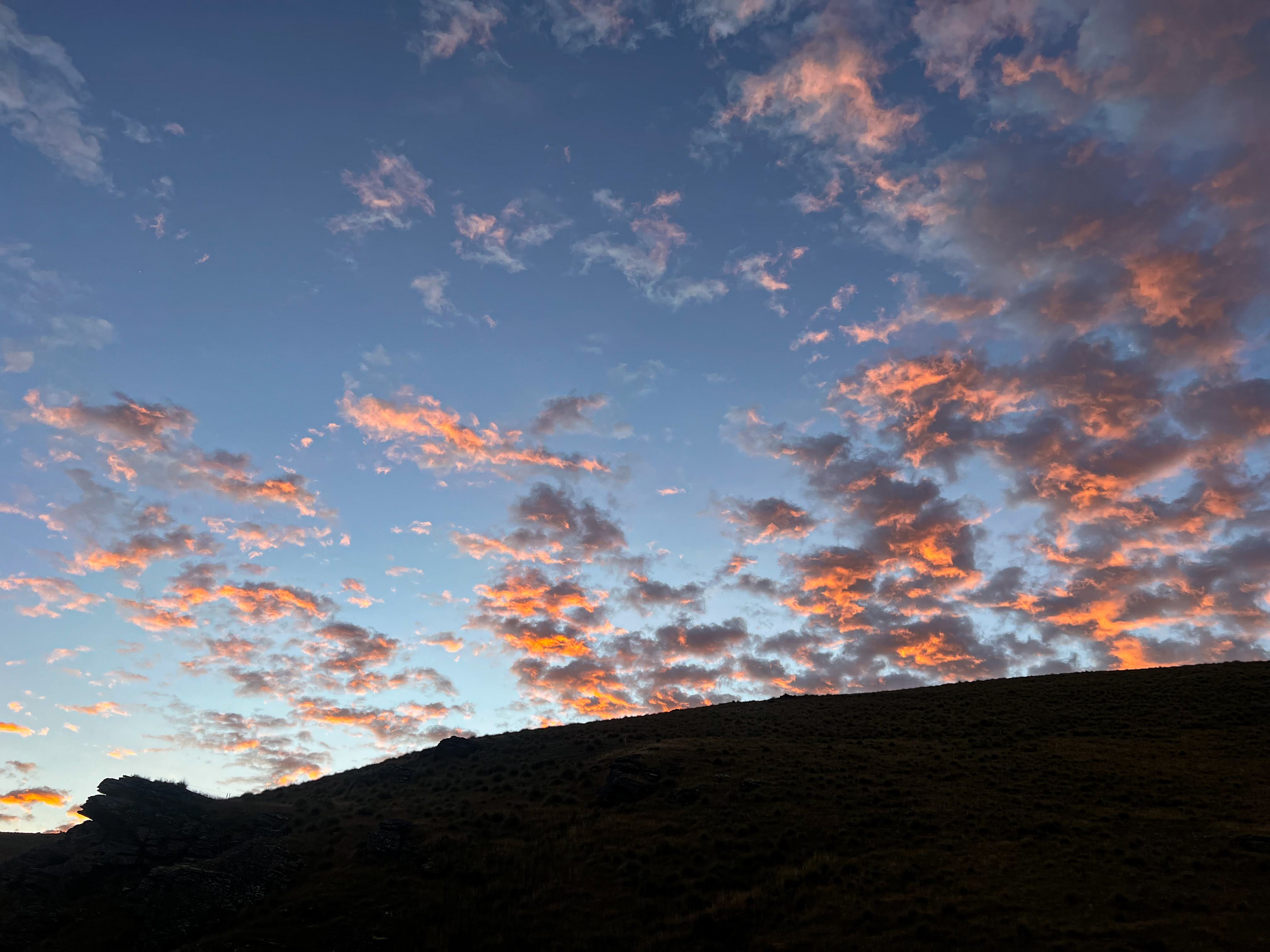
The Old Man Range extends in a north south line west of the highway south of Alexandra. It's all tussock and low growing tundra-like alpine terrain, punctuated by numerous, quite imposing, rocky tors. From the 1860s it was subjected to some pretty intensive gold mining, meaning every creek and river shows signs of intervention. There are still people working mining claims up there today, but mostly it's a recreational area, for those on foot, bicycle, motorbike or 4WD. In winter it's covered in snow and can be explored by ski tourers and cross country skiers. There's only a few DOC huts, but there's quite a few other, mostly derelict, huts, many with a wealth of history.
My first attempt to go exploring on the Old Man Range had ended before it started, with a boiling radiator and a red face for my mechanic. On my second attempt I decided not to drive up the steep road to the top of the range but to start my tramp down the southern end near Roxburgh. With a week of good weather forecast I planned to wander around and try and bag as many huts as possible. So I brought the tent, because few of the huts are still habitable.

Day 1 Roadend to Junction Hut
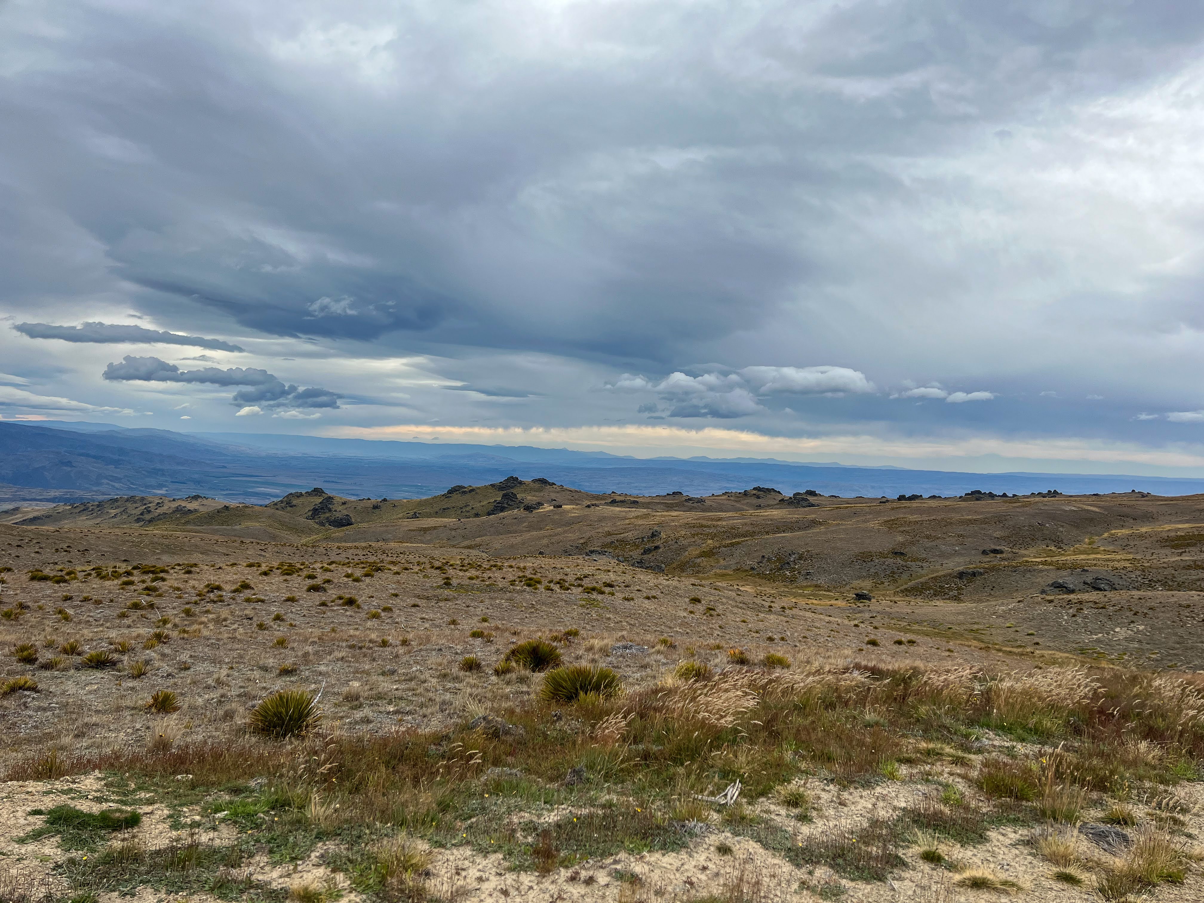
From Wanaka, I drove down the highway, past Alex, and turned in at Pomohaka Road which is just north of Roxburgh. I parked at the start of the Bullock Track and began the long slog straight uphill following a 4WD track the whole way. I don't mind a steep ascent when you gain elevation quickly, especially when there are good views. I was glad I'd been training last week in Mount Cook National Park!!
 |
| Looking down into the Clutha Valley |
 |
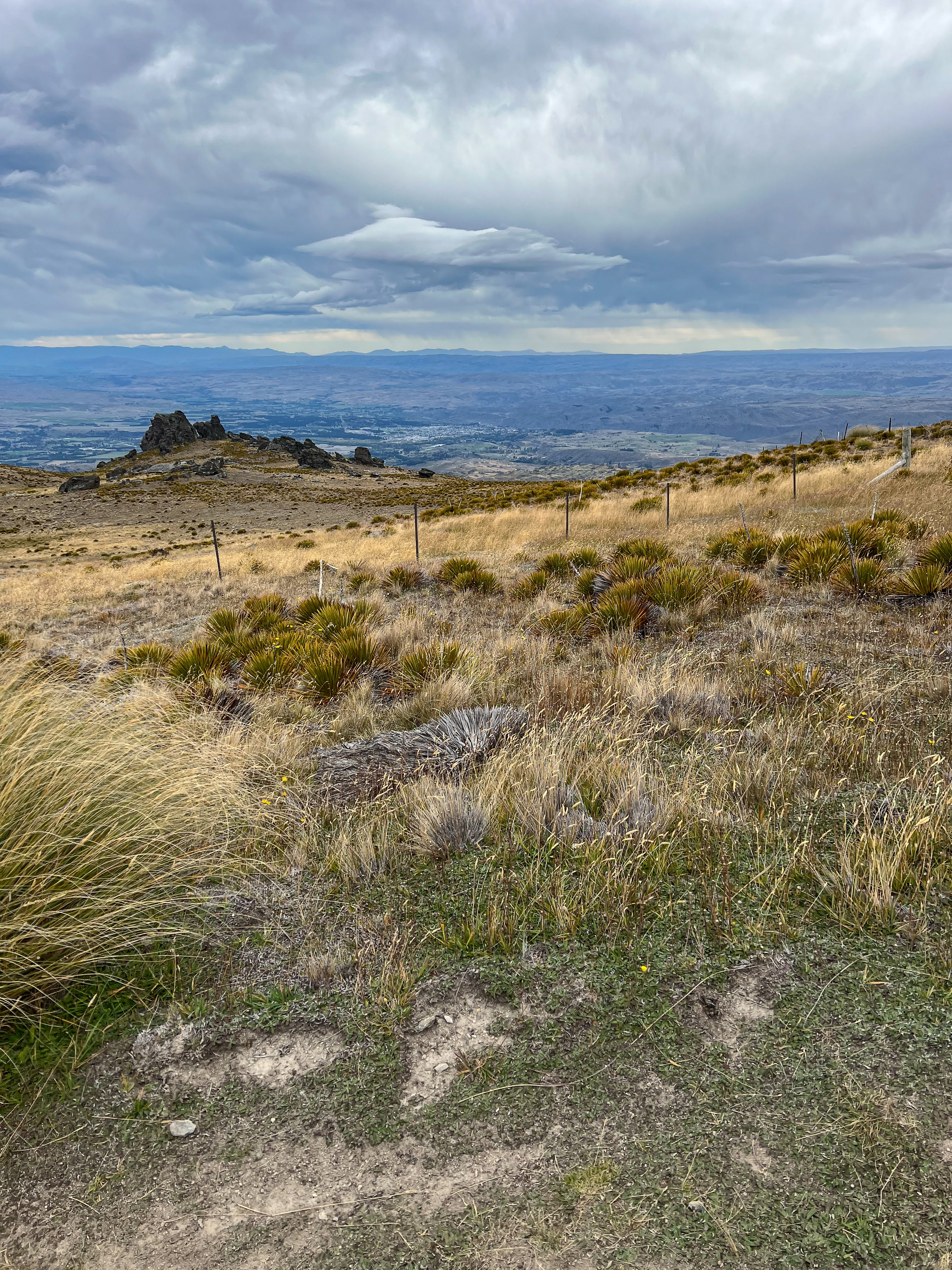
| Looking down the Bullock Track to Roxburgh |


It had been a late start so I had lunch just before making it to the top of the first ridge. I had been following the Godzone Adventure Race online so knew that the track got fairly close to one of the checkpoints but my route was a little further south of theirs and most of the teams hadn't got that far yet anyway. The track continued westwards making it's way along and up a few more ridges to Junction Huts. The final descent down to the Pomohaka River was quite steep, with a couple of gates to open and close and one not very shy Karearea. Much of the route is on private property but there is a public easement through it that doesn't require permission if on foot or bicycle.


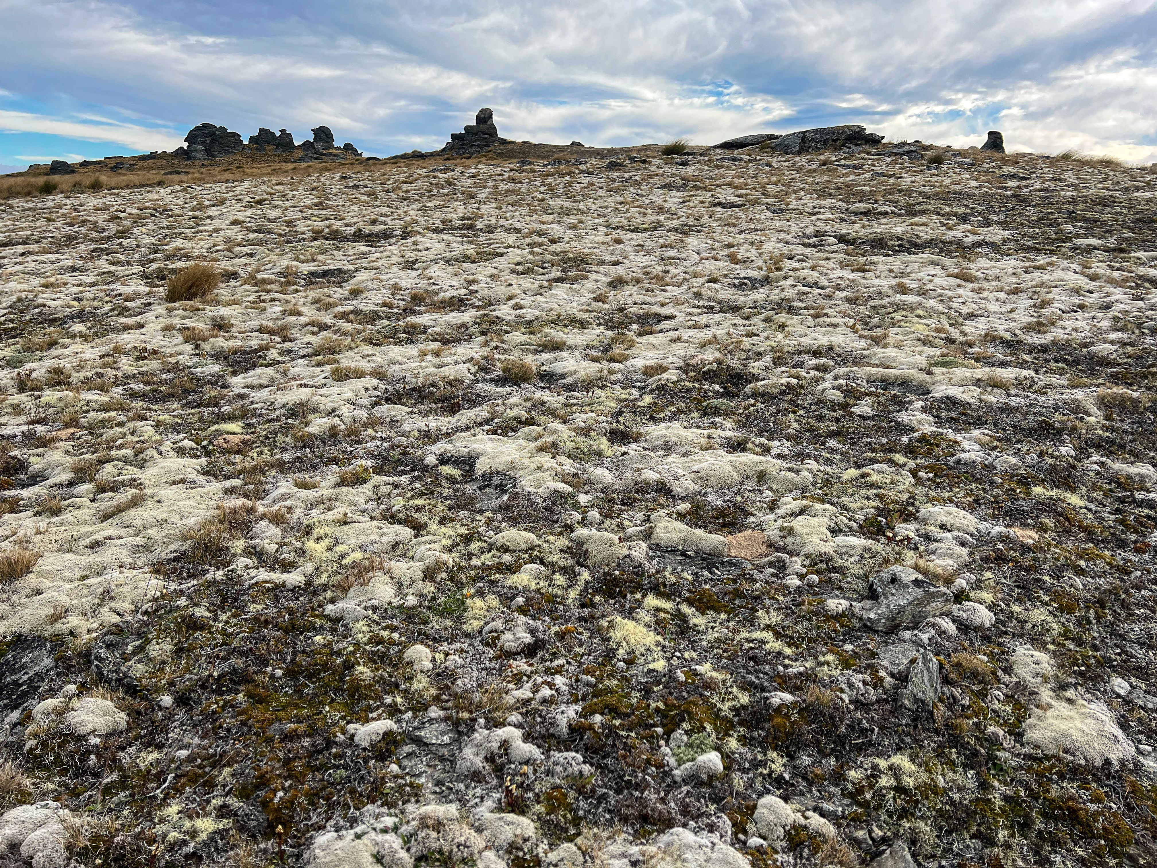
 |
| Do those rocks look like people's profiles to you too? |


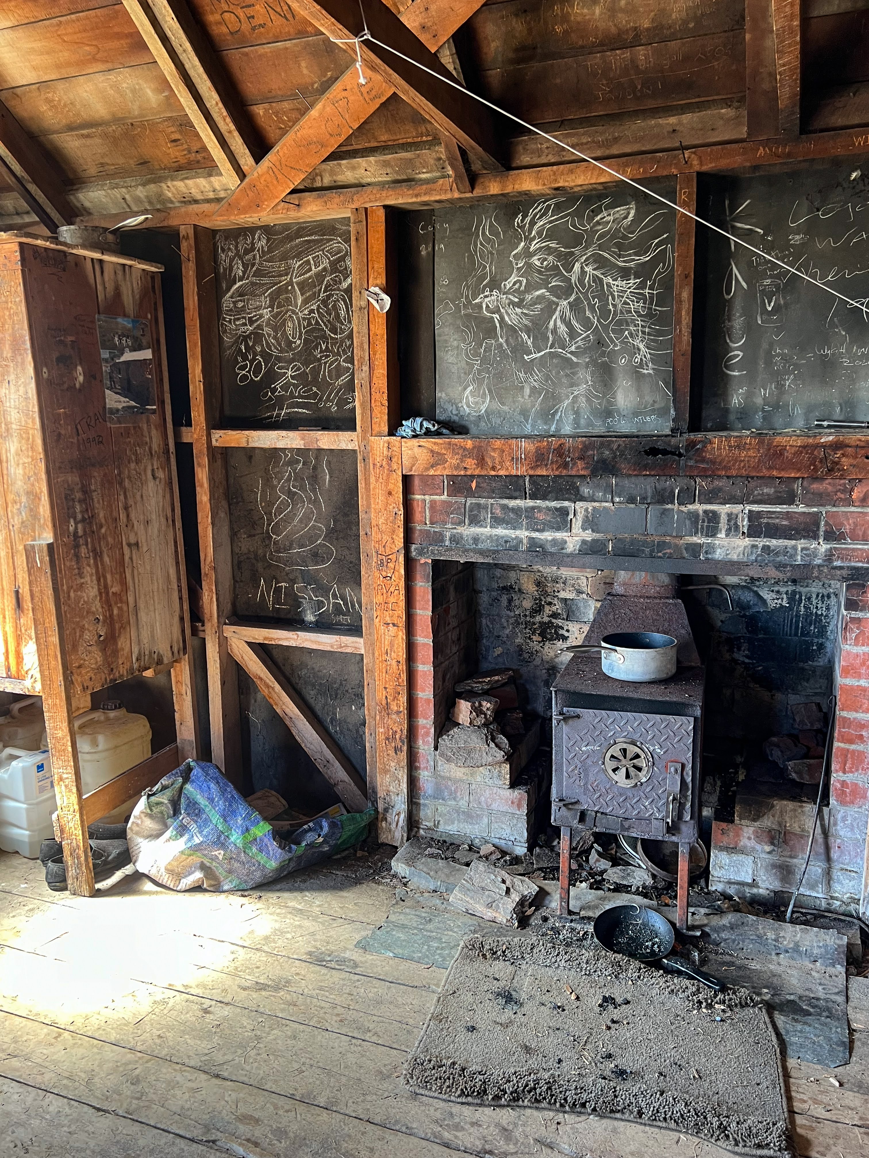
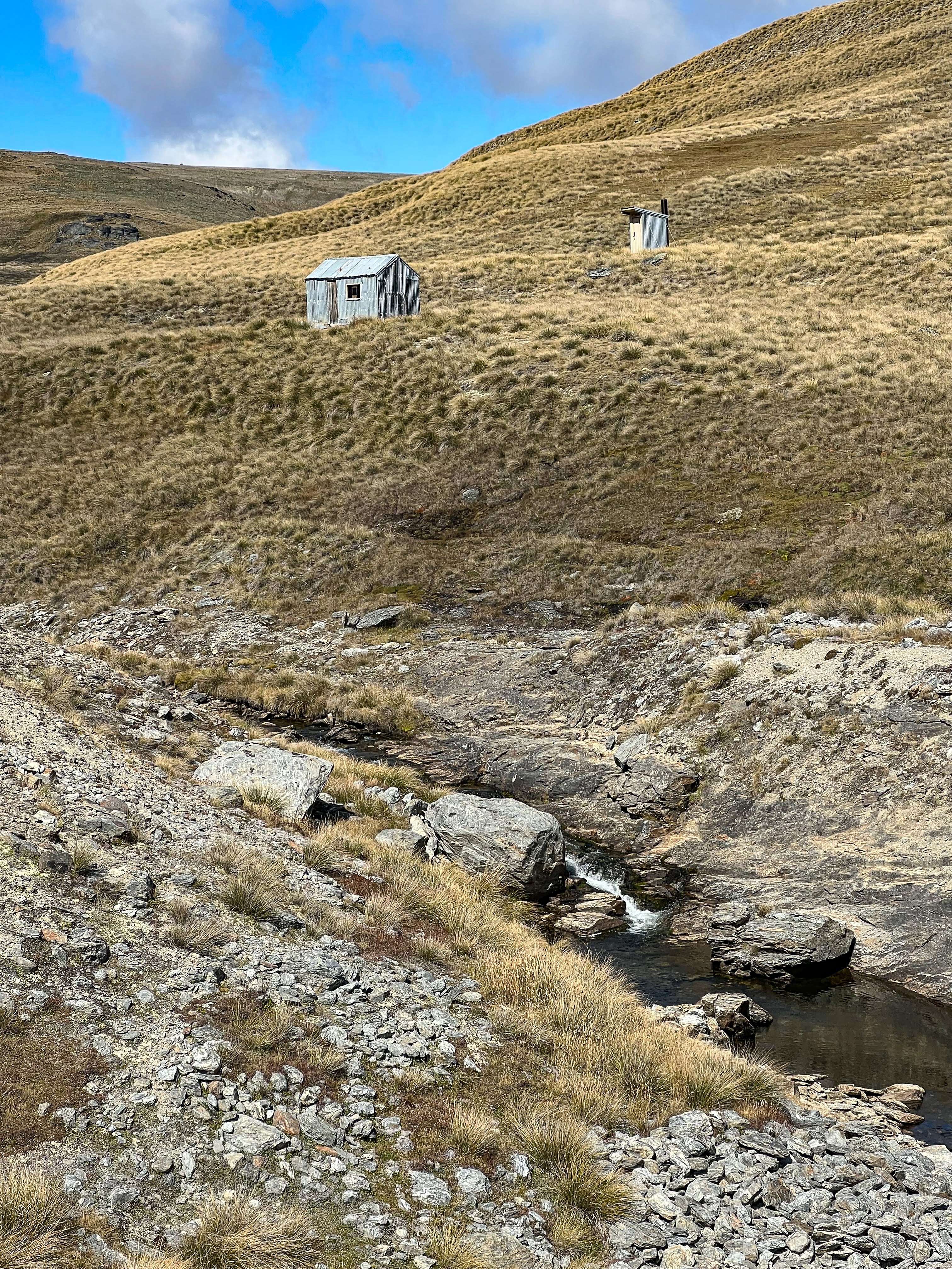
Just as I got to the huts a big mob of 4x4s could be seen making their way towards me down the track further west. Thankfully they were just passing through. There was one 4WD already parked at the hut, and evidence of people staying more long term, but the people themselves were nowhere to be found. There was plenty of room for me so I claimed a bunk, brewed a cup of tea and went for a wander around the nearby diggings.
 |
| The main hut |
 |
| The old hut |
There were quite extensive sluice works at the junction of the Pomohaka, evidence of the hard work Chinese miners undertook in search of gold dust.


 |
| Extensive sluice works at junction of Pomohaka |
Later in the afternoon three lads returned from their mining claim further up the Pomohaka. They were Hawkes Bay lads, who had purchased the lease a few months previously and were still pretty new to the game. They said there were numerous old stone cottages further up the river and a lot of evidence of previous mining. They were sluicing for gold with more modern machinery but, because of the history, were not allowed to disturb any tailings or past mining structures.
Early to bed, I was knackered.
Day 2 Junction Hut to Diggers Hut
I left the hut about 8:30, heading straight up a 4WD track behind the hut with a sign saying no access. They meant 4WD access rather than plebs like me on foot. The DOC boundary is the fence right next to the 4WD track, I just figured I'd take the easy option. The boys said the land owner was pretty chill, and anyway, I had been on his land all yesterday already!
It was a beautiful clear sunny day, but not quite so hot as yesterday, what with starting earlier. Still, it was a grind up the ridge, through tussock covered fields peppered with stone outcrops. The 4WD track petered out at a fence, so I jumped the fence into conservation land and continued climbing. There was lots of boggy land, but with the dry summer it wasn't too difficult to walk through it and keep my feet dry. Just before I got to the top I saw a Godzone team in the distance, negotiating a gate along the 4WD ridge track.


Soon I was on the same road as the racers would be on and had a few teams pass me. The competition leaders had all passed through in the night, these guys and gals were just hoping to finish the course. One team, 71, stopped to chat. They had walked out from Hidden Falls and were now on the short course. They said it had had it's ups and downs, not all enjoyable, but they were looking forward to a hot pie in Roxburgh!!


Back on a 4WD track it was easy going, the track following the ridge line and then through a gate at Waikaia Bush Road. I veered left to visit AA Hut and then on downhill to Potters Huts. Aside from 2 motorcycle riders at the gate, I saw no one else for the rest of the day.
 |
| Aa Hut |

 |
| Potters Hut (the newer one) |
 |
| Interior of hut |

The land I was crossing was on private land, part of the massive Glenary Station. They have removed stock from most of the high country these days and are more than happy to allow trampers to access if you ask permission first, and let them know when you are safely off their land.
 |
| The older stone Potters Hut |


 |
| More evidence of gold sluicing |
 |
| Looking back at Potters Huts |
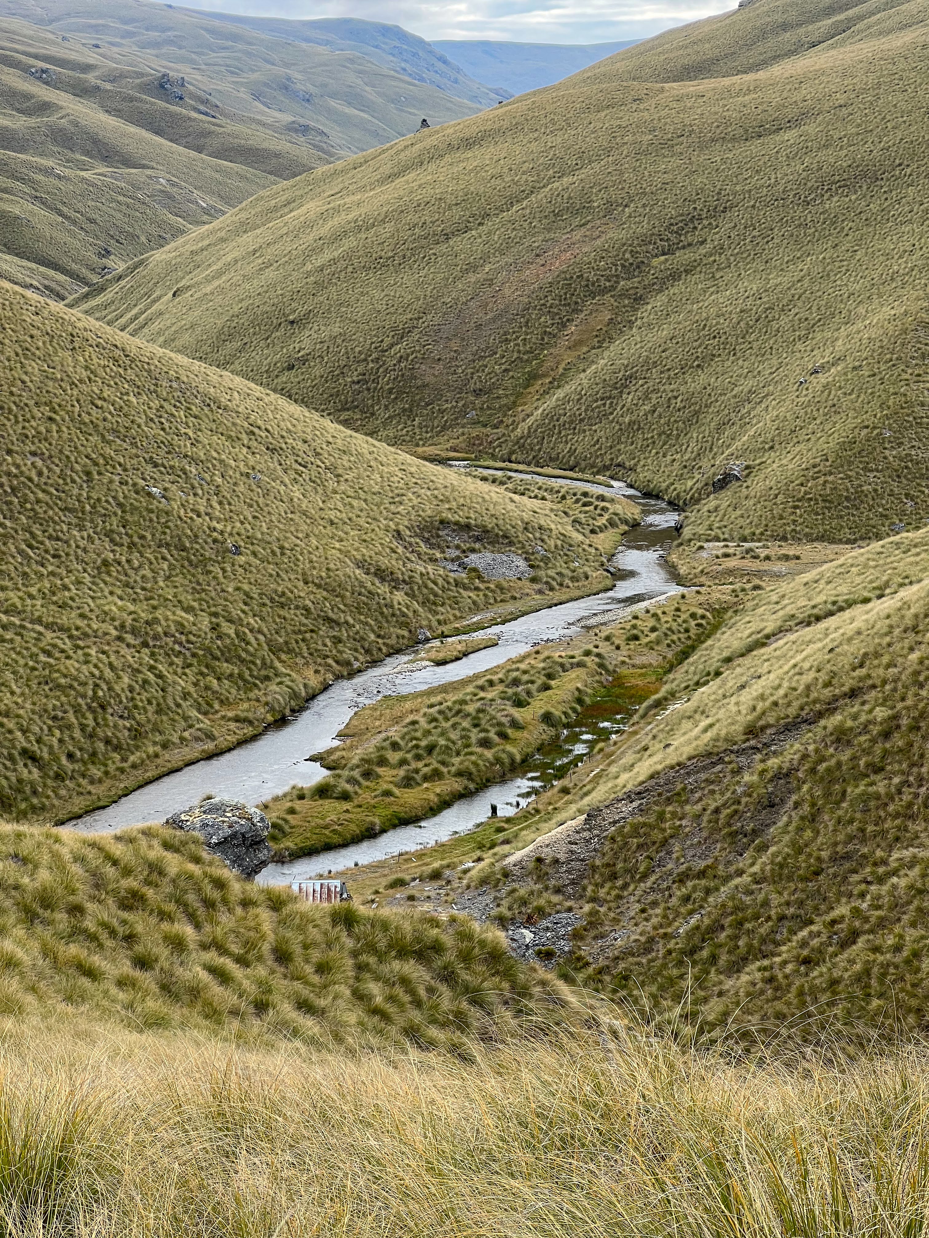
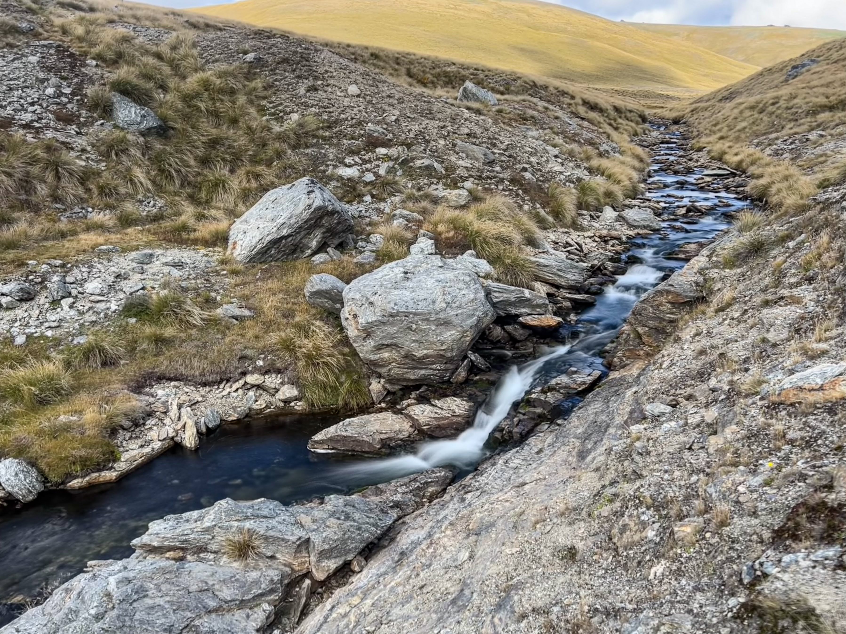
After lunch at Potters I began my cross country tramp. I'd planned and saved a route on my phone which made it so much easier. Gotta love having GPS mapping on your phone. From Potters I initially followed the track to the grave site (commemorating where a bunch of miners perished in a snowstorm) but then kept going straight when the track veered off uphill. I followed a spur down to Campbell Creek where there were a few remains of old stone miners cottages. It was a lovely spot, with deep pools that you could swim in, but I didn't partake, as I was concerned about how long it would take me to get to my destination for the night.


Once across the creek it was a steep climb up to a low saddle and another descent to Swinburne Creek. I saw lots of deer including a young buck. This creek also had remains from mining days, but was smaller and easy to cross.

From Swinburne there was another ridge to climb and then I sidled high to avoid bluffs before following the spur down to Digger's Hut which is on the east branch of the Waikaia River. There were quite a few deer tracks but also quite a few Spaniards! The spur narrowed and narrowed as it got further down to the river but I managed to find a way down the last bit, between and around rocky bluffs to at last come out right next to the toilet!!
 |
| Making my way down the final spur |


Built by a miner who has now passed on, the hut has a lot of character but is in pretty poor condition, though still weather proof. The clouds had been coming in and the tops looked fairly clagged so I was glad to sleep in the hut overnight. Since there was pretty good evidence of vermin, the food bags were hung up out of reach!! I went for a quick dip in the river to wash off the day's sweat and after dinner was soon in bed for another early night.

Day 3 Digger's Hut to White's Hut
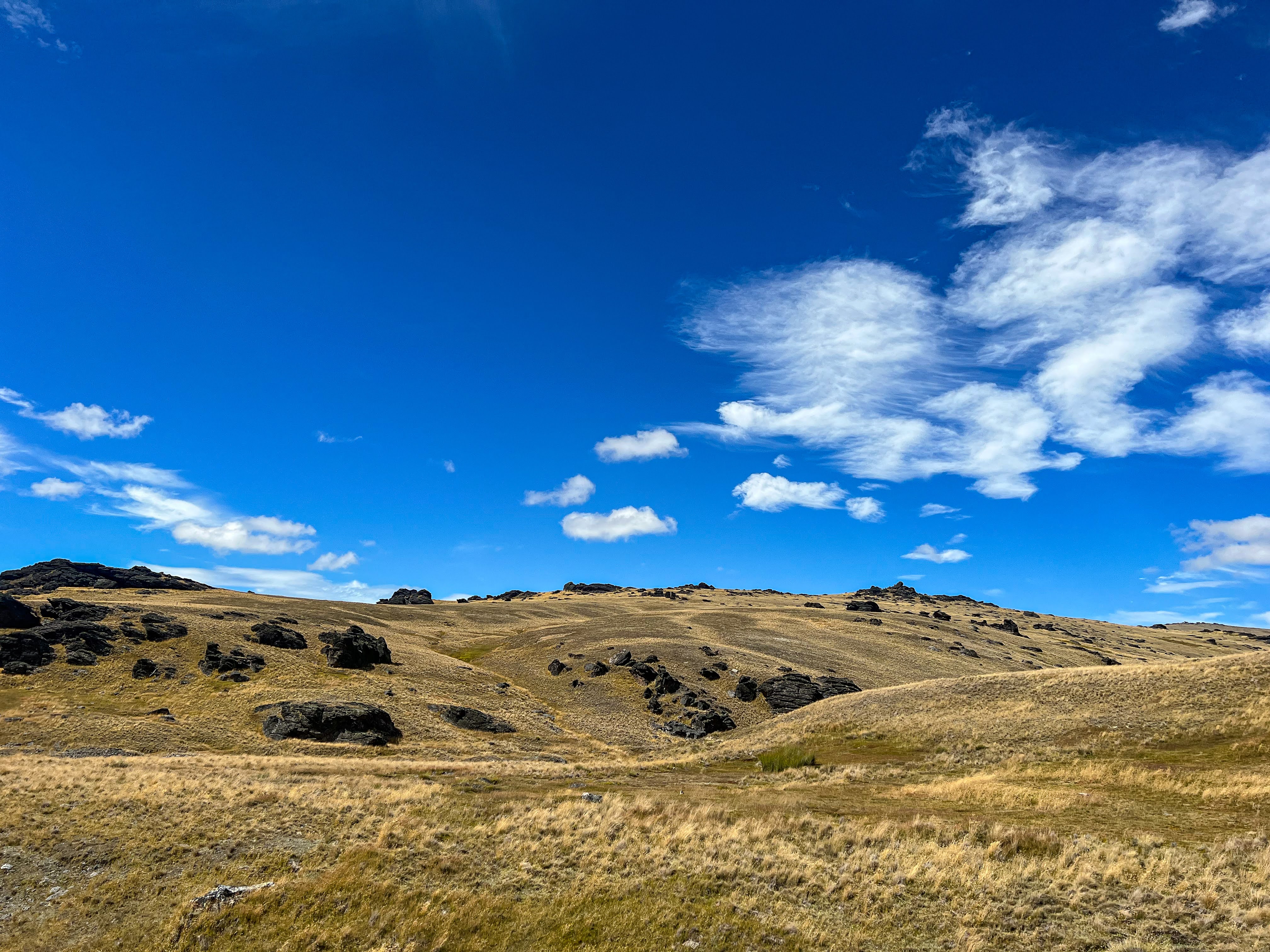
The clouds had cleared overnight and it was another stunning day. I set off around 9am, up the steep 4WD track to the main summit track. Getting up to the top took about 2 hours. The Godzone teams were all well and truly gone now, in fact Avaya looked to be about to arrive at the finish line in Brighton (yes there was mobile coverage on the tops). There was a chap with his 4WD parked at the junction with the main ridge track but the track I was on was wired off, so I jumped the wire, waved at the chap then turned left.

The vegetation on the tops was pretty rugged, mostly just mosses and lichens. There was a cold wind blowing so I stopped and put on my jacket, and then my trousers and gloves. Being prepared for changeable weather, especially when the tops are so exposed, is crucial to comfortable tramping, and more importantly, staying alive.


I was passed by three chaps on motor bikes but no one else. I turned down the track to Boundary Hut, which isn't far from the main ridge track, set in a lovely grassy sun bowl off the side track. With a cute wooden veranda out front, and 3 bunks, it was a nice cosy spot to get out of the wind and warm up a bit, and have lunch. Imagine my surprise to see Anna and Rene had stayed there last night!!


After a short lunch stop I headed off, sidling along a well used footpad to meet up with the main track a bit further down the ridge. I then followed the ridge all the way down to the Earnscleugh River. There was again evidence of mining with an old cottage ruins and tailings. I headed off onto another track which would take me the closest to White's Hut before needing to head cross country again. I noticed quite a good rock Bivy at the river, just in case I fancied returning for the night.
 |


The track crossed a small stream and climbed over a small ridge and then took a sharp right turn along a fence line so instead I climbed over the fence and headed off across dryish boggy ground and over some ridges to a creek I needed to cross. The creek was gorged and bluffed so I had to traverse high to at last find a way through. Then I walked up beside the creek which was very boggy and at last spied the hut.

 |
| White's Hut in distance |
The hut was a cute stone affair, with one window but no glass and a dirt floor, so not very inviting at all. I got there around 4 pm but I'd had enough for the day, as it would be at least 1 and a half to 2 hours back to the river. I pitched my tent just outside the hut on a patch of level grass, which gave me some protection from the wind as well.


The wind came up in the evening, so my earplugs ensured I got a good nights sleep.
Day 4 Whites Hut to Omeo Gully Hut
A horrible windy day, overcast but high cloud only, so good visibility. I wore my jacket and pants all day, gloves most of the time, and even long sections where I had the hood up as well. Definitely not my favourite weather, but to be expected up here. After a while I got into the mood of it, those much tougher Godzone athletes giving me a bit of perspective.

I took a different route back to the Earnscleugh, heading higher up on the ridge across the stream to avoid the boggy bits and crossed the side stream at the same spot as yesterday. But then rather than sidling above the creek I took a more direct route up over the ridge and across the dry bog, but higher again, which meant I overshot the 4WD track and ended up coming down a different ridge to the stream crossing, and then rejoined the track up over the next ridge to arrive back at the river. It took me 2 hours.


 |
| Back at the Earnscleugh River |
The track crossed the river and then began climbing, up to The Sisters, where there were two track options. I took the signposted option, which suddenly joined a good gravel road, obviously a private road, which didn't do too much up and down and was easy travelling. I'd had a snack at the junction, sheltering behind a rock but imagine my surprise to find a nice private hut beside the road. It wasn't locked so I had a wee look, very tidy. I had my lunch in the sun on a wooden verandah of a nearby feed shed and then continued on.


Just after the hut was the next junction, heading uphill again to join the main track up to the Obelisk. I could now see the big tower, and down below was Alexandra, so I checked for coverage, weeded out the emails and got an up to date weather forecast. The wind was forecast to settle some time tonight and be much better weather tomorrow. I headed downhill on the Omeo Gully track and not long afterwards I looked uphill and saw another tramper on the other track. The only person I'd seen all day.
 |
| Can you see the radio tower? |

The track was overgrown and quite steep heading down so I decided to stop for the night when I got to Omeo Gully Hut. Once I could see the hut I left the main track and headed cross country, arriving about 3pm. The hut door was open and the two windows don't have glass so it was pretty grotty inside, but not as draughty or as depressing as White's Hut. There was bird shit on the wooden floor and elsewhere so I found a spot behind the hut where it was most sheltered from the wind, and pitched the tent in between the Spaniards!!


There was an old well and sluice nearby, but derelict. So much mining history up here. Almost every creek shows some evidence of it. The sun came out around 6 pm as the sky cleared somewhat. Still windy so another early night, with earplugs!!


Day 5 Omeo Gully Hut to Nicholson Hut
A spectacular sunrise greeted me, and fairly clear skies.


Once packed I headed up the ridge behind the hut rather than returning to the Omeo Gully Track, passing more evidence of mining before reaching the main track up to the Obelisk.


As I ascended I walked into a brutally cold southerly. I was rugged up from top to toe, and kept perfectly comfortable whilst walking, but needed to seek shelter behind the numerous rocky outcrops whenever I stopped for a snack. I saw a few deer out wandering around as well.


Just past the massive telecommunications towers are the rocks that the range is named after. The Obelisk/ Kopuwai is quite spectacular, and provided nice shelter for me to stop for lunch. A couple who had walked up on a day trip were also sheltering there and they shared some plums.
 |
| Old Man/Kopuwai in the shadow of the telecommunications tower |
 |
| This photo fails to depict just how cold it was up there... |


From Kopuwai the track followed the ridge back to the junction with Symes Road. I turned right on the 4WD track down to Nicholson Hut, which I reached a little after 1pm. It was much more sheltered in this sun drenched bowl, and the river running through it was very pretty. I had walked enough for the day.


There were two 4WDs parked opposite the hut, and again evidence that there were 2 people staying longer than overnight. The hut only had five bunks so when a young family with 3 kids arrived, without a tent, they had to make the hard decision to return back to their vehicle at Symes Road. They had an early dinner and then headed off into the descending mist. It will still be a great adventure, even if they didn't get to stay overnight.


A bunch of 4WD couch potatoes had driven down the road for a quick gander mid afternoon, and had only stayed long enough to check out the hut and toilet before jumping back into their vehicles to continue on. Late afternoon the two chaps staying longer term returned to the hut. They were from Queenstown and were working a gold claim further down the river. More modern day gold miners. Since they too were sluicing, they were quite cold after being submerged, wearing wetsuits, all day. Things people do for a bit of gold dust hey?
I'd already had my dinner, but the boys had cooked extra steak so they offered me some. Don't mind if I do....
Day 6 Nicholson Hut to Highway
With an easy day ahead I had a leisurely start, joining the boys for a cooked breakfast before heading up the hill to the ridgeline. The wind was still blowing a chilly southerly, but not as bad as the previous day, and soon I was heading down Symes Road, and out of the wind, making it quite pleasant indeed. I met some people heading up the road, wearing only singlets and shorts, and warned them that it was very cold up top. It never ceases to amaze me how many people I see walking up mountains completely unprepared for inclement weather.

I veered off the track to visit one final hut, another White's Hut, this one named after the nearby White's Reef and a beautifully crafted stone cottage. It was built by the same stone mason who built the impressive Mitchell's Cottage down the bottom of the hill, which I'd visited on a previous trip. Although there are various places along the road where you can see the hut, there isn't a signposted track to it, so you've just got to know it's there and do a little tussock hopping to reach it.


Then it was on down the road, through the gate where my radiator had boiled on my previous attempt at this trip, and onwards down Symes Rd to the highway, where I hitched a lift back down to my car.

