The Paparoa Track is NZ's newest Great Walk, and was purpose built as a joint mountain bike and tramping trail. Cyclists usually take two days to ride it, staying overnight at the middle hut. Trampers, on the other hand, usually take 3-4 days to walk it, requiring bookings at all 3 huts. As a result the middle hut gets booked out before the others, which can limit availability of the walk to trampers, who would find walking between the first and third hut a bit too long for one day.
It had taken me about 4 months to find availability, having booked my walk some time before Christmas. After my paddles at Murchison with Kelvin, Liz and Julie I headed south to Lake Brunner to ride out some bad weather over the Anzac Day weekend and took a peak at the weather for my upcoming trip. It looked like more bad weather, so I decided to check the DOC website to see if there had been any cancellations so I could change my itinerary to more salubrious conditions. Imagine my surprise to find there were indeed openings, so change I did, heading off a few days earlier.
After arranging a car relocation from Blackball to Punakaiki I received an email from the relocation providers informing me that the track had been closed partway along the track due to a huge slip and would not be open to through traffic for at least another month. DOC had yet to inform me of this!!
The relocation service refunded my money and I looked at my options. A few years ago when staying at Kirwan's Hut I had met a west coaster who had highly recommended the walk up along the ridgeline from Smoke Ho carpark up to Mt Watson and across to Croesus Knob. The closed track gave me the perfect opportunity to create a loop, so I rebooked my huts for a second time and headed up to Blackball. I stayed overnight at one of the pubs (not the Hilton) and enjoyed the hospitality of this wonderfully interesting town, with it's history of coal mining, trade unionism, women's suffrage and even being the headquarters of the NZ Communist Party!!
The next morning I headed off early, leaving the car at Smoke Ho carpark and heading straight up hill on a well marked track to the bush line a few hundred metres below Mt Watson. It was wet and boggy in places but as a result was lush with a healthy undergrowth and lots of birds. From the bush line the track followed a ridge up to Mt Watson, with views out to the west coast and to the nearby open cut mine.
 |
| Smoke Ho carpark, I would be following that ridge from bottom right to top left |
 |
| Paparoa Track, southern start |
 |
| Alternative track up to Mt Watson |
 |
| Cool steps |
 |
| Lush forest, narrow track |
 |
| Nice big trees and some root scrambling |
 |
| Arriving at the tree line |
 |
| Grey Valley, Southern Alps in background |
 |
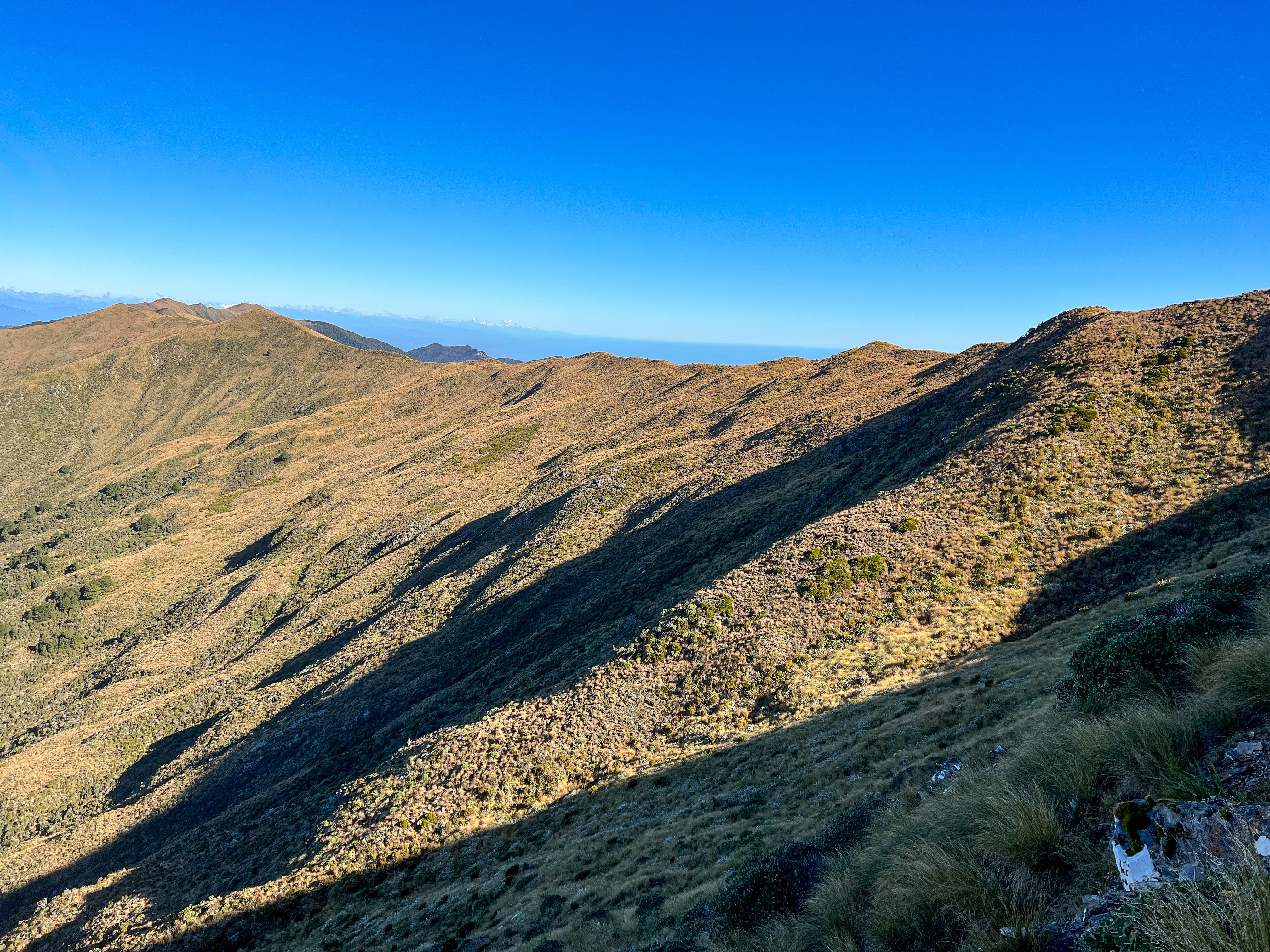
| Ridge walking towards Mt Watson and Mt Leitch behind it |
From Mt Watson the poled route headed north, bypassing Mt Leitch summit. I climbed up though so I could check out the bivy below Mt Leitch, which was currently occupied by a group of workers doing kiwi monitoring. I continued on, following the well marked route in excellent sunny weather all the way towards Croesus Knob.
 |
| Mt Leitch Biv is used by biodiversity workers doing trapping and kiwi monitoring |
 |
| Looking back at Mt Leitch |
 |
| Ridge walking, my favourite when the weather's good |
 |
| Croesus Knob, I'm heading for that wee notch top right |
 |
| Looking back south |
I met some trampers walking in the opposite direction just as I stopped to repair my ripped shoe. They had come from Moonlight Tops Hut, and having been reassured that would be easily achievable I yet again changed my booking online (the advantage of being on the ridge was excellent mobile coverage) from Ces Clarke Hut to Moonlight Tops instead. That would avoid needing to backtrack from where the ridge rejoined the main Paparoa Track but would add another hour or 2 to the day. Since I was making excellent time and the walking was easy it seemed like a good plan.
My Hoka Speedgoats had ripped across the top of the shoe. This was my second pair of these trail shoes, which I love wearing because they are light and very comfortable, with great cushioning especially on hard ground. They have a weakness on the upper where they dry out and crack, causing the material to be prone to holes, and I had inadvertently caught my toe under a rock and split the whole upper part. I had some strapping tape, so I used that to repair them, and continued on.
The views all day were magnificent, and after about 5 hours I rejoined the Paparoa track after skirting around the summit of Croesus Knob. I didn't fancy the steep descent from the Knob summit, and didn't think the view would be any different to that I'd been enjoying all morning.
 |
| Heading towards that notch |
 |
| Getting closer |
 |
| The Paparoa Track below, heading down to Ces Clark Hut |
Once back on the track I met other walkers and cyclists, going in both directions. The track closure was between Moonlight Tops Hut and Pororari Hut, so trail users needed to return the way they had come. The track continued to climb, sidling along as it continued in a northerly direction, with more magnificent views, including the Southern Alps and Aoraki. The first section of the Paparoa Track is actually part of the much older Croesus Pack Track, which soon heads off the tops for the steep descent down to the west coast at Barrytown. The Paparoa Track stays on the ridges, continuing north.
 |
| West coast cloud blowing in.... |
After an hour on the tops the infamous west coast mist began to blow in. These moisture laden clouds do a good job of keeping the vegetation so lush, but they kinda kill the views! They do add mood to the landscape though, and it was pleasant walking regardless. Besides, I'd been spoilt all day already.
 |
| Looking back: Croesus Knob on left, Aoraki way in the distance |
 |
| One km in the moody gloom to the hut |
 |
| Dracophyllum bushes |
About 2 hours after hitting the main trail I arrived at Moonlight Tops Hut. There were already a few other trampers there, but no cyclists, hence why there were so many free spots in the hut. I had heard that The Paparoa Track and Old Ghost Road mostly attract the type of mountain biker who likes to ride the tracks and then skedaddle back to where they come from. Unlike less technical trails like The West Coast Wilderness Trail, where cyclists stay longer in the area and spend more money in the region. So with the thru track closed, the cyclists had all cancelled en masse!!
The evening was really pleasant, with the hut only half full, and we all scrambled up the rise behind the hut to watch the rather muted sunset. We met Jess, the hut warden, and discovered we had some mutual friends in the paddling world. She also gave me some beta on the gorges in the Pororari River, but more about that later.
 |
| There is a stunning view of the escarpment from here, but the west coast mist obscures it |
 |
| Sunset from behind the hut |
The next morning trampers either headed back the way they had come or, like me, they headed out along the closed part of the track along the escarpment to the shelter. The slip was actually below the escarpment, so the section of track along the top was completely unaffected, and I needed to tick that shelter off my hutbagging list!! I had booked a second night at Midnight Tops so I had all day.
 |
| Good morning! |
 |
| Sunrise, Moonlight Tops Hut |
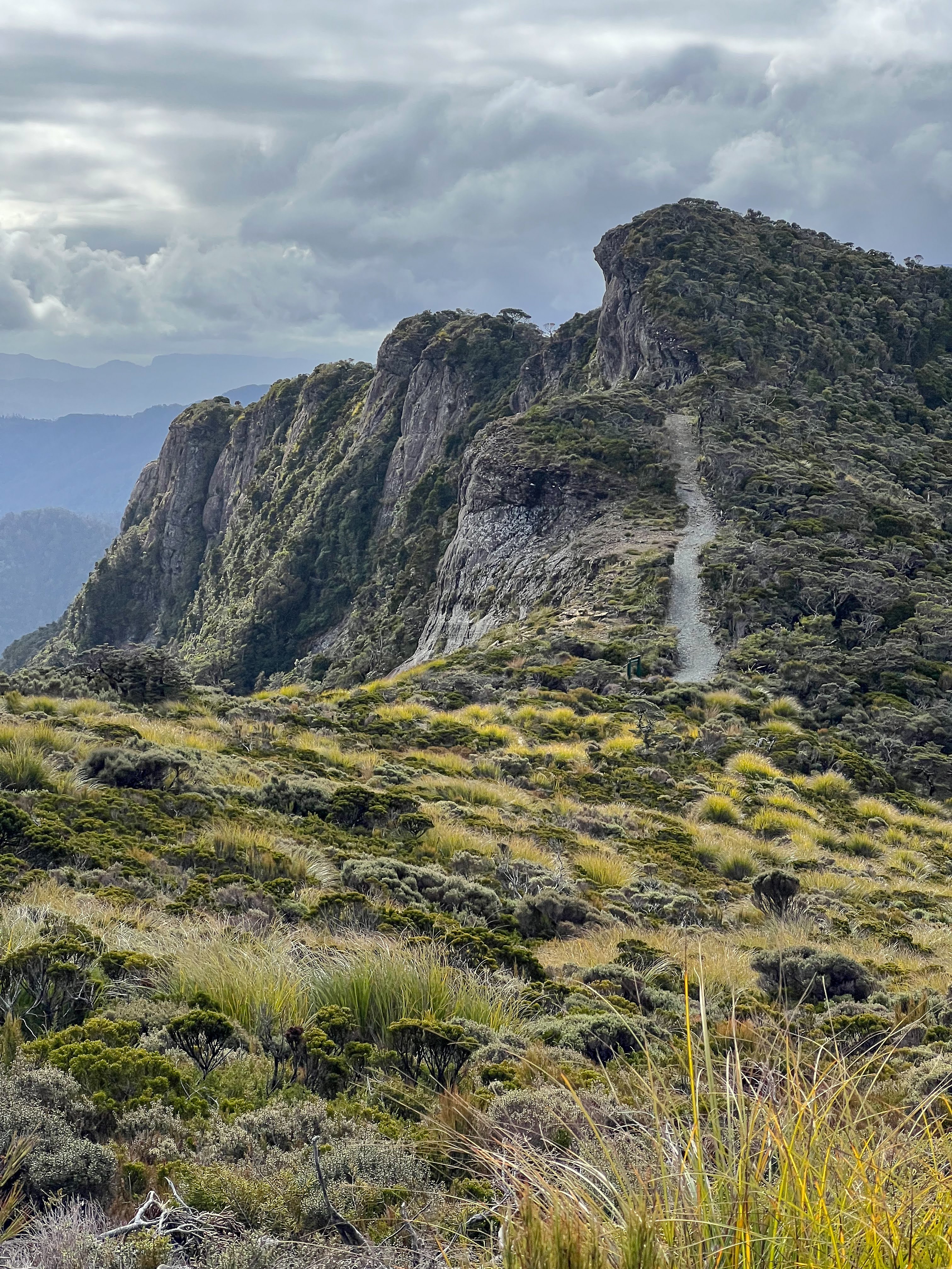
It was another stunner, starting with a spectacular sunrise. The walk out along the escarpment was lovely, through wonderful gnarly mountain beech and drachophyllum, with occasional glimpses of the precipitous drop on the western side. However, the true grandeur of the escarpment is best appreciated from the hut.
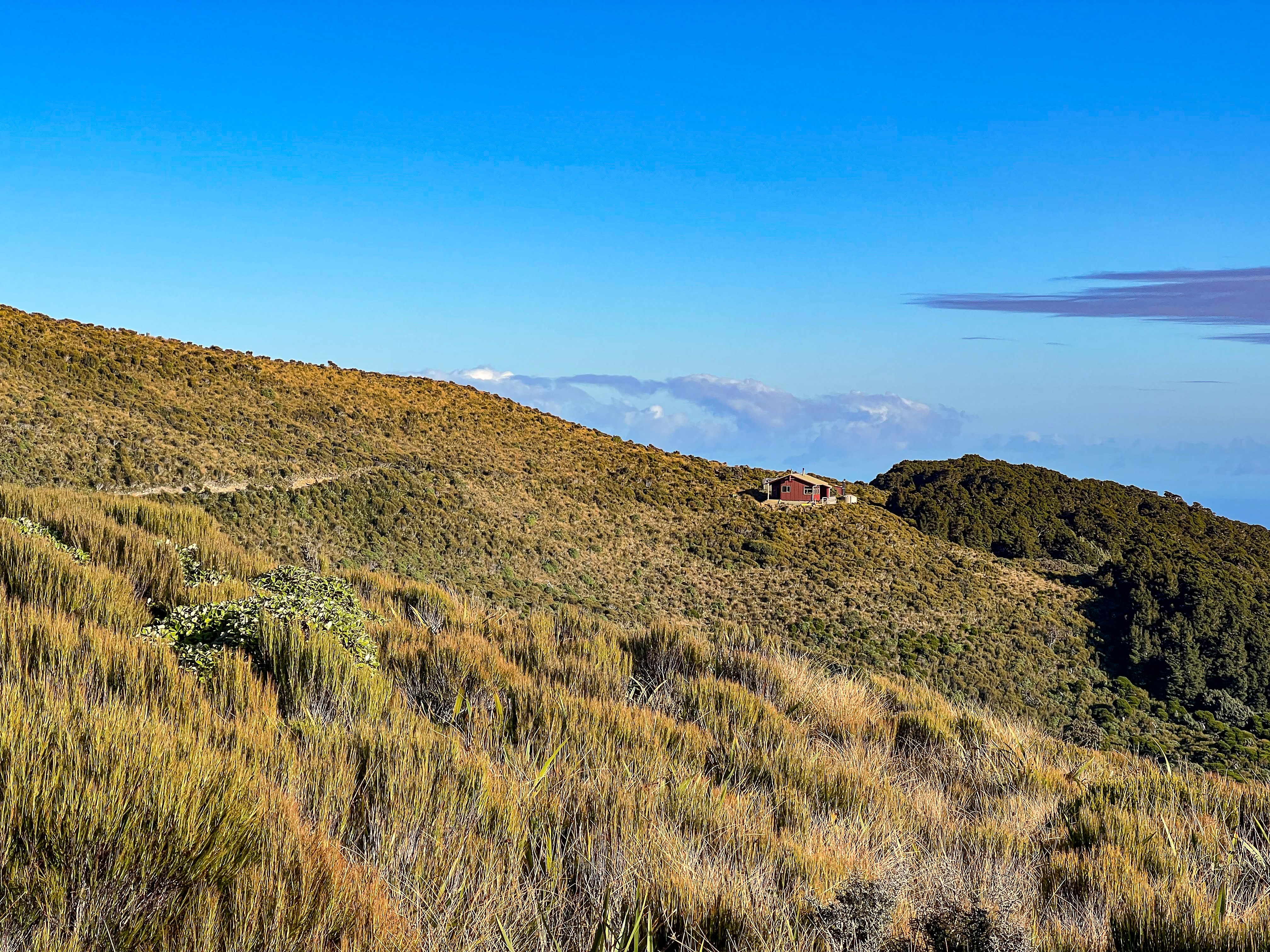
 |
| Look closely and you can see Moonlight Tops Hut in distance |
 |
| Pororari Hut in the distance, at the end of the first ridge to the left |
There was a new shelter being built, much bigger than the current shelter, with room for a large equipment shed for DOC. The section of track down off the escarpment is where they have all the slips occurring with wet weather events, so having access to track clearing equipment is a DOC priority.
 |
| Old shelter |
 |
| Enormous new shelter |
After a cuppa and some lunch I headed back to Moonlight Tops. The weather stayed clear, and the hut slowly filled up with a new group of trampers. Still no cyclists, but a group on an organised tour having a very delicious looking gourmet dinner.
 |
| A small cirque and waterfall off to the east of the track |
 |
| Fossil? Or explosive? |
 |
| That magnificent escarpment in all it's glory |
The next morning I returned back along the track, this time continuing to Ces Clarke Hut and following the old packrtrack back to Smoke Ho carpark.
 |
| Another stunning sunrise |
 |
| View down to the west coast, no mist |
 |
| The hazard markers are for the cyclists! |
 |
| Croesus Knob on right |
 |
| West coast, Greymouth, and little old Aoraki in the distance |
 |
| The notch I walked down from a couple of days before |
 |
| Ces Clark Hut, smoko stop |
There were a few huts to visit, some off the main track, and lots of mining history. A really enjoyable, mostly downhill amble.
Back at Blackball I booked back in at the same hotel I'd stayed in 3 nights ago, and was entertained by the annual May Day debate. Topic: that the Wellington Protestors were an embarrassment. The affirmative team did a great job of dressing up as Ashley Bloomfield and Siouxsie Wiles (complete with pink wig!) and a decent argument, the negative team took themselves far too seriously with a strong anti-vax theme. The affirmative won, and no-one behaved badly, though it wasn't exactly a large turnout. The locals are wonderfully friendly, can't recommend the place more.
The next morning I headed down to the west coast. I left my car at the motor camp whilst I walked the other end of the track up to Pororari Hut and back again. I'd originally thought about bringing the packraft and paddling back out, but after speaking with Jess at Moonlight Tops I decided it wasn't worth the effort. The upper gorge was just too gnarly to be paddling alone, and the lower portion was probably better done as a half day trip, so I left the packraft in the car and just tramped it.
The track follows the Pororari River most of the way, at one point climbing up and away from the upper gorge, so I could see for myself that it definitely wasn't something I'd be paddling by myself, if at all! There were a number of rock sieves and drops, but it certainly looked portageable.
 |
| Northern start of Paparoa Track |
 |
| Up through Pororari Gorge |
 |
| through a tunnel |
 |
| easy walking |
 |
| Moonlight Tops Hut is on that ledge way in the distance |
The final climb up a ridge to Pororari Hut took about an hour. There was an American couple already there, celebrating 5 years living in NZ. Later, a lone cyclist turned up, and over a few cups of tea we made great conversation and solved most of the world's ills. Awesome company!!
 |
| Random woodcarving.. |
 |
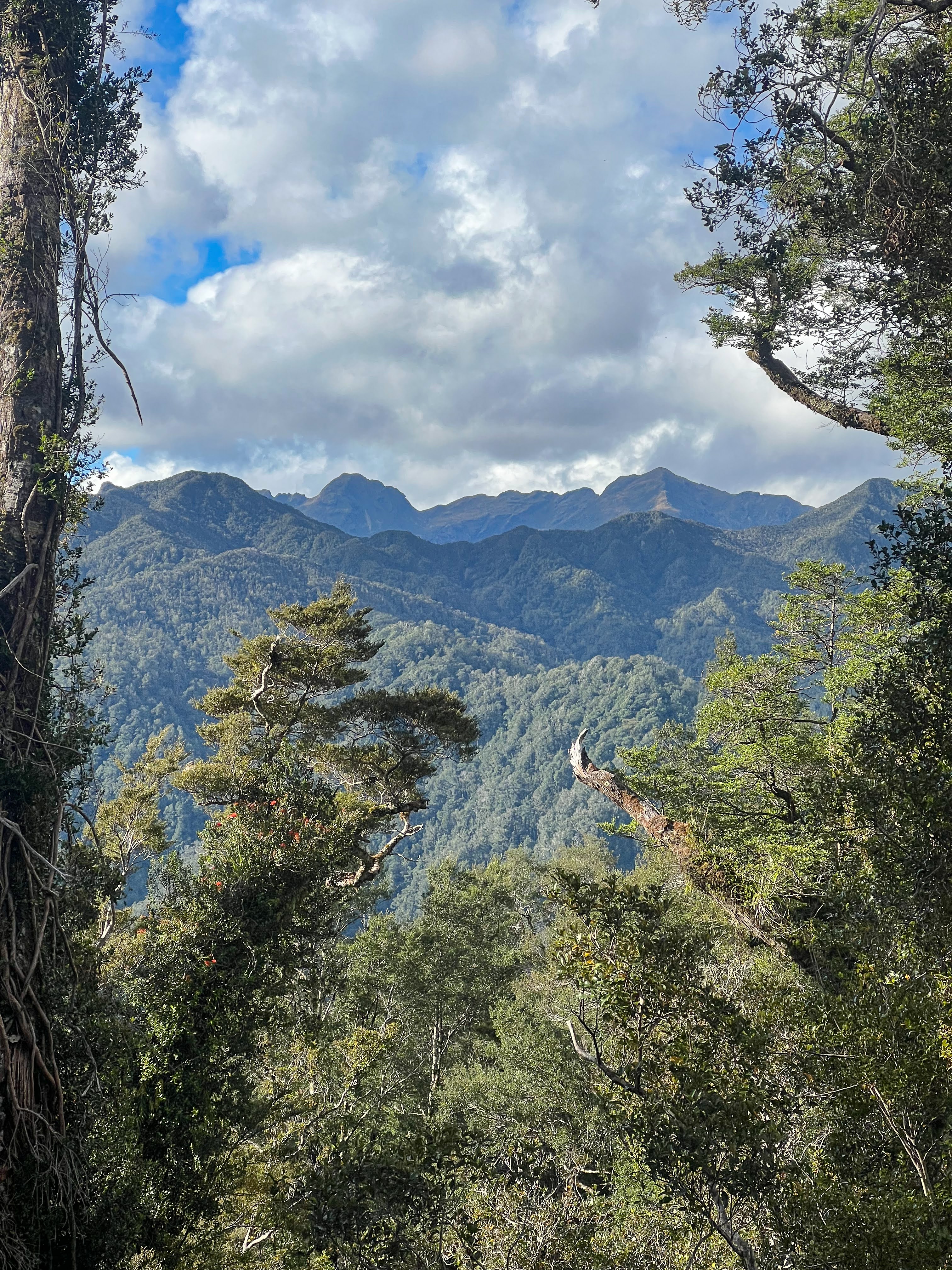
| The craggy limestone mountains in the north of Paparoa National Park |
 |
| The escarpment, can you see the track descending off it on the left? |
 |
| Moonlight Tops Hut |
 |
| Sunset, Pororari Hut |
We all took our time leaving the next morning, it being an easy downhill walk, even easier cycle, back out.
I booked in at the motor camp, enjoyed a nice hot shower, and the next day headed back down to Wanaka. I had no choice, all my footwear was buggered, and there was a brand new pair of trail shoes waiting in Wanaka for me.
There was also a bike to look at. What's that?? A bike??
That's next...


No comments:
Post a Comment