When I first started walking again I used a walking frame, gradually making my way around the hospital wards, and getting to and from the toilet unaided. Once I returned home I soon graduated from a walking frame to two crutches, then one, then finally none. That took about 8 weeks.
Gradually I was able to go for longer walks, mostly in the vicinity of where I lived. Walking along the Clutha River tracks is always scenic and enjoyable, no matter how many times you go.

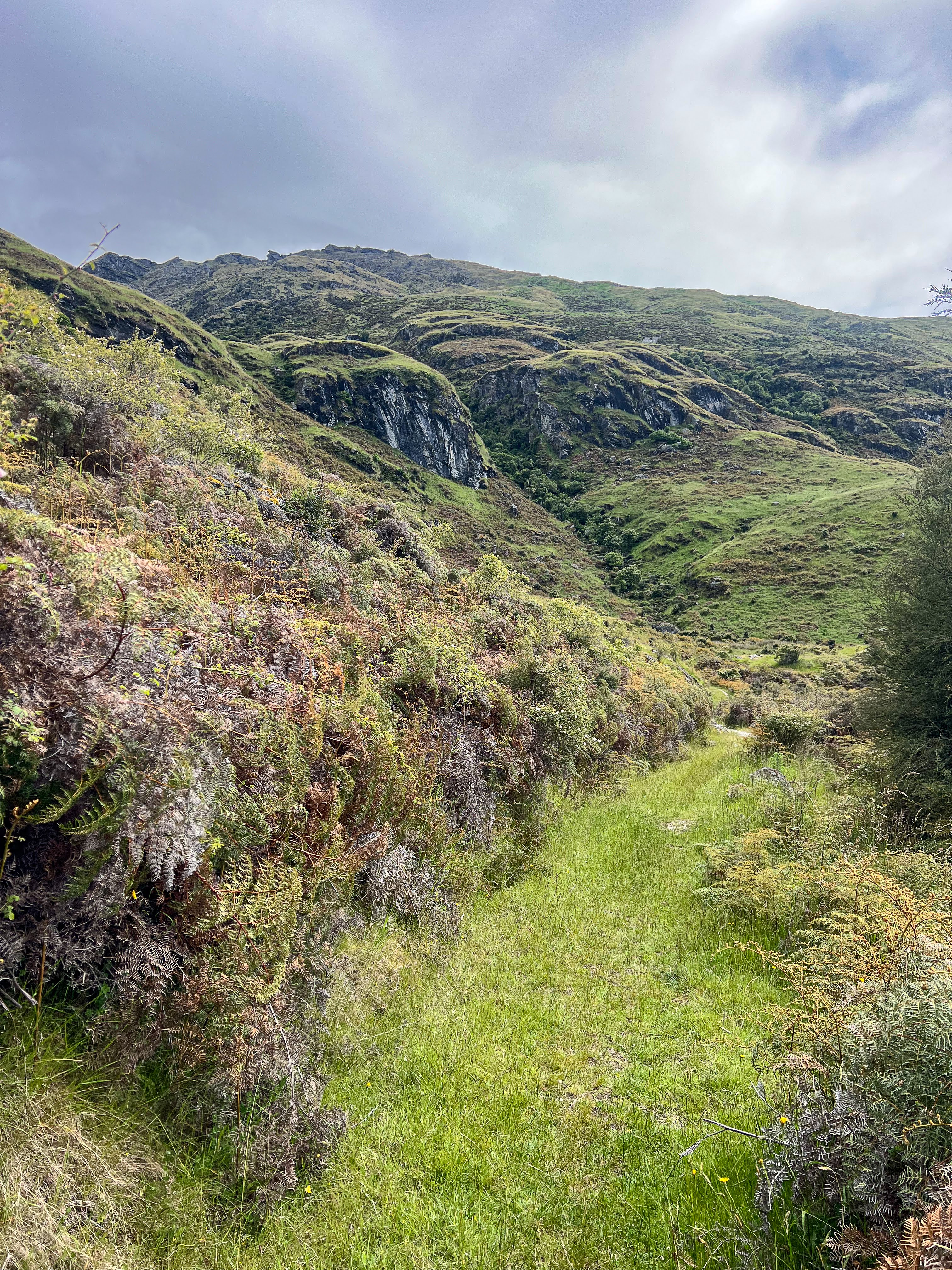
Once my orthopaedic specialist had given me the go ahead, my walks became more ambitious. A ski instructor friend of mine joined me for a walk up Fern Burn. It's a glorious walk through beech forest, but the track is pretty uneven with some scrambling involved, so it was good to get off the manicured paths and work on my balance.

We walked as far as the bridge and return, marvelling at the huge trout we could see in each pool. We didn't tell the fishermen further downstream though!

Next I climbed Mt Iron. This was the first proper hill I had climbed post accident. All those glute exercises had worked a treat and I found it incredibly easy.

 |
| a great view from the top |
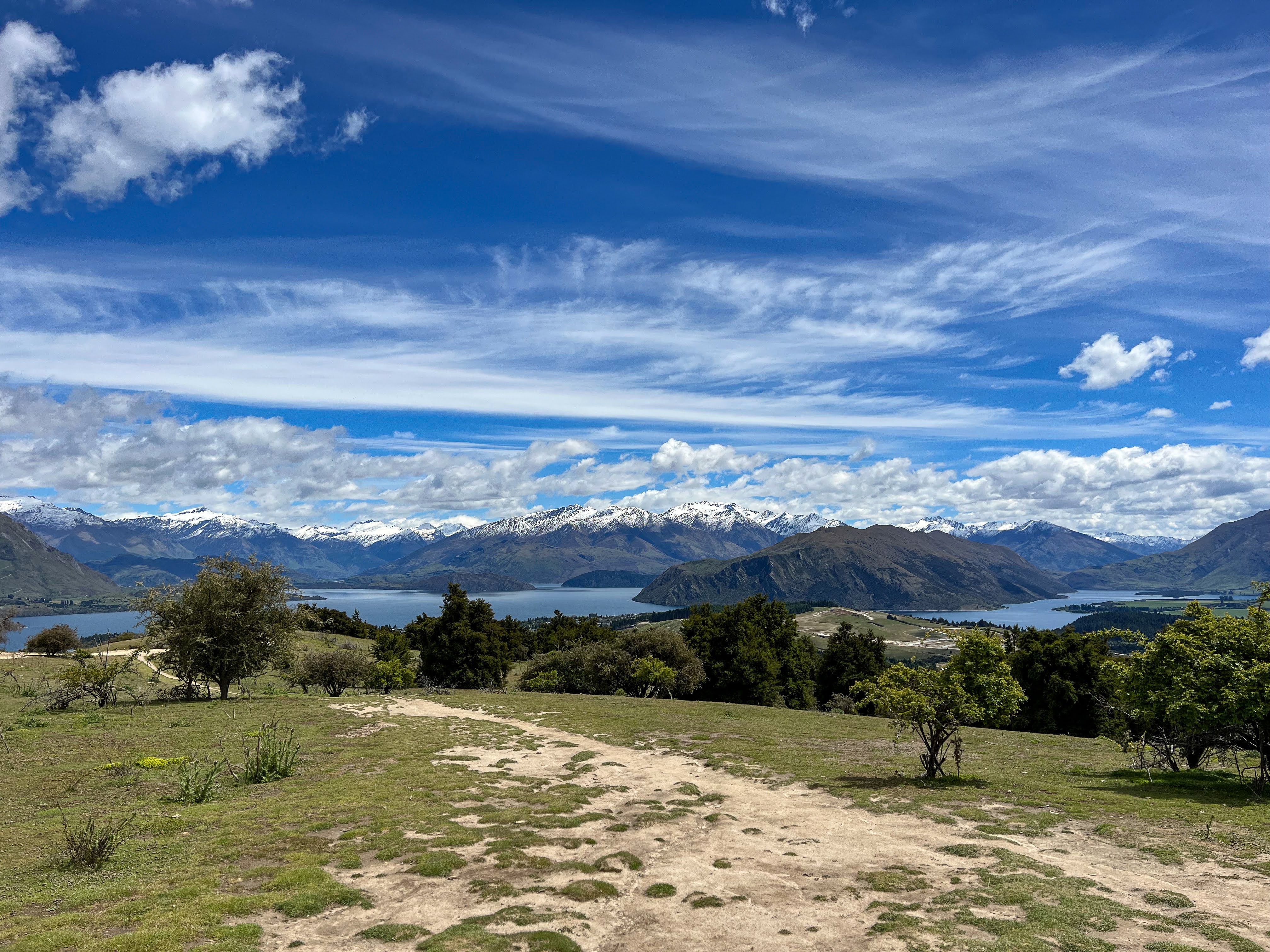
Mt Iron is only a small hill, so to up the ante I planned to climb Grandview Mountain next. To keep things in perspective I decided to limit my climb to 2 hours uphill, before returning back to the car. Sure I didn't make the summit, but I still got to appreciate the fine views over Lake Hawea.


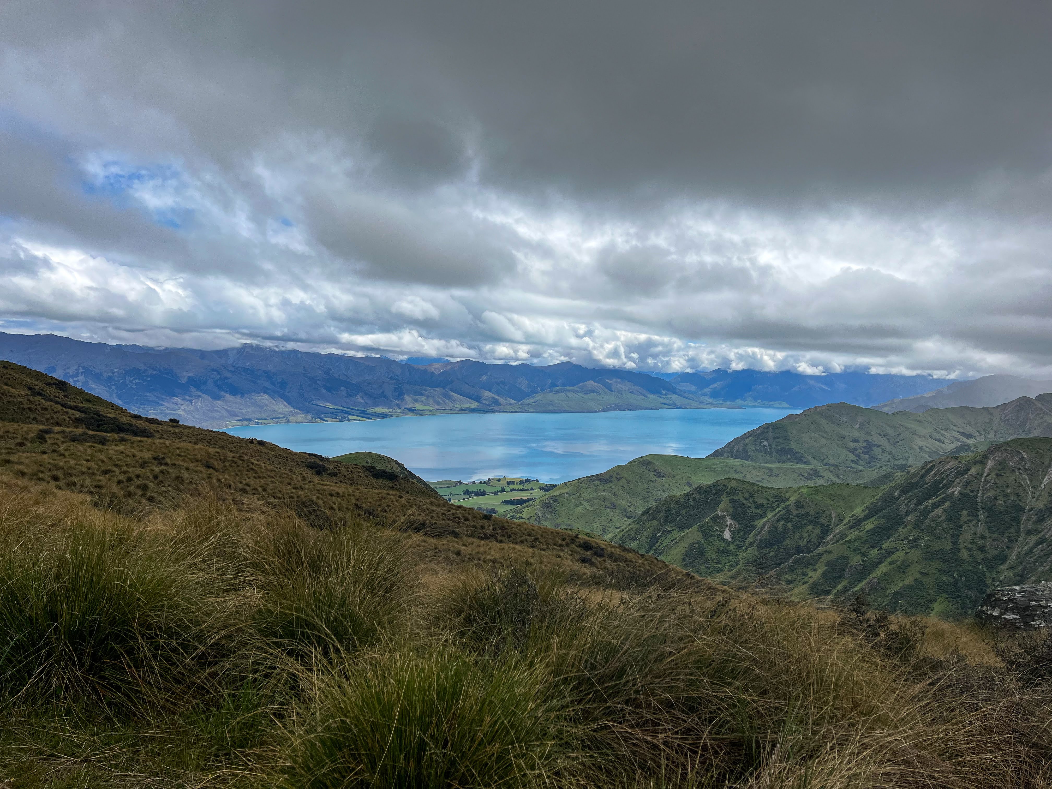 |
| Lake Hawea |
 |
| my turnaround spot |

My next hill was Little Criffell, and this time I decided to make the summit. The walk started with a crossing of the Cardrona River and then a fairly continuous ascent up farm tracks to the ridgeline. It was a further 3 km to the summit and there were times when I felt I just might have bitten off too much. But I made it, enjoying the amazing views in all directions. Roy's Peak across the valley as well as right up the Cardrona Valley, Lakes Wanaka and Hawea, and behind me the Pisa Range.


After a short lunch break hiding from the wind I returned the same way. My quads were screaming by the time I got back to the river, so I had a wee dip before returning to the car. Time to add a few more leg exercises to the pilates program...


Once the quads had recovered I took on my next adventure. This was to be my first overnight tramp, and to ease into it I decided to make it a bikepacking trip. By now I'd been going on a few bike rides around the area, including a section of the Lake Dunstan Trail, so I felt ready to tackle a ride along the Dingleburn Road and then over the hill to a campsite. From there I would do a daywalk up to the bottom hut on the Dingle, and then cycle back out the next day. Only that wasn't what happened....
 |
| Lake Hawea |
 |
| Lake Dunstan trail |


 |
| Coffee break, Lake Dunstan Trail |

I drove out to the carpark, loaded the bike and began the cycle along the road which skirts high above some bluffs next to Lake Hawea. There were a few hills that I walked up, and one descent I didn't ride as I felt my 37mm tyres were just a bit too narrow to provide enough traction. The rest of the downhills were fine.
 |
| Setting off from the carpark |
 |
| View across Lake Hawea to The Neck |
The great unwashed public can't use the road past the homestead, but must take a track along the lakeside and up through a saddle between two hills before a descent and sidle around to the mouth of the Dingle, where the campsite is. This is where the wheels fell off...
 |
| Lovely wee beach, the road I had cycled in the background |
The first bit around the lakeside was fine, but the steep climb to the saddle was far outside my ability or fitness on a fully laden gravel bike. That climb was hot and sweaty, and took ages!
 |
| Lake Hawea and Silver Island from halfway up |
 |
| Looking north up the lake |
 |
| Rest stop |
 |
| Still quite a bit of hike-a-bike to go |
At the top the track descended to a stile, which I had to muscle my bike over, no mean feat when your arm isn't all that strong. Then the sidle. I could see my destination a km or so ahead, but then I reached a rather muddy patch, and to get through it I needed to manhandle my bike up and over a small incline, whilst sinking into slippery mud.
 |
| View up to head of the lake and Hunter Valley |
 |
| Across the lake |
The photo doesn't do it justice. I tried, but I just couldn't get my gear up and across it. Perhaps I could have unloaded the bike, but the day's struggle already had been considerable, so I decided to turn around.
 |
| I tried, you can see my wheel marks, it goes uphill BTW |
Getting back over the stile took more effort, but I was able to easily ride most of the way back down the hill to the lakeside, and then back to the road.
The final ride along the road still required me to do a bit of hike-a-bike, but my increasing confidence with the bike's handling meant it was a much quicker return to the car than the outward journey.
 |
| Stunning lakeside ride |
Despite aborting the trip I felt pretty good the next day, so made a plan to do a 3 day tramping trip next. I took the bike in for a service, and upgraded the tyres to 40mm, giving me a lot more grip and comfort, since I run the tyres tubeless.
I also went for a wee paddle with the packraft in Lake Wanaka, to see how my arm felt. All good, but you can see from the picture it was raining up in the headwaters.


I headed out to Homestead Bay at West Wanaka and began the walk to Minaret Burn. It was a glorious day with no wind and the views were stupendous.


 |
| Homestead Bay and mouth of Matukituki River |


I stopped for lunch at Colquhoun Bay and then continued towards Rumbling Burn, the crux of the trip.
 |
| Colquhoun Beach |
 |
| Mou Waho Island |


There had been a bit of rain in the hills over the previous few days and I heard the burn before I got to it. The vehicle crossing was a decent rapid, with a standing wave! My poles were well and truly vibrating when I put them in the stream to gauge the intensity of the flow. If I slipped here, I would end up being washed into a fairly steep boulder garden. No thanks!
 |
| Deep and fast flowing, no thanks!! |
Plan B was to walk down to the lake and cross there. Only the flow was just as nasty, and there was a deep channel that I would have needed to swim. The safest option was to swim across at the lake, but I didn't want to get wet so I explored a little more before deciding to again turn around and return home.
 |
| Alternative crossing, also no thanks! |
At Colquhoun Beach I stopped to boil the billy and have a cup of tea, and visit some nearby ruins, then made my way back to the car.


I'd managed to carry an overnight pack for 6 hours so I was pretty happy with that achievement. The next day, however, my back was pretty sore, and it took me a few days to recover. I'd actually dodged a bullet by returning the same day, as it seems my body wasn't quite ready yet for a multi-day tramp.
Jude was driving in to Macetown with friends just before Christmas, so I hitched a lift in with her, planning to walk back out with my pack. I also wanted to visit an old miner's hut I hadn't bagged when I'd visited during my Motatapu tramp a few years ago.
It was fun bumping along in Jude's flash 4WD. We visited the dam and I got to see what the walk out would be like. When I had tramped the Motatapu Track I had gone over Big Hill rather than follow the Arrow River 4WD track. After setting up camp, and with rain imminent, I decided to put off the hut bagging until the next day.
 |
| Arrow River |
 |
| Luxury travel |
 |
| Chilly bin went back out in the car |
Polly, one of Jude's friends, and Willow, Jude's dog, joined me for the walk up the Gold Burn. We continued past the various stamper batteries to a river fork, with the hut hidden behind a bluff, requiring a bit of a scramble to get there. Willow found a hare to chase and was in heaven!


We had lunch at the tidy wee hut and then walked back to our campsite. Lots of exotic flowering plants, so I picked a bunch of lilies.
Christmas Day I walked out. The track crosses the river many times before sidling high above it as the river makes a steep descent through boulders and cascades to the dam. It then drops precipitously, though the road is more gradual, and as I began crossing the final few river crossings Jude caught up to me in her 4WD so I took the offered lift for the final km.


Boxing Day I got a lift down to the Red Bridge with Karen and walked back home along the Upper Clutha River Track. I decided to replicate a multi-day tramp by taking my fully loaded backpack from the day before. Which meant when I stopped for lunch I could also boil up for a cuppa!


I felt pretty good after those two days of walking, despite the hot temperatures of this unseasonably dry summer. The North Island was being inundated with extreme weather events and flooding, but down south it was warm and dry pretty well every day. Almost too hot for tramping...
Marlene, massage therapist and friend, had invited me down to Colac Bay, so I headed down there to see in the New Year. A few nice walks along the beach, walking Tucker the dog, reading books and watching Marlene and Rudi surfing, and a beach bonfire on NYE.


1st January I returned to Queenstown to pick up Stu and Ian who were planning some more South Island packrafting adventures. With an extended tramp in Australia planned for late February I'm more focussed on getting tramping fit, so I decided not to join them. I went tramping instead, on my first successful overnight mission!
That's next!
No comments:
Post a Comment