Just over 6 months since I'd broken my pelvis in 3 places, my forearm in so many pieces it took four hours to piece together, and 6 ribs just to round it out, I headed off on a 3 week unsupported bushwalk through the Aussie bush.
It's been 5 years since we walked the last section (Dead Horse Gap to Kiandra) of the Australian Alps Walking Track. Eye injuries, bushfires and Covid had got in the way of completing another section, so this year we had decided to combine two 10 day sections into one long hike. Iain was keen, but my brother was hesitant, and due to a few life issues and injuries, decided to pull out. Which left just two...
There are no towns between Hotham and Thredbo, though Bright isn't that far away from Mt Bogong. There's some roads that are crossed, and a few 4WD tracks frequented by enthusiasts but otherwise it's remote and there's no plan B. Committing to 20 days of walking in remote areas is exactly that: a commitment. And I knew it was going to be harder than the NSW sections we had already covered.
I had designed a conservative itinerary. There was a lot of elevation gain and loss, and unknowns as far as track quality was concerned. The 2019/20 bushfires had affected some of the areas we were walking through, much of it on marked foot trails rather than fire trails, so regrowth and tree fall would potentially make following a trail difficult. I'm not into epic walking days, and with those uncertainties built into the itinerary I opted for shorter walking days rather than fitting in too much. I also added in the side trips to the many interesting huts in the high country, be they old stockmen's huts from when the high country was grazed in summer, or ski lodges run by various alpine clubs.
In the last 5 years technology had caught up. There was a Facebook group dedicated to the walk, which provided some recent updates to track conditions and water sources, and a few trip reports and pictures to enjoy whilst preparing for our own walk. It's still a niche thru-walk, due to the difficulties of resupplying, but it's definitely seeing a few more people on it than 5 years ago.
Map technology has also improved. Last time I had relied on my not very good InReach maps for navigation, as well as some paper maps printed out beforehand. This time I would be using offline maps downloaded onto my phone using the Avenza App. Iain had also downloaded them. Little did I know how essential they would be during our trip....
With Matt no longer joining us it took me a couple of days to cook and dehydrate the food I would need for the trip. I'm a sucker for individually packaging everything, using the vacuum sealer. First remove water, secondly remove air. Makes for much smaller packages.

Iain provided the drums for our food drop. Although there were options to do more frequent resupplies, we opted to just do the one, meaning each segment we would be carrying approximately 10 days' food. I popped in a shop bought Indian curry with naan bread for my dinner at the food drop, and Iain added a six pack of beer. He would be returning to pick up the drums so we could also leave our trash in them.
The other logistic challenge of doing a long walk in the wilderness was keeping our electronics powered. Rather than bringing multiple power banks I elected to purchase a folding solar panel that we could both use. At 28W it could charge up to 3 devices at once, with a maximum output of 4.8V. I elected to therefore take only a small 8000MAh power bank, what I would normally take on a 4-5 day trip. It garnered excellent reviews on the internet, but it was still a leap of faith.....
The rest of my gear was my standard tramping kit. The Helinox chair made the cut, because I'd reduced the weight of my tent by 800g changing to the Tarptent. Besides, camping with a chair is soooo much more comfortable than sitting on the ground.

We left Canberra on Sunday morning for the drive down to Omeo where we had booked an AirBnB for the night. This allowed us to do the food drop along the Benambra-Corryong Rd and still enjoy a meal at the local pub. Sandra would drive us to Hotham the next morning and then continue over to Bright and back home via Albury/ Wodonga.
 |
| Lyrebird sculpture |
 |
| Food drop hidden somewhere in this photo, Benambra Corryong Rd |
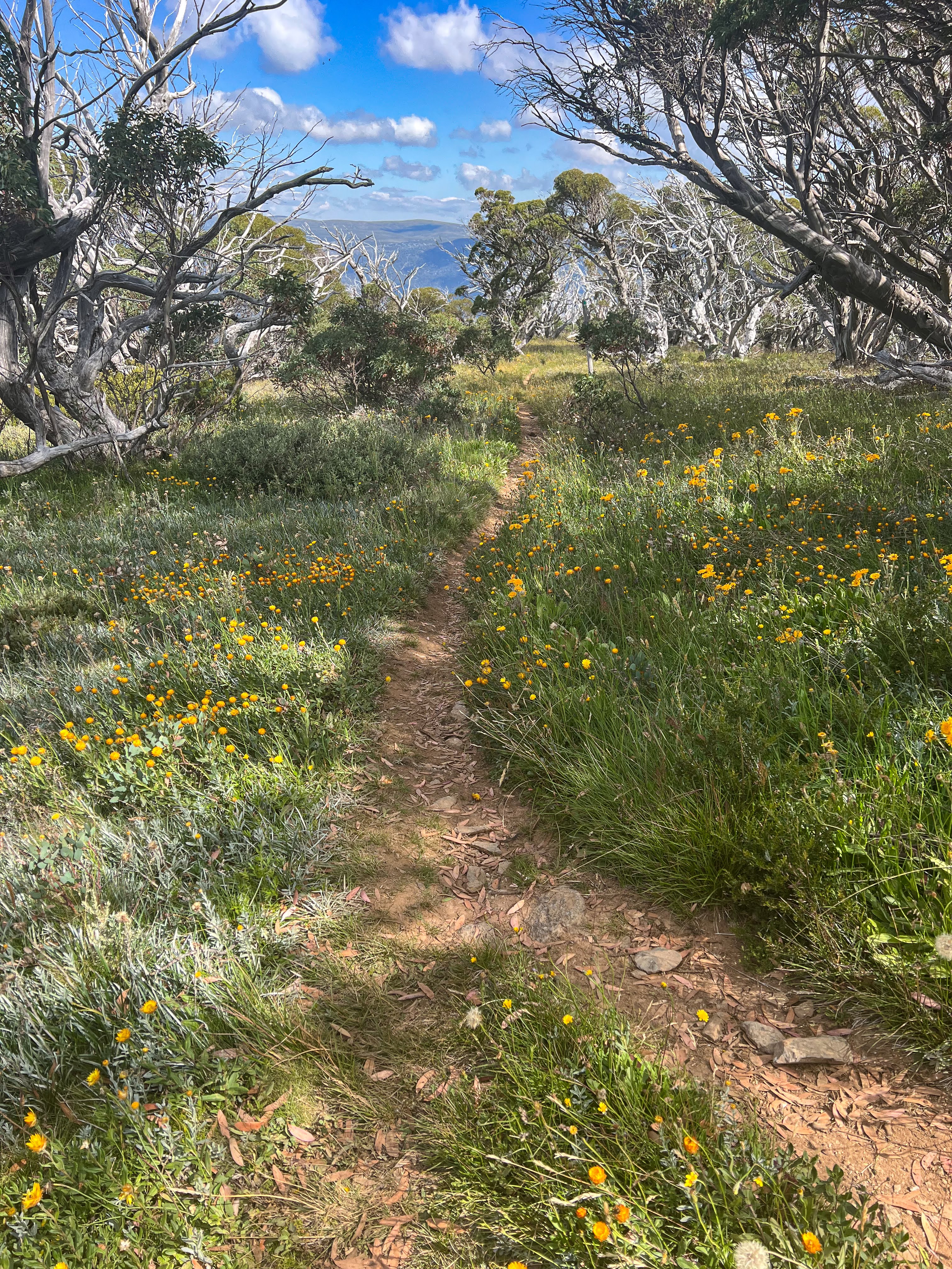
Day 1 Hotham to Ryders Yards (19.1 km, 635m👆 775m👇 max elevation 1892m)
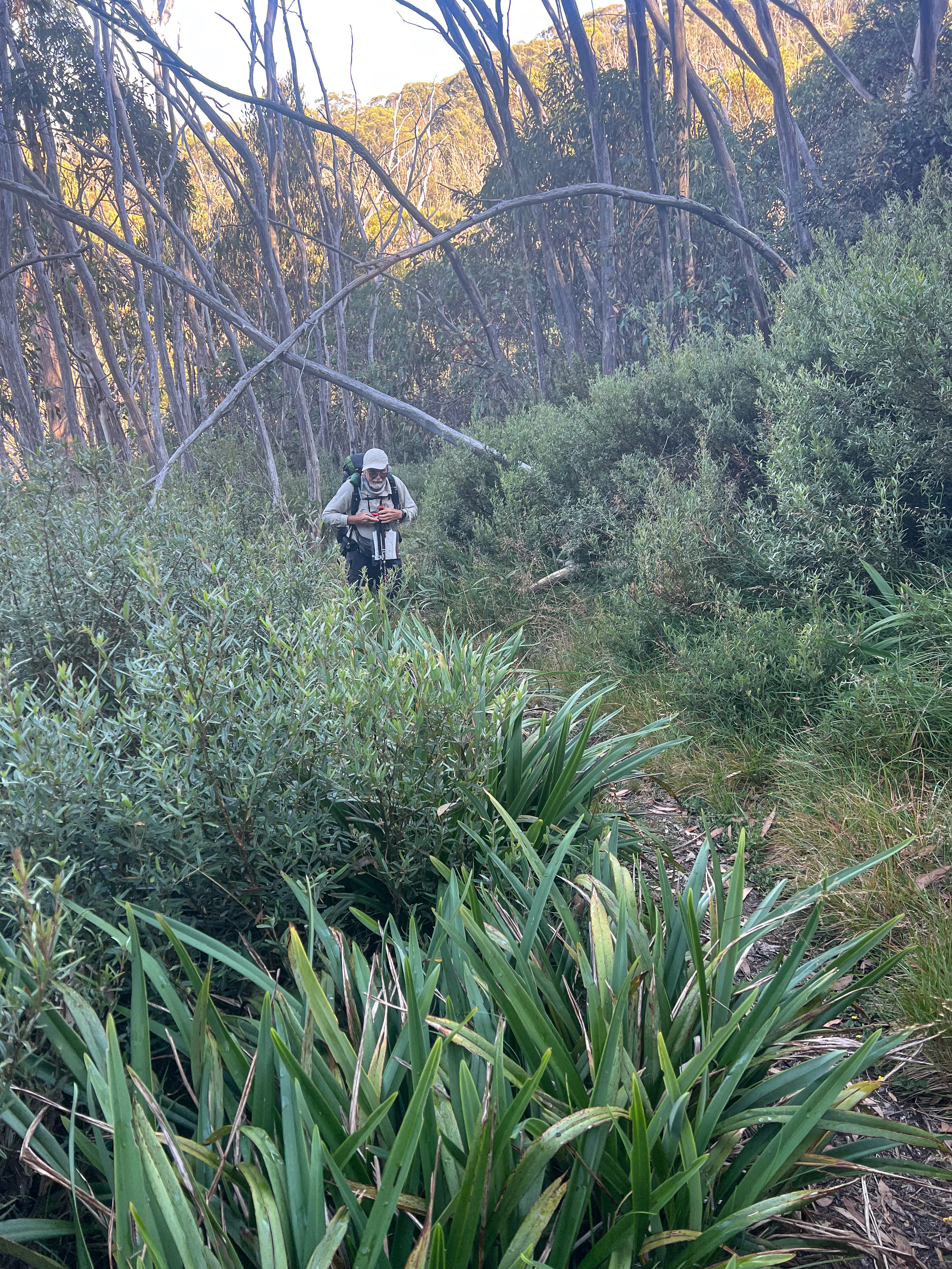
We left Omeo at 7:30am for the one hour drive to Hotham where we stopped in at The General for coffee and a bacon and egg wrap. Then we drove up to the start of the track at Mt Loch carpark. The carpark was a construction site so we pulled in to the verge, hoisted packs, took obligatory photos and then we were off.

.jpg) |
| And we're off! |
The track skirted around Mt Hotham ski field so we walked past chair lifts and the occasional memorial cairn to someone who had died up on the range.


 |
| Memorial to Derrick, perished doing something he loved... |
Once we left the ski field behind we continued following the numbered snow poles for the rest of the day,
through snow gum forest or across alpine tundra, following ridge lines.


Derrick Hut was a cute diversion but we didn't stay long, continuing on to another ridge which we followed before descending steeply to Dibbins Hut.
 |
| Derrick Hut |


 |
| Dibbins Hut |
Iain was feeling quite poorly, with light headedness and was unsteady on his feet. We had to stop a number of times and I was really concerned he was going to pass out. Every time he took his pack off he would soon come good. But it wouldn't be long before he'd be dizzy and keeling over again. At one point I had to grab him to stop him falling off the side of a steep bit of track!!
We made it to Dibbins Hut, and I noticed that Iain's unsteady gait improved almost instantaneously when he walked the last bit to the hut without wearing his pack. I postulated that the symptoms might be due to the waist belt being too tight and restricting blood flow back to his heart. Not only had he recently lost a lot of weight, he was using a 38L backpack which may not have had a waist belt rating for the 18 plus kilos he was carrying in it. He was wearing a bumbag as well and that may have been pushing the belt too high.
After a good rest, some lunch and refilling the water supplies, we headed off, this time with a looser belt. Problem solved!
We had a long climb from Dibbins Hut, to Cobungra Gap, up Basalt Temple then the final push to the main range at 1700m. With heavily laden packs that was a bit of a struggle, all forgotten once we reached the tops.

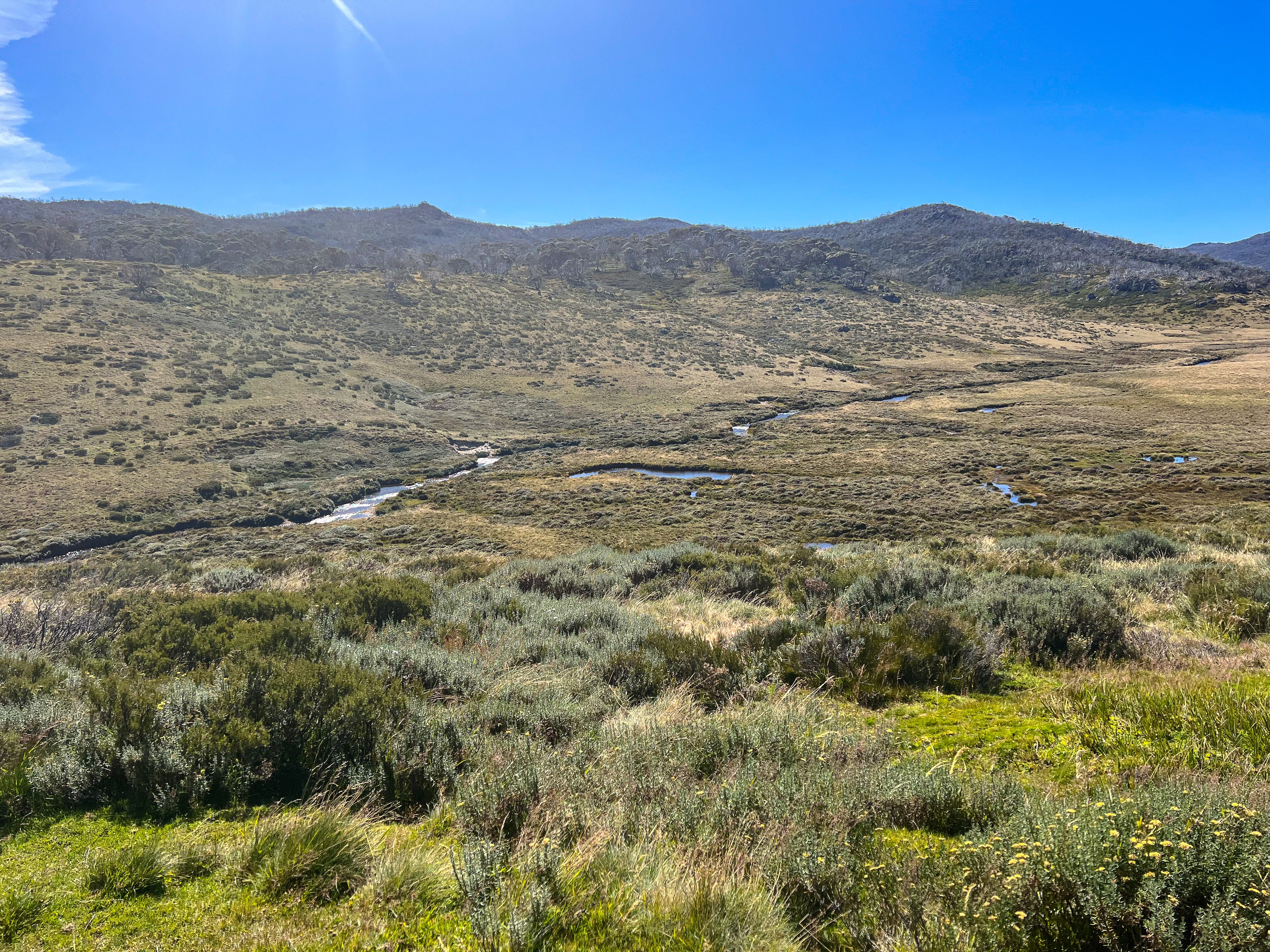
Once up on the high plains we followed the poles over alpine bogs with carefully placed stones to keep our feet dry. Not that it was very wet anyway.

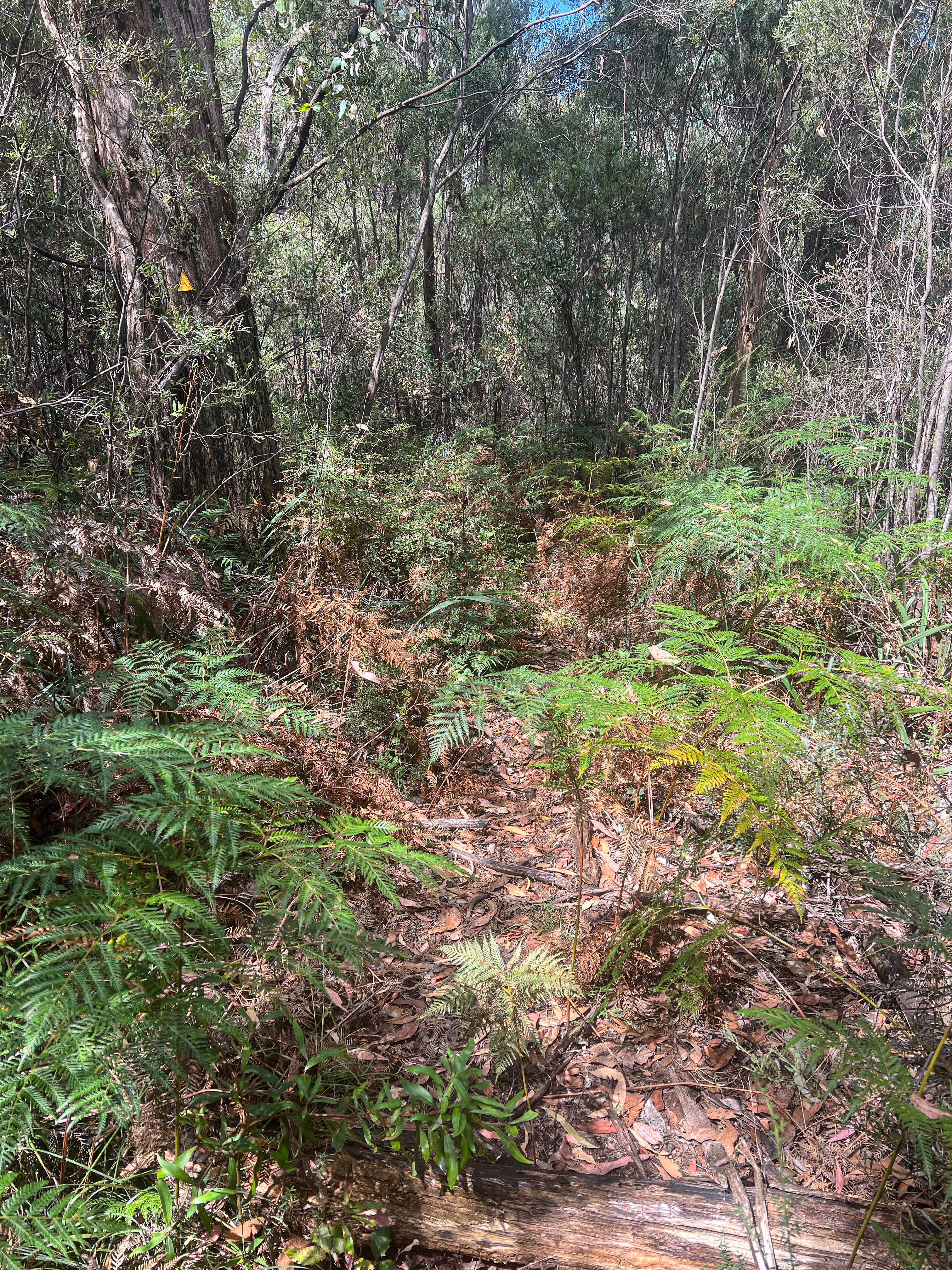
We had about 6 kms to walk, and although there was little elevation gain or loss, it was still tough walking on a narrow rocky track with lots of scratches from the bushes overhanging the path.
 |
| Rocky, desolate, but quite beautiful... |


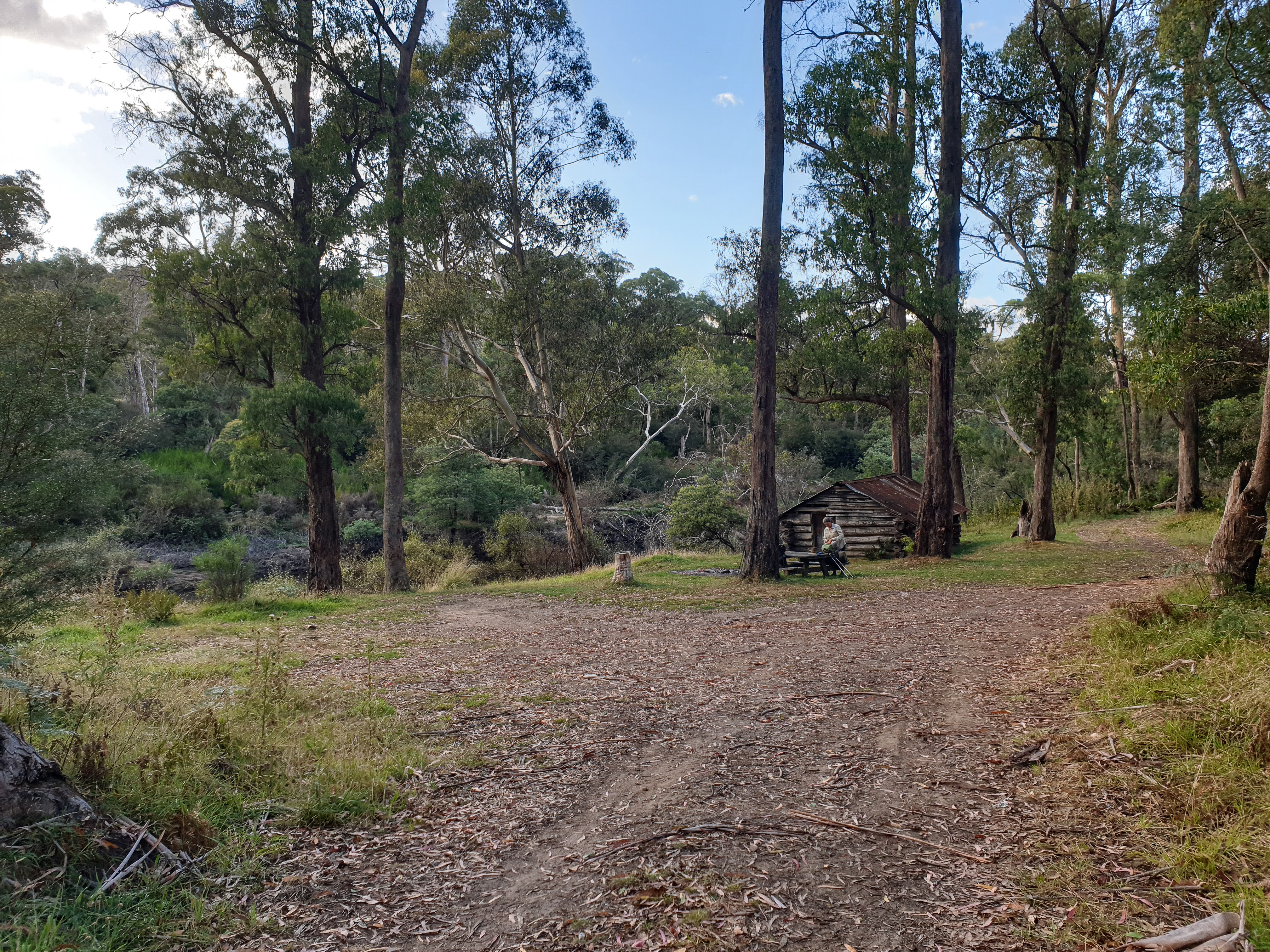
At Cope Saddle we stocked up on water supplies and walked the short distance to Ryder's Yards, which was used for cattle until 2003 when all cattle grazing in the park was banned. The buildings were in good condition so we camped and cooked in them rather than putting up tents.
 |
| Ryder's Huts (photo taken in the morning) |
It got quite cold overnight though.
Day 2 Ryders to Fitzgerald Hut (16.18 km, 210m👆 270m👇 max elevation 1721m)
I got up around 6 for a firey sunrise and we were away by 8. A cold breeze was blowing which kept things comfortable, although I wore my new polypro gloves all morning.


It was easy walking all day beside aqueducts. We crossed Bogong High Plains Rd and walked down to Cope Hut, the first hut to be specifically built for tourists. It was a lovely place with room for lots to sleep there but you are expected to camp instead, so that day visitors don't feel they are imposing. This is quite different to NZ where sharing of public facilities by all visitors is a given. There were heaps of campsites, which you need to pay for, the same as at Dibbins Hut.
 |
| The iconic Cope Hut |
 |
| Bit basic inside though... |
We continued on down the gully and then back onto another aqueduct which we followed all day. We passed Rovers Chalet, and then detoured to Wallace's Hut, another old cattlemen's hut, but this one constructed of wood slabs and shingle roof, though the shingles had been covered with corrugated iron roofing.
 |
| Wallace's Hut |
 |
| Dodgy floorboards and wooden shingled roof (covered over with tin) |
 |
| The tastefully built shingle roofed loo |
We had lunch back at the track junction and set out the solar panel to recharge our phones. It worked really well and charging was very quick. Iain was suitably impressed.
Onward following the aqueduct with a short stop to soak our feet in a dam, using the panel again whilst lying around, then off again.


At a covered bridge the AAWT left the aqueduct but we continued along the aqueduct instead, until a small horse trail took us up a creek line to Fitzgeralds Hut.

 |
| Covered bridge, we kept on along the aqueduct as we were heading for Fitzgerald Hut |
 |
| Following the horse trail up the gully, the track we had followed in background |

Fitzgerald's Hut was another wooden beauty in a lovely clearing. It had burned down accidentally a few years ago and been rebuilt by the community. A sign requested people not stay in the hut itself, so we dutifully pitched our tents and just did our cooking inside.


Although it had been a much easier day than yesterday it was still tiring towards the end. After dinner we were both early to bed.
Day 3 Fitzgerald Hut to Big River (21.37 km, 400m👆 790m👇 max elevation 1866m)
We rose to misty foggy conditions and wet tents, but we had the dry hut to have breakfast in and pack. We headed off around 9 in misty weather, following snow poles to the track and then down to check out Kelly's Hut. This was another old cattlemen's hut. Not as nice as Fitzgerald's though.

 |
| Kelly's Hut |
We returned to our packs and a few kilometres of walking in the fog, following a track back to the main trail and then soon veering off again to Johnstone Hut which is a ski club hut. Some workers were replacing the hearth so we got to have a wee look inside.


 |
| Johnstone Ski Hut |


I dropped down to the creek to get water as I was out. There had been no water at either of our campsites so far, meaning we had to carry in enough for the evening's meals and morning coffee fix.
It was a steep walk back from Johnstone Hut to the packs and I was struggling. Although I had been confident I could physically do this walk I was still struggling with both fitness and endurance. But there's one thing I know: the only way to get tramping fit is to go tramping...
Edmonson Hut was just off the main track on the other side from Johnstone Hut. It was a public hut, but had little character though a welcome shelter if inclement weather. The composting toilets were high spec though!
 |
| Edmonsons Hut |

 |
| High spec composting toilets in the Alpine National Park |
 |
| Friendly huntsman spider in the flash loo |
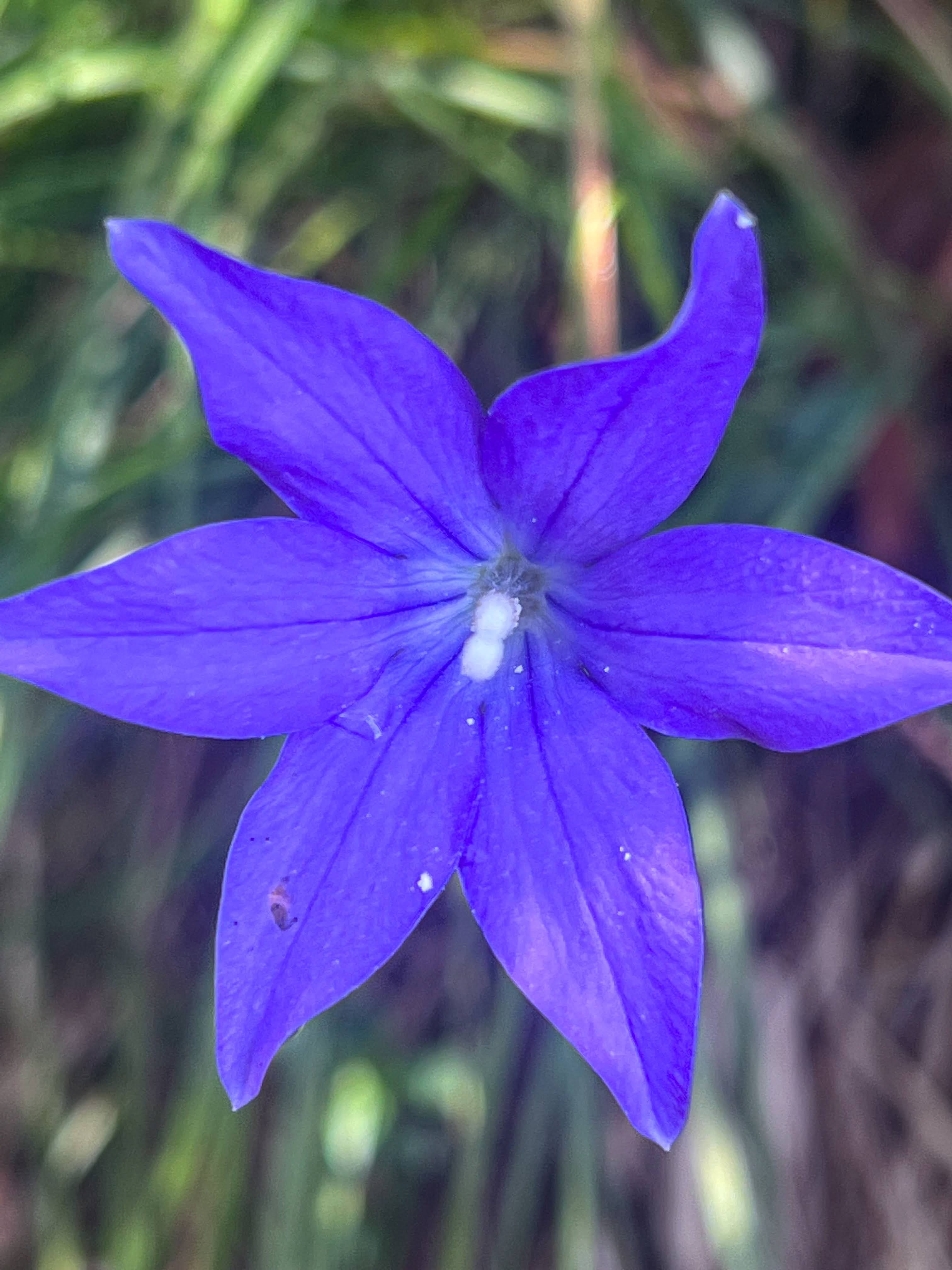
We had lunch back at the main track then continued up to Langford Gap and then along to where the track heads down to Roper Hut and Big River. The fog had at last cleared and we could see Falls Creek in the distance.

 |
| Gentians |
Rather than head down to Roper Hut on the official AAWT route, we had planned to take the alternative route up Timms Spur and then down to Big River further up stream, in order to do a full traverse of Mt Bogong. Due to some confusion as to whether there was a hut in existence (the sign said hut site) we didn't take the short detour down to visit Roper Hut.
The landscape changed suddenly from treeless alpine terrain to a few trees and some scree, and then into more usual eucalyptus forest as we descended down the ridge. It was tough walking with no shade and no cooling breeze like up higher. The ground was hard underfoot so we both stopped a few times to take our shoes and socks off for some respite.


 |
| Sunhat anyone? |
We finally arrived at Big River around 5pm. The sun had left the valley by then but it was a warm evening and nice to have a wash with plenty of water in the river.

Our damp tents dried quickly, dinner was had, a little laundry and then bed.
Day 4 Big River to Cleve Cole Hut (10.85 km, 740m👆 340m👇 max elevation 2101m)
With good weather forecast for what was the crux of the trip we decided not to take a rest day and continue on. Due to the nearby ski fields of Hotham and Falls Creek there's pretty good mobile coverage up on the Bogong High Plains. I'm not that bothered about keeping up with social media, but it's nice to get a more accurate weather forecast than the one I can get on the InReach. Yeah, I'm a fussy tramper....
We were up around 6:15 to dry tents but for some condensation as it had been another warm still night. Though I'd woken myself up during the night after dreaming something rather large was pushing against my tent!

After coffee (me) and breakfast (Iain) it was a quick crossing of the stream and then up the hill into a sunny spot to put on shoes and socks for the long climb to Mt Bogong.
 |
| Crossing the not so Big River |
 |
| Black cockatoos |

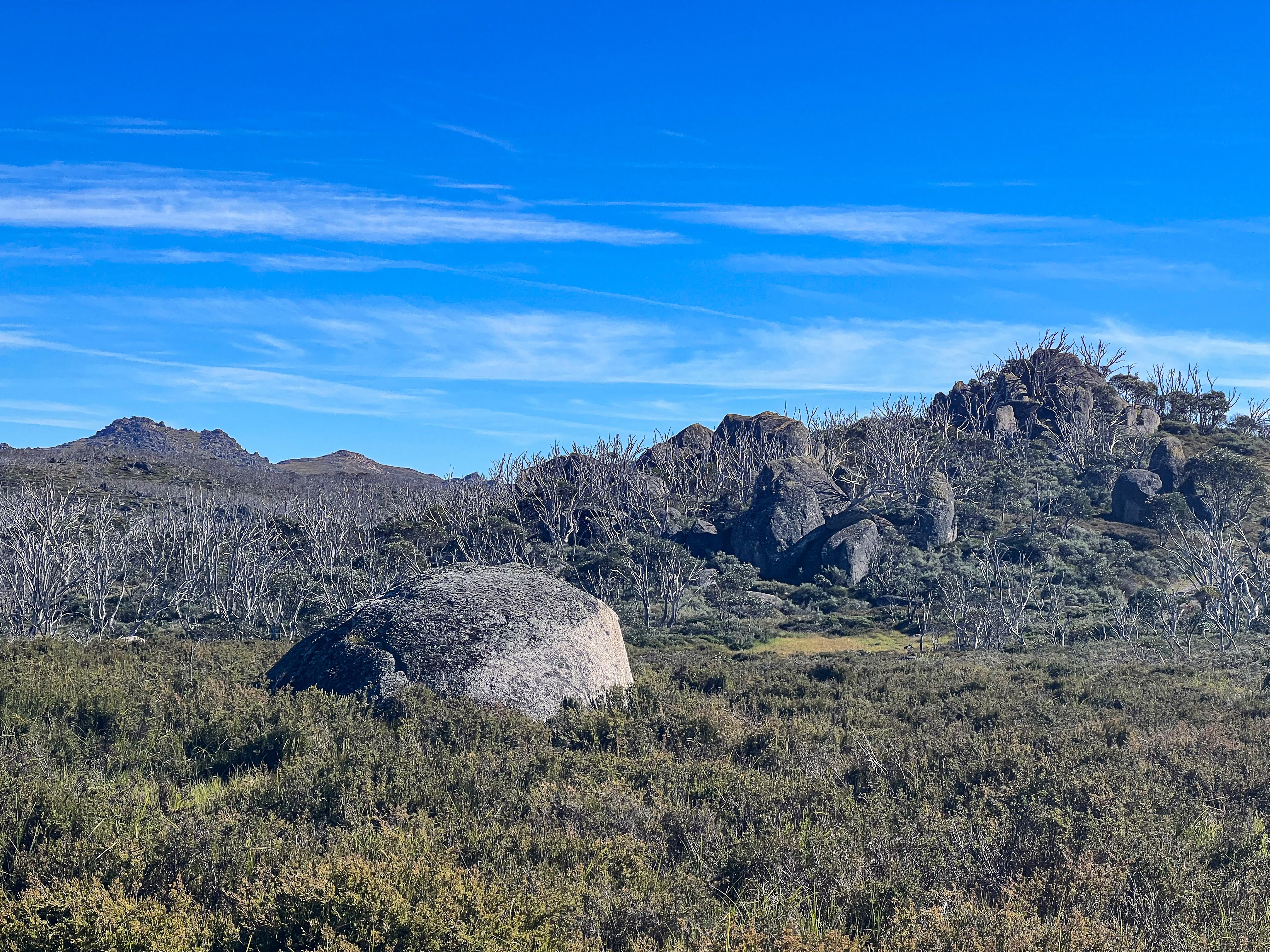
The Quartz Ridge Trail was a really pleasant narrow track through trees and low undergrowth which wound it's way higher. There was one steep scramble down to a saddle and then the climb continued until coming out of the trees and following a rocky ridge line up to Quartz Knob.


 |
| Can you see the zigzagging track we descended down yesterday? |
We stopped for lunch on some rocks above the tree line but a little short of Quartz Knob, marvelling at the nearby rocky gulches (remnants of glacial action many thousands of years ago) and the mist coming and going from Bogong's summit.
 |
| I heard later it was a controlled burn on the ridge the other side of Bright (top right) |


 |
| Continuing our climb to Quartz Knob |

 |
| Quartz I'm assuming.... |
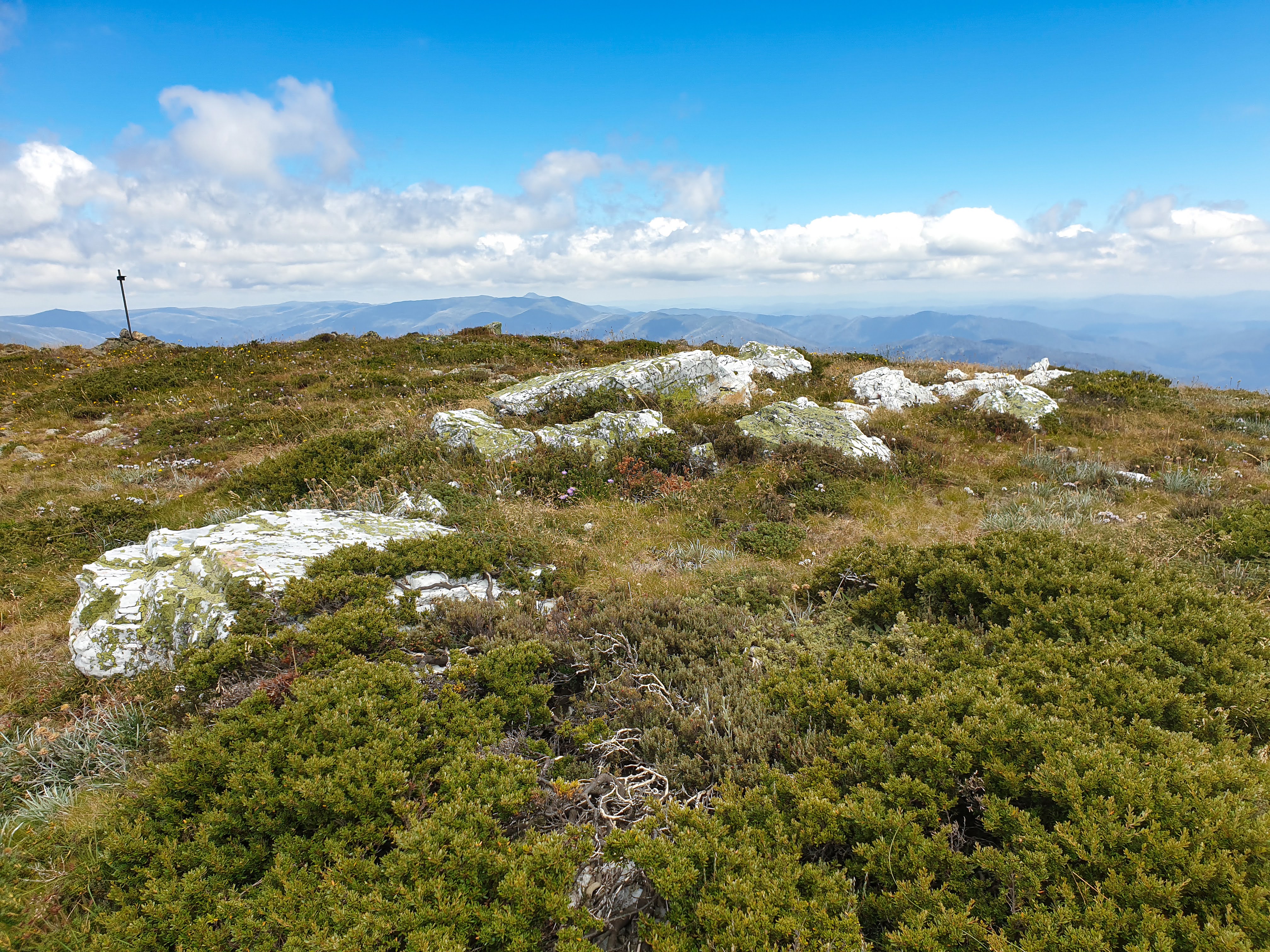
From Quartz Knob the track got easier, crossing across the massive plateau that is Bogong, with West Peak to our left. We could see Bright down in the valley and as we climbed up to the summit could see right down the Goulburn Valley. There was a fire burning on the ridge on the other side of Bright from us so not of concern for our trip.


At last we reached Mt Bogong, where we took obligatory pictures and posted to Facebook whilst we had cell coverage, and then it was back to following snow poles as we descended around to the northern side and down to Cleve Cole Hut. Across Hell Gap, which was actually quite sheltered and not living up to it's name, and back into the snow gum forest surrounding the hut.
 |
| Ant's eye view of the big Bogong cairn |

 |
| Magnificent weather, but tough on the feet |


 |
| Snow pole number 1200 |

Cleve Cole is a fabulous stone hut with a firebox and running water, and mattresses! I opted to sleep in the hut, but still erected my tent just to dry it out before packing it away again. Iain camped in his tent, though we both cooked in the hut, and took advantage of the running water to have a decent wash of both ourselves and our hiking clothes.


 |
| More of those high tech composting loos, with views!! |
The solar panel was doing a stellar job of keeping everything well charged, with Iain and I yet to use our power banks. Although I can attach the panel to my backpack, our leisurely pace and numerous breaks allow us to just put the panel out for short periods and still get adequate charging.
A large snake was sunning on the steps in the late afternoon. It seemed to be used to human visitors and neither of us disturbed it's evening dose from the sun warmed stone steps.

 |
| I think this is a copperhead snake, it certainly wasn't aggressive |
Day 5 Cleve Cole Hut to Maddison Hut site (2.34 km, 150m👇 max elevation 1796m)
We had decided to have a rest day as we were already one day ahead on our itinerary. Which was a good thing, as I'd slept poorly overnight and wasn't up to what we knew would be one of the harder days of the trip.
There was a thick mist in the valleys but bluebird up where we were. We waited for our clothes to dry and charged up our electronics, then headed off just after 11.

We went down to visit Howman Falls, definitely a lovely spot to linger for a swim on a hot day.


On the walk back we noticed a wallow hole. Deer are being actively culled in the high country as they cause considerable damage to delicate alpine ecosystems.

 |
| Big mud hole, courtesy of wild deer |
Hoisting the packs we walked up to a saddle where the AAWT from Roper Hut meets up again. A mere 3 km from Cleve Cole Hut, but a lower elevation beside a small stream.
 |
| Striking pattern on this snow gum |
 |
| The AAWT heading towards Big River, pretty flowers... |

I had brought a tiny folding tripod so made a small twig fire to boil up water for a cup of tea for both of us and we had lunch. Two girls came down the track from Ropers Hut who were heading up to Cleve Cole Hut and Mt Bogong. Then they planned to walk to Mt Wills tomorrow too.
After lunch we pitched our tents and had a lazy afternoon reading.
 |
| Bushwalking isn't always about moving |

Again early to bed.

Day 6 Maddison Hut site to Mt Wills Hut (16.23 km, 915m👆 855m👇 max elevation 1781m)
I slept really well, waking up at 6:30! Away at 8:15, we headed up Long Spur. This is a ridge walk which is undulating and very long, amongst regenerating snow gums, but we encountered 3 picnic tables along the way, each in a nice clearing in the middle of nowhere! The track was just a narrow path but easy to follow.


 |
| The snow gum forest is showing signs of regenerating, it just takes many years.. |

 |
| Picnic table #1 was in a fine clearing |

 |
| Picnic table #2 on a saddle at a track junction, our track heads straight up... |
 |
| An old track marker from before it extended into NSW and ACT |


 |
| Picnic table #3 was over to the right. The 4WD track starts here |
We encountered our first uncleared tree fall of the trip. Someone had been through doing some clearing but blackberries were already growing back. A snake crossed the path in front of me, too fast for a photo. I guess I disturbed his sunbaking!


At the last of the 3 picnic tables began a 4WD track which continued to undulate but trended down hill. The trees changed from snow gums to woollybutt forest and some wattles and tree ferns in the damper valleys. We stopped for lunch and the girls we'd met yesterday passed us.


As we descended and joined other 4WD tracks we could hear dirt bikers hooning around a circuit but we thankfully didn't cross paths with them. It felt an unwelcome intrusion after being in remote high country for six days.
A faint path left the 4WD track, initially through a blackberry thicket which was somewhat unpleasant and left us with scratches all over any exposed skin. We stopped to chat with the girls having their lunch before beginning the nasty steep climb up to Mt Wills 4WD track. That climb seemed to go on forever. We took lots of stops, the girls obviously soon overtook us, as we slowly struggled up that hill. There were no track markers and only a faint foot pad to follow but it was easily navigable.
 |
| Lunch break just after the nasty blackberry patch, and before the nasty hill climb! |
 |
| Not so steep now |

At last we reached the 4WD track and followed that up to the hut. Mt Wills Hut reminded me of a fairly typical NZ hut, with 2 bunk rooms and a central wood stove, water tank and toilet. I put my tent up to dry, but planned to sleep in the hut, as were girls, Iain again opting to sleep in his tent. I was absolutely bushed, as was Iain.

Iain had initially thought my conservative itinerary was a bit too conservative, but he had now changed his mind. Although he had been doing regular walks prior to this trip he had done next to no hill climbing, and not with a heavy pack either. He was also having trouble with his feet, possibly shoe related, and I suggested he try different lacing to stop his feet sliding forwards in the toe box. Despite my recent injuries, Iain seemed to be suffering more than me. I was finding the climbs hard, but I just needed to keep plodding.
 |
| Worth climbing the rocks for some great views (and cell reception) |
We cooked dinner then took it out to enjoy, sitting on the rocks near the hut watching the sunset, then I wasn't long to bed, feeling quite sore and shattered.
 |
| That mountain in the centre distance? Mt Bogong. |

Day 7 Mt Wills Hut to Wombat Divide Track (15.49 km, 675m👆 1185m👇 max elevation 1776m)
There was quite a storm overnight but I was cosy inside the hut. I think Iain's night was a bit more interrupted!
 |
| Mt Wills Hut |

It was still windy and all misty in the morning when we headed off. The path off Mt Wills wasn't easy to find at times, with not a lot of markers, and lots of animal tracks to confuse us. Luckily the Avenza map was helpful for keeping us on track, and as we got lower the mist cleared.
 |
| Well marked right there... |
 |
| I spy a marker! |
The track descended steeply after Mt Wills South and after a while we joined an old road that was easy to follow all the way to Omeo Highway. The highway has been sealed since Chapman's 2nd edition was published, but I'm told is very windy so isn't heavily used.
 |
| Hello Omeo Highway! |
After removing our rain gear we walked down the road to the track along Gill Spur. It was heavily overgrown though easy enough to follow, stopping for lunch on a log crossing the track.
 |
| Flax Lily fruit, edible apparently |
 |
| This 4WD track hasn't seen a vehicle for a long time.... |
Despite Chapman's notes suggesting otherwise there was only one path down to Gill Creek though the track had lots of wind fall and was like an obstacle course. We had to climb over and through a few big trees!


 |
| There's a marker, must be the track.... |
As we got lower we began to encounter a lot more ferns and a thick under story. Gill Creek was pretty with a deep pool you could swim in, but it also had leeches and mossies galore. We had also been warned that there were bull ants, but we didn't see any ourselves. The camping area was tiny, room for one tent but a squeeze for two. We filled up with water, took our shoes and socks off for a rest and decided to continue on.
 |
| Not a lot of room for tents, but many leeches.... |
Iain had pulled off quite a few leeches whilst sitting at Gill Creek. I had no leeches until I crossed the creek, picking them up as I scrambled up the steep bank on the other side. I pulled off 7 or 8 of the blood suckers.
The track wasn't where it was marked on the Avenza map, but corresponded with Chapman's notes. The climb went up and up, with nowhere suitable to camp, as the bush was too thick. We had our daily snake sighting, disturbing him sunning on the track.
A last we made it to the fire track at the top of the hill. It had recently been bulldozed as there were notices proclaiming they would be doing a controlled burn in the near future. We figured the likelihood of encountering any traffic was about zero, so we pitched our tents on the road where it was flat and hoped nobody would drive through overnight!
 |
| Camped on a fire trail... |
Another day of being shattered, though we would have a shorter day tomorrow since we hadn't camped at Gill Creek as originally planned.
Day 8 Fire Trail to Kennedys Hut (10.15 km, 60m👆 820m👇 max elevation 1250m)
Three thunder storms passed over overnight, with not a lot of rain, but enough to splash dirt all over the bottom of my tent. I tried wiping off as much dirt as I could, in an effort to treat my ultralight tent a bit better than I've treated previous tents. It's not quite so robust, the tradeoff for saving on weight.
We headed off along fire trails which had recently been cleared, making for fairly easy walking. Aside from one small section through bush on an overgrown track, where I saw a wallaby, we were on good roads all the way. However, after a couple of tough days I found the uphill sections difficult, like there's no fuel in the tank. This lack of endurance is definitely a result of enforced inactivity for a couple of months post accident, and is perhaps the most frustrating part of my recovery. Let's hope it improves as the months pass...


Kennedy Hut is set by the Mitta Mitta River with a picnic table and a toilet so we decided to camp there and spend the afternoon doing all the chores, like washing clothes and charging power banks, and cleaning off as much dirt from my tent as I could. After a few cups of tea and a chilled afternoon reading I felt much better.
 |
| Kennedys Hut (and if you zoom in you'll find out what Lloyd is...) |


I would have liked to go for a swim, but the river bank was too muddy to be able to get out without getting completely filthy in the process. Getting water was a challenge, I ended up sinking to above my knees in mud trying to collect it, but then walked up the track to where a side stream crossed a smaller track and got water there without any problem.

 |
| Picnic tables make camping just that little bit more comfortable |
 |
| The mighty Mitta Mitta is actually an extension of Big River, we've met before... |
Aside from a couple of 4WDs visiting the hut, we saw no-one else all day.
Day 9 Kennedy Hut to Benambra Corryong Road (9.34 km, 465m👆305m👇 max elevation 841m)
I slept really well, waking up at 6:30 and heading off a bit after 8. We walked to Taylor's Crossing, which has a nice campground by the river with a pretty substantial footbridge. It's a bit more public than where we camped. One 4WD passed and crossed the river at a ford above the bridge and there was another car parked on the other side of the river. I don't think I would have felt all that confident to leave an unattended tent to wander down to Kennedy's and back so I think our choice not to stay there was good. Plus the toilet at Kennedy's didn't require crossing the river to get to!!


 |
| Taylor's Crossing is at the lowest elevation on the entire Australian Alps Walking track (507m ASL) |

 |
| Motorbike bar |

Once over the bridge we followed the river downstream on a fairly indistinct path that wound through broom and thistle and blackberries. Yummy blackberries! This section had been cleared since the publication of my edition of Chapman's book, which had given an alternative route along dirt roads. The track seemed to be on private land, as we passed a number of shacks along the way.
Once through the broom and blackberries the path got easier to follow, mostly sidling high above the river through fairly dry open eucalyptus forests. There were numerous ups and downs crossing side creeks which were mostly dry. A few windfalls made going a little tough at times but overall it was good, if slow, travel.


We stopped at a crossroad at 12 for a snack/lunch then there was a bit more climbing before a long and very steep descent to Morass Creek. Iain's shoes needed readjusting a few times, whereas my feet were fine. Saw another wallaby.
At Morass Creek there were nasty prickly bushes similar to matagouri and lots of cotoneaster, the berries of which the local rosellas were feasting on. We crossed the creek and found a nice spot in the shade to relax for an hour. I had a late lunch and then went for a swim. Bliss to wash the sweat away!!
 |
| Morass Creek |
The climb up to Benambra Corryong Rd only took half an hour. We grabbed our food canisters, found a campsite and had a beer, which were surprisingly fairly cold. Then we put up tents etc before walking the one kilometre down the road to Stony Creek to get water. I got 8 litres, much more than I needed but better to have too much than have to go down and get more water in the morning.
Back at camp we had another beer whilst sorting our food supplies, then I enjoyed a palak paneer with garlic naan bread washed down with a third beer. In all our elation at having successfully completed the first half of our trip, neither of us took a celebratory photo!
I felt suitably carb loaded and well hydrated for tomorrow's hard slog. Uphill all day with heavy packs.
Day 10 Benambra Corryong Road to Johnnies Tops (14.65 km, 1075m👆 155m👇 max elevation 1601m)
It was a warm night and I didn't sleep well as where I had scratched my legs on brambles yesterday was sore, and I was quite sweaty despite removing most of my clothes. It began spitting just as we were packing up the tents. Iain hid the tubs again as there was lots of stuff he decided he didn't need so put back in the tub. Like more clothes!! We had both had plenty of gas left from the first 9 days, so I decided not to take my extra small canister as Iain was bringing two small ones.
Morning ablutions involved the obligatory wander into the scrub to dig a hole. Iain didn't quite take enough notice of which direction he went and a few "Cooee" calls later he found his way back! Packs on, we crossed the road and headed uphill.
There were lots of brumby tracks and not many markers. Thank goodness for those Avenza maps to keep us on course. There was one steep section over rocks, but I just didn't seem to have any energy, despite the carb load of the previous evening. The trail went through much wetter forest and along an old road before joining fire trails which we followed for the rest of the way to Johnnies Tops.
 |
| That way.... |

 |
| Over the rocks |
 |
| Around the fallen log |


Once on the fire trails the temperature dropped. We were in cloud with constant drizzle and lots of wind so we walked in rain gear and took only a very short stop for lunch as it was just too cold. We arrived at Johnnies at 3:30, found camp spots and set up tents quickly to escape the now heavy rain and wind and get warm. I got out of all my wet clothes and into dry thermals, down jacket, pants and even booties. I even got into my sleeping bag just to warm up again!
 |
| Cooking in the tent vestibule |
 |
| Dinner in bed |
About 5pm the clouds cleared but it was still windy and too cold to hang out so we both cooked in our tents. I slept in all my down gear, plus bivy bag and beanie and was warm and cozy.
 |
| Windy and cold, but at least the rain had stopped |
Day 11 Johnnies Tops to Buenba Hut site (12.27 km, 90m👆 805m👇 max elevation 1601m)
I woke up early to a brilliant sunrise and a full moon. The wind had dropped and the sky was clear but it was still brutally cold. It took us a while to get going.
 |
| Beautiful, but bloody freezing! |
Once moving we warmed up quickly and were able to shed the extra layers. The going was incredibly slow as there had been so much regrowth and fallen trees after the bushfires in 2019/2020 that the track was easy to lose. Lots of bush bashing and following the Avenza maps helped us re-find the track many times on the way down to Buenba Creek.
 |
| Easy to start with |
 |
| Still a trail to follow |
 |
| Now where?? |
 |
| Not lost, but found |
Once almost at the bottom we had lunch then followed a trail skirting the swamp. As expected, we saw our daily snake.
It took about 3 hours to make our way along the valley heading up stream, avoiding swamp and blackberries. Chapman's notes described the route as open river valley but that was so far from our experience it was laughable. Amongst the swamp bashing, bramble disentangling, and occasional good dry travel, we saw and heard lots of rosellas, cockatoos and kookaburras, so it wasn't all horrible.
 |
| A photo of a nice bit of walking along the valley |
 |
| Buenba Stream |
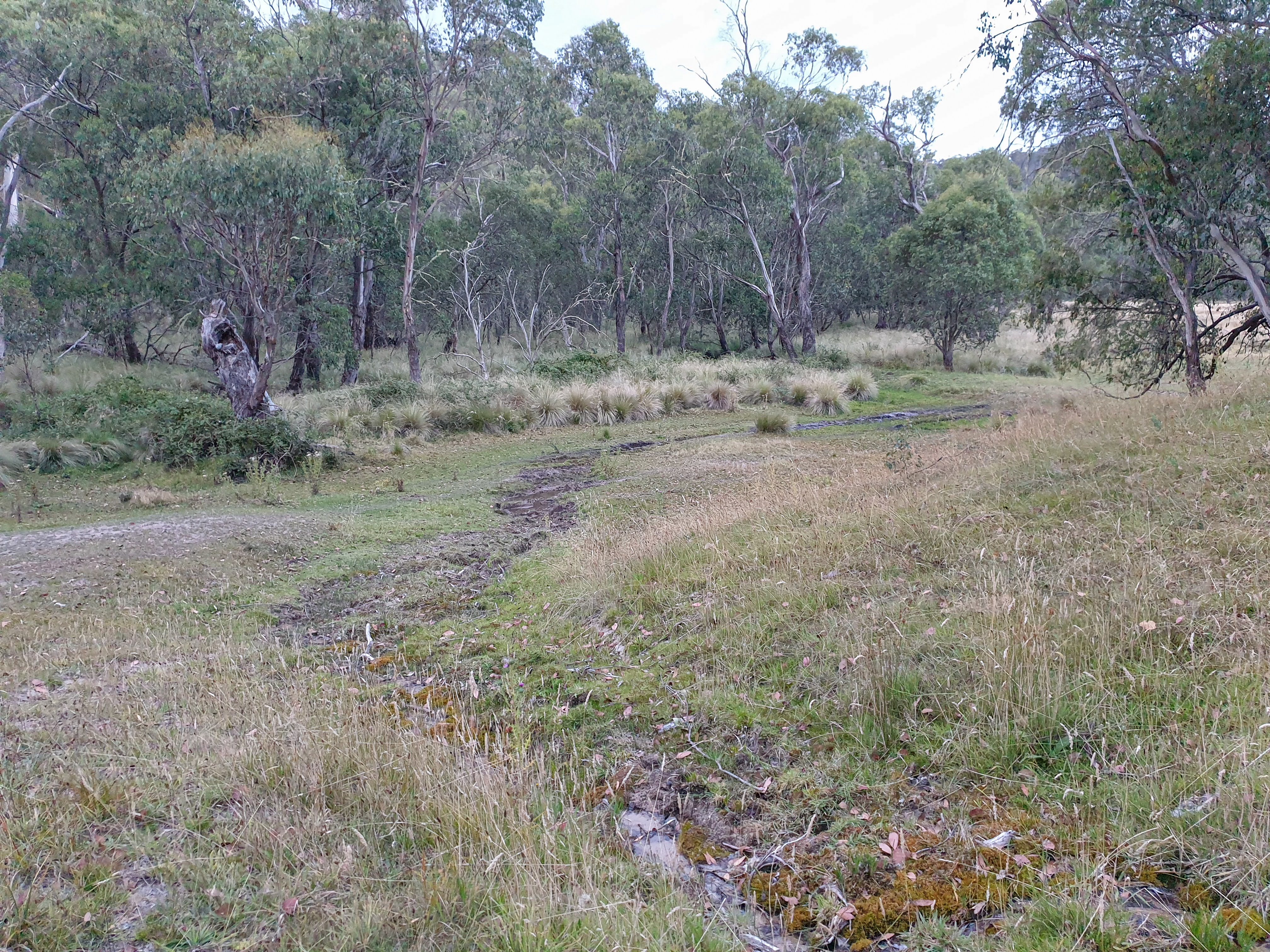
There were lots of brumby tracks but we saw no track markers until just before climbing the small saddle to descend into Buenba Flat. Then there was one more swampy area to cross, with hidden water ditches, to a vehicle track, which we followed to the campsite. There were big mobs of grey kangaroos grazing on the flats and the nearby creek was deep enough to have a proper wash in.
 |
| Marshy ground, hidden blackberry brambles, and the occasional snake.... |
 |
| Big mob bounding away |
 |
| A bit more curious |
I went over to chat to Iain whilst my dinner rehydrated and in the middle of a conversation he had a strange turn where he stopped speaking in the middle of a conversation and just stared at me, not responding to my repeated questions. After a couple of minutes he came out of it, but was obviously completely disoriented and had no idea where he was. A few minutes later he was back to normal, with no recollection of the event. If I hadn't been a doctor he would have just laughed at me telling him he had just had a serious medical event, possibly a partial seizure of some sort. Since he seemed to be completely back to normal, and it was 6:30pm, I decided not to push the SOS on my emergency beacon, but informed Iain that should he have another turn I would certainly suggest an emergency retrieval. Iain was somewhat nonplussed, saying nothing like this had happened to him before. I suggested that since he actually spends a lot of his time involved in solitary activities he wouldn't know if he had had one of these turns before unless it was witnessed by another person. That got him thinking....
After that exciting start to the evening we enjoyed a pleasant meal and the sounds of a group of people drifting over from another campsite near the road. It was also much warmer than the previous evening!


Day 12 Buenba Hut site to Buckwong Hut (16.1 km, 670m👆 425m👇 max elevation 1350m)
We woke up to a hard frost so waited for the sun to do some thawing of both us and tents. We even lit a fire to warm us up, as there was lots of wood nearby from some dead poplars. A couple of 4WDs drove past our campsite, possibly the campers from last night, but since the track goes nowhere they turned around and headed off in another direction.
 |
| Iain left his gaiters out overnight, whoops!! |
We left at 9:45, along Buenba Road before heading uphill on another poorly marked track through post bushfire regrowth. Up the track went, with us not having quite as many navigational issues as yesterday, at last reaching Mt Hope Road which we walked along until finding a spot in the shade for lunch.
 |
| Recently cleared track through bushfire regrowth |


From Mt Hope Road we turned onto Buckwong Track, walking through the most stark burnt landscape so far.


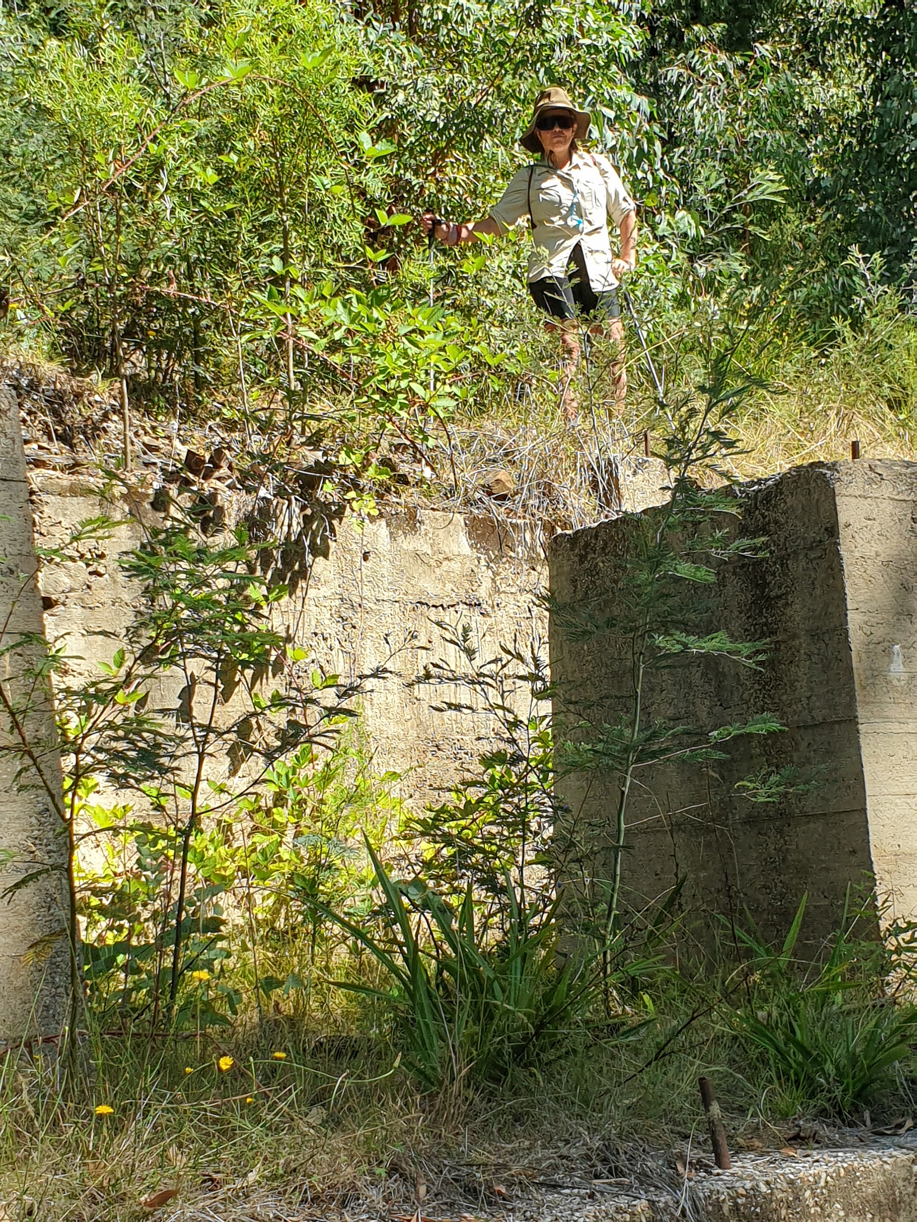
We arrived at the turnoff to Mt Murphy Mine about 2 pm. We dumped the packs and headed down the road to see the ruins. There wasn't much to see, just a few concrete foundations for the crusher left, plus a few big mullock heaps. Our daily snake slithered across the path on our way down.


The packs felt really heavy when we donned them again for the final few kms to Buckwong Hut. The hut itself was locked, but there was good camping beside it, and a good creek for having a wash in.


Day 13 Buckwong Hut to Limestone Creek (14.71 km, 670m👆 855m👇 max elevation 1633m)
It was a cold morning with lots of condensation on the tents but no actual frost. My air mattress had sprung a leak so I had to pump it up a couple of times overnight. Whilst we were packing up we met another walker, doing the whole AAWT in one go. He was walking much faster than us, having come from Johnnies Tops yesterday, and hoping to get to the Cowombat Track tonight. He'd camped just at the last river though I felt he would have liked to have had company if he'd known we were here. After chatting a while he headed off, we finished packing and headed off ourselves.

Firstly we walked along the river flats and then headed uphill, following a brumby track and an occasional marker. Again we lost the track, found it and lost it a few times, and 3 hours later we were at last up on the Misery Trail.
 |
| The bark from this tree had shed in one big piece. |

 |
| Not so miserable Misery Trail |
We stopped for lunch then continued along the Misery Trail for a couple of kms before another foot track took us downhill, again through bushfire regrowth. We lost the track pretty quickly and then found the track, and for a while things went swimmingly until we again lost the track and had to descend down steep terrain through thick acacia and ferns. We had a few navigational disagreements but finally Iain refound the track and it was back to stress free easy travel.


We followed brumby tracks down to Dead Horse Creek, of which there were many. We were yet to see any horses despite lots of manure around. We saw our daily snake though.
Once we had crossed the creek there was a well marked track to follow. We found a good camping spot, and at last sighted our first brumbies of the trip. It had been a tough day so we had decided to camp a bit early at Dead Horse Creek because the track notes suggested the track through to Limestone Creek would take a couple more hours. Iain thought there would be better spots to camp further along Dead Horse Creek, but there turned out to be none, so at Smoke Ho Creek we continued on.

 |
| Large galls (insect larvae eggs) on eucalyptus leaves |
From Smoke Ho the track climbed slowly via a sidle around some hills to get to Limestone Creek Road and was actually easy travel on an easy to follow path. We saw lots more groups of brumbies as well.
Limestone Creek Road was a steep, slippery descent all the way down, to a lovely campsite by the creek. A 4WD passed along the track, but we had the campsite to ourselves, complete with blackberry brambles along the river, covered in ripe fruit. We arrived at 6:15 so it was a long day which meant a late dinner. A clear sky saw us enjoying an awesome starry night!
Day 14 Limestone Creek lay day (8.69 km, max elevation 1027m)
Knowing we had a lay day, we slept a little longer then packed up to walk a few kilometres along Limestone Creek Track towards a larger camping area frequented by 4WDers. We found a new campsite which a young family were just vacating, and set up our tents before going exploring.
 |
| Packing up at Limestone Creek campsite |


 |
| New campsite further along Limestone Creek |
We wandered down, past the official campsite, and along the road to check out the historic Limestone Creek Hut. Since we jumped the fence we didn't actually see the private property sign until we returned to the road. We were keen to visit as the hut was supposedly built in the 1880s. Lots of work had been done to preserve it, and it still had lots of character.
 |
| Limestone Creek Hut |


 |
| Possibly some of the external cladding reused inside and preserved |
Heading back to the campsite we met quite a lot of 4WDers coming and going, as it was a long weekend in Victoria, and saw 2 tiny snakes on the track. Back at camp we did our washing and met Wayne, who was camped further down but was fly fishing along the creek. He kindly caught 2 trout and gutted them for us. We would have to work out how to cook them, as neither of us had a frypan!
 |
| This one was tiny compared with others we'd seen. Still venomous... |
 |
| The first of two trout caught and gutted for us. Thanks Wayne! |
I made a small fire and boiled the billy for a cuppa. I had brought along a tiny foldable tripod that can be used on an open fire, with only a few twigs needed to do the job. It was really relaxing to just chill and read a book after the last few tough days.

Late afternoon I got the fire going again for another cuppa and then put a bit more wood on to build up some coals for cooking the trout. Iain found some foil stashed away in his first aid kit which was enough to wrap the fish in after sprinkling with some MCT oil that I had brought along. Popped in the coals for about 5 minutes and they were cooked to perfection. Delicious!

 |
| Two trout, oiled and wrapped in foil, then popped on coals for 5 minutes |


 |
| After I'd finished!! |
That was entree, we still had our usual dinner. No point carrying extra food in your backpack!
A few brumbies came down to the flats in the late evening but kept their distance, the stallions doing a bit of huffing and puffing to let us know we were intruders.


It was the first evening where we actually sat by a fire instead of going straight to bed.


Day 15 Limestone Creek campsite to Bulley Creek (8.54 km, 485m👆 105m👇 max elevation 1343m)
We had been expecting rain, but it didn't eventuate, so we packed up dry tents and headed off at 8:20. We walked back up the hill we had come down yesterday and then crossed over at the saddle, taking brumby tracks down to meet up with the AAWT heading up Stony Creek. It was a good track, we only lost it once when it went over the other side of the creek and then we weren't too comfortable following it away from the creek so we recrossed and climbed up over a rocky knoll with no trees on it to rejoin the trail again.


Although we had no major issues with navigating today I was really struggling with the long uphill climb to Cowombat Flat Track. The long road back after my accident really rears it's head when it comes to lack of endurance. But the good news is, from where we joined Cowombat Track, we would be on fire trails for the rest of the way through to Thredbo. Which meant much easier travel...

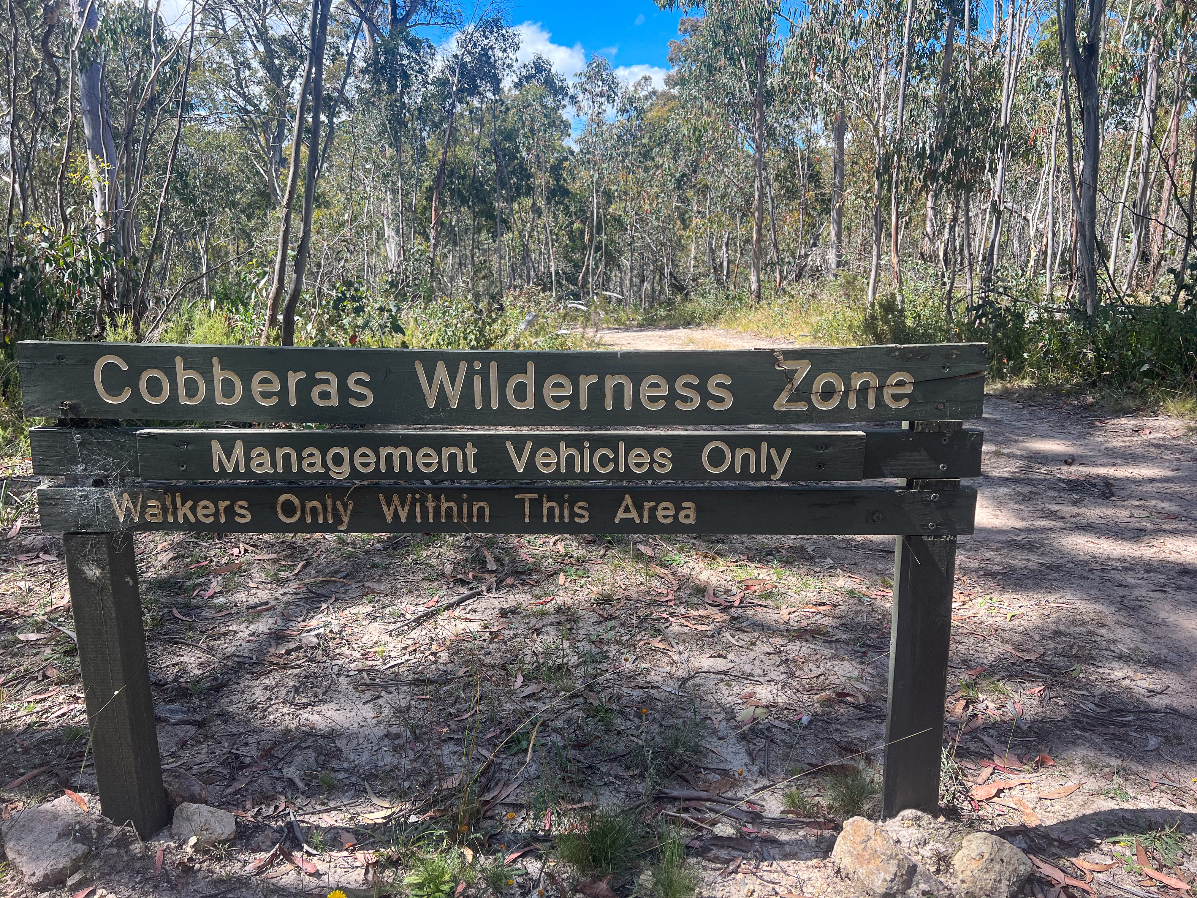
We walked along the fire trail until Bulley Creek which we got to at 1:30. We had already decided against climbing up the Cobberas Peaks, or doing the off track high traverse to Cowombat Flat, so we had a bit of time up our sleeves.
We set up camp and I mucked around setting up shade with my poncho tarp and some sticks, twine and the extra pegs I had brought with me. Iain just went and sat under some trees!!
 |
| My intellectual exercise for the afternoon: make some shade to sit under |

After getting some water from the creek, which was full of tiny fishes and huge clouds of flying insects, we had a cuppa using the tripod and a small fire that Iain managed to start without using firelighters. I also boiled up water for dinner to save on gas.
 |
| Iain's intellectual exercise was to start a fire without using firelighters. It took a little longer.... |
Another early night was had.
Day 16 Bulley Creek to Cowombat Flat (10.71 km, 300m👆 430m👇 max elevation 1418m)
Having decided not to climb the Cobberas we had an easy day along the fire trail to Cowombat Flat. It was sunny and uncomfortably hot. We saw some brumbies, including a young pony but no snakes. We also met a crew of 8 people from Canberra Bushwalking Club who had done the Cobberas traverse and a trip up The Pilot and were walking back to their cars at the carpark. They said the going was good up around Cobberas 1 and Moscow Peak and good brumby trails to follow to Cobberas 2 but the way down to Cowombat Flat had been hard due to regrowth. They highly recommended The Pilot though.


We arrived at Cowombat Flat, took the obligatory "crossing the state border" photos then had lunch. Afterwards we went looking for the remains of a small plane that had crashed in the Flats in 1953. It wasn't where it was marked on our map. I gave up and wandered back to where we had left our packs, feeling very hot and bothered, whilst Iain kept looking.
 |
| The "mighty" Murray River, Vic/NSW border |


It's inevitable on a long walk that your emotions have ups and downs just like your energy levels do. Today was a day where everything just seemed overwhelming, so I sat down in the shade to rest after putting up my tent to dry. Iain wandered back, having still not found the plane wreck site, but he had found a really nice camping spot. After erecting his tent to dry also, he wandered off up the other end of the Flats to check out some of the fencing work being done to protect areas from the damage wreaked by wild brumbies.


We were planning on staying two nights at Cowombat Flats, so after I had cooled down, figuratively and literally, in the shade for a while I packed up my tent and wandered down to where Iain had found a lovely shady spot with a fireplace and right near the river. It also had great views to The Pilot.
 |
| The Pilot is the tallest peak on the left. It's treeless so promises good views |

The river, by the way, is the Murray River, which forms the boundary between the states of Victoria and NSW. Our campsite was on the Victorian side of the border, and the river was only ankle deep, enough to have a decent wash and do laundry though, which is all one really needs.


Rain threatened all afternoon but we just had a few sprinkles until about 6pm when a shower came through. Iain went off to his tent but I sat it out, enjoying the sight of double rainbows over The Pilot. I again made a small fire to boil water for cuppas and cook my dinner, and then stoked it up a bit more for some bush TV. Which meant a slightly later bedtime of 7:30! Unfortunately I had to pump up my air mattress at 8, 10 and 12:30, but each time I had woken because I was cold, so I progressively put on more layers and then slept through until morning.


Day 17 Cowombat Flat Layday (8.19 km, max elevation 1428m)
We had a lazy start to the morning with a few herds of brumbies passing through the flats, looking to be a bit bigger than the ones we'd seen before.


With a little laundry done before setting off, we headed up the Cowombat Trail in NSW to find the source of the Murray. We found a taped brumby trail, which took us down to the Murray then we followed it up to where the land border meets the Murray. We saw three pigs, and lots of signs of pig rooting, as well as lots of damage from brumbies.
 |
| Pigs rooting |
 |
| Tootling up the Murray |


Once we had satisfied ourselves we had found the point on the map where the land border intersects the river, we found the trail heading up to Forest Hill where a substantial rock cairn marks the land border. Since the cairn isn't marked on any maps, and we are in a Wilderness Area where signage is almost non existent, we spent a huge amount of time scouring the large hilltop looking for it. I even managed to scare my snake for the day!


After a short break and consulting Chapman's notes yet again, we wandered back towards the track we had ascended, as Chapman suggested the cairn was right at the northern end of the tops closer to the border. I mean duh! Of course the cairn will be on the actual border! We needed to look for the cairn along the border, not the other side of the hill! And once we looked in the right direction, we found it!

 |
| NSW bound |
 |
| Sitting on the fence |
 |
| Friendly cross border relations |
We had lunch back down by the Murray and then wandered back to Cowombat Flat. Iain had found the aircraft wreckage yesterday, exactly where Chapman said it would be! I joined him to check it out and then we headed back to camp.


We got back to camp a bit after 2 and had a wash and did a bit more laundry before rain clouds came in and we had a few showers and the temperature dropped. I built up the fire again for cuppas and dinner and then sat around watching flames until dark. A single crow hung around in the trees above us, calling mournfully. Quite atmospheric...

 |
| Storm clouds approaching... it blew over pretty quickly |
I'm getting used to my air mattress only lasting a couple of hours finding I can sleep with it half deflated anyway. I guess the ground is soft enough....
Day 18 Cowombat Flat to Tin Mines Huts (18.01 km, 930m👆 835m👇 max elevation 1841m)
Iain woke me a bit abruptly just before 6:30 am which didn't exactly put me in a good mood. We got away at 8:20 so a good early start.


We saw no brumbies in the valley this morning. We took the Cowombat Trail rather than the official AAWT route along Snow Gums Trail because it looked less steep and it had the turnoff to The Pilot. Aside from the first bit, which we had done yesterday, the trail was undulating with no particularly steep bits and we made good time, arriving at the cairn marking the start of the climb at about 11.


 |
| No signage, just this rock cairn marking the track up to The Pilot summit |
We dumped the packs and just took our daypacks with lunch and electronics up the hill. My phone battery was a little low so I asked Iain to track our way with his phone and off we went. There were lots of cairns to keep you on track although higher up we lost them and just made our own way up through the trees as they thinned out, scrambling over a few rocky bits to at last make the summit. As we climbed the wind got stronger and stronger, probably gusting 40 knots up on the top. It was wild!!


 |
| Cowombat Flat in centre, Cobberas Peaks behind |
 |
| One of those peaks is Kosciusko |
I took advantage of cell coverage to post a photo to Facebook and check the weather forecast and
Sync my Fitbit but Iain had wanted to ring family. Too windy for that!

 |
| Too windy for hats |
 |
| Unless they are extremely firmly secured.... |
We headed back down, initially following cairns before losing them again and relying on the track Iain had recorded on the way up to rejoin the trail back to the fire trail. We had lunch back at the packs and then headed off along the trail again, getting to Tin Mines Huts around 3:30. A good day for me, Iain found the climb up The Pilot a struggle, but I was good.

 |
| These caterpillars were a little community, they waved around like a sea anemone |


 |
| Brumby fencing |
Tin Mines had 2 huts and lots of grass to pitch tents, but the water in the creek was silty so I was glad to have the filter. Later, Ben turned up on a fat bike, travelling for 8 months so far, and currently loosely following the Hunt1000 route to Melbourne. It was only the second time on this trip we had shared a campsite with others.


 |
| The smaller of the two huts |
 |
| Singed, but not destroyed |


 |
| Ben with his fat bike |
Day 19 Tin Mines Huts to Cascade Hut (15.9 km, 450m👆 230m👇 max elevation 1528m)
It was a warm night. Due to the crappy creek water there wasn't an option for an evening wash so it was a bit of a sweaty uncomfortable night.

I woke up just after 6:30, having specifically asked Iain not to wake me like he had the night before, and enjoyed the novelty of using an actual toilet (with toilet paper) for the first time since Kennedys Hut. There were a few brumbies grazing in the valley below the huts.


We followed an easy fire trail all day, though the ups and downs seemed steeper, possibly because it was much hotter, with no wind. We stopped for lunch where some birds were making a right racket back in the undergrowth, and I surmised that maybe it was a lyrebird convention. Blow me down if not too soon afterwards Iain, who was walking a few hundred metres behind me, saw two lyrebirds run across the track!!


At a creek at the bottom of a hill we took another break, removing our shoes and socks and soaking our tired feet in the freezing cold water until the pain of the cold got unbearable. Very refreshing...
Then on we went. We met a couple walking to Cowombat Flat and gave them some beta on the Pilot track, as well as our good campsite, and they let us know there was a total fire ban in place. No more fires for the rest of this trip...

At last the track began to even out through some grasslands and we soon arrived at Cascade Hut. It's in a glorious setting above the river valley with great views.
 |
| Cascade Hut |


There were some contractors fencing off bits of the river to keep the brumbies out. We had seen similar work in other water catchments, in an attempt to preserve water quality and fragile environments. In recent years there has also been some culling of the brumby populations, though shooting them has caused some controversy. We had seen quite a few old carcases at Cowombat Flats.

Not surprisingly, the fencer works as a groomer driver at Thredbo in winter, and a chap who turned up on an e-bike turned out to be the retired mountain manager at Thredbo. Sounds like the Jindabyne population is similarly lifestyle driven like in Wanaka.
After the contractors and bike day tripper left I went down to the river and had a swim. It was a very quick immersion in the chillingly cold Cascade River but glorious! I even changed into my spare tramping dress, so nice to get out of the regular tramping clothes.


Another lazy afternoon drinking tea and chilling. The lows of a few days ago seem forgotten when the walking is easy and you get to camp with lots of time to just enjoy the serenity.

 |
| Final night's campsite was a beauty |

Day 20 Cascade Hut to Dead Horse Gap (8.9 km, 365m👆 295m👇 max elevation 1776m)
We were up at 6:30 after a disturbed night, by the sounds of very loud water birds calling from the river. We got away at 8:30, initially walking down the river valley before crossing the river and then a long climb uphill to Bobs Ridge. My legs were not feeling so good today, but the scenery was spectacular, with fantastic views across to the Ramshead Range.


 |
| View from the loo |
 |
| Packed and ready to go! |

 |
| About to cross the Cascade River (there was a footbridge) |


From Bob's Ridge the track descended to the Thredbo River valley which we crossed then followed a track downriver all the way to the trail head. It's a beautiful river with lots of rock pools and cascades, and even a fly fisherman casting into the pools.
 |
| Descending into Thredbo River valley |


 |
| Still friends... |
 |
| Thredbo River looking upstream |
 |
| Looking downstream, and across to Ramshead Range |
 |
| There was another footbridge |


We arrived at the trail head at 11:30, so had a bit of a wait for Sandra, who we'd arranged to pick us up at 1pm. We chatted to the daywalkers, one of whom mistook us for park rangers, and used the time fruitfully to check through all the emails and other electronic messages that bank up when you go off grid for a few days.

 |
| Mistaken for a Park Ranger!! |
 |
| Checking emails whilst waiting for our ride back to Canberra |
We stopped in Jindabyne for a late lunch then onwards to Canberra.
It was a long, and at times tough, trip. The bushbashing through bushfire regrowth was hard work, as were some of the steep climbs, but I was extremely grateful that my body coped with everything I threw at it. Especially only six months after such a serious accident.
The maps on the Avenza app made navigation a breeze, and with Iain also using the maps we could share the load of deciding where to go. We had a couple of minor disagreements when quagmired in dense bush, but we always found the track again, even if sometimes the progress was painfully slow.
Neither of us regretted taking the 20 days to walk this section. Although we had some tough days, we also had a number of easy days, we visited lots of interesting old huts, and we even got a free feed of freshly caught mountain trout!!
We both found the 20 days to be a long time away from civilisation, even if we did have cell phone coverage for most of the first half. We didn't see many people throughout our walk, with 4WDers making up the largest group we met. I'm certainly glad I had the company of Iain for the trip. Even though I frequently tramp solo, the length, isolation and navigational challenges of this trip were better shared. Iain, for his part, appreciated sticking to a slower, more relaxed schedule.
So if you've read this far, well done! Thanks to Iain for his company, and for sharing his photos, many of which I have used in this post.
Next it's off to Perth then Geraldton for 10 days, and then back to NZ at the end of March.
No comments:
Post a Comment