My hutbagging obsession is both a blessing and a curse. It makes me devise trips that incorporate visiting as many huts as possible in the region I'm visiting. That can often mean longer, more circuitous routes that might be less frequented, but it also means I may neglect visiting some places because there isn't a hut there to tick off. I need to stay aware of the latter bias in my trip planning, because there are so many stunning places in NZ to visit, and some of them don't have a hut anywhere to be seen. (Which is actually quite a feat really when there are so many of those wee homely structures scattered in the most unlikely places all over the country)!
For this trip I was visiting the southern end of Oteake Conservation Park. I'd visited the northern end many years ago when I'd tramped up to Omarama Saddle, Hidden Lake and up onto the St Bathans Ridgeline, and I'd also recently knocked off a couple more huts on a bike packing overnighter. Within a four day weather window, which also happened to be Easter, I intended to tramp and visit nine huts in total.
I drove from Wanaka to Naseby and managed to get a cabin at the Naseby Motor Camp, enjoying a delicious late lunch/early dinner at the Black Forest Cafe. It was brutally cold in Naseby so I was glad to be warm in a heated cabin overnight.

Day 1 Mt Buster Rd to Brown Hut 6.5 hours
My alarm went off at 7 and I was packed and on the road by 7:30, after defrosting the windscreen as there was a very hard frost in Naseby. The chap at the Motor Camp had advised taking the Kyeburn River Road which comes off the Danseys Pass Rd a bit further along. He said the ford on the Mt Buster Road was hard even for 4WDs!
The first part of the road was in great condition, but the last section involved two river fords and a less maintained road surface, but it was all perfectly doable in my Subaru Outback. I got to the carpark in good time, setting off on foot at 8:30. First hut to be bagged were the two huts at the Kyeburn carpark. There were two vehicles with trailers parked at the huts, but no one around. One hut looked habitable with table and chairs but no bunks. The other was a bit too rustic with the bunks looking to be unusable.

Little Kyeburn Track followed a 4WD track across the tussock bench above the river and then became a narrow track that sidled beside the river as it climbed beside a massive waterfall. There were numerous pools to swim in, though the one below the waterfall would be a tad difficult to get down to. I had no interest in going swimming, not least because it was freezing cold with a hard frost over everything!


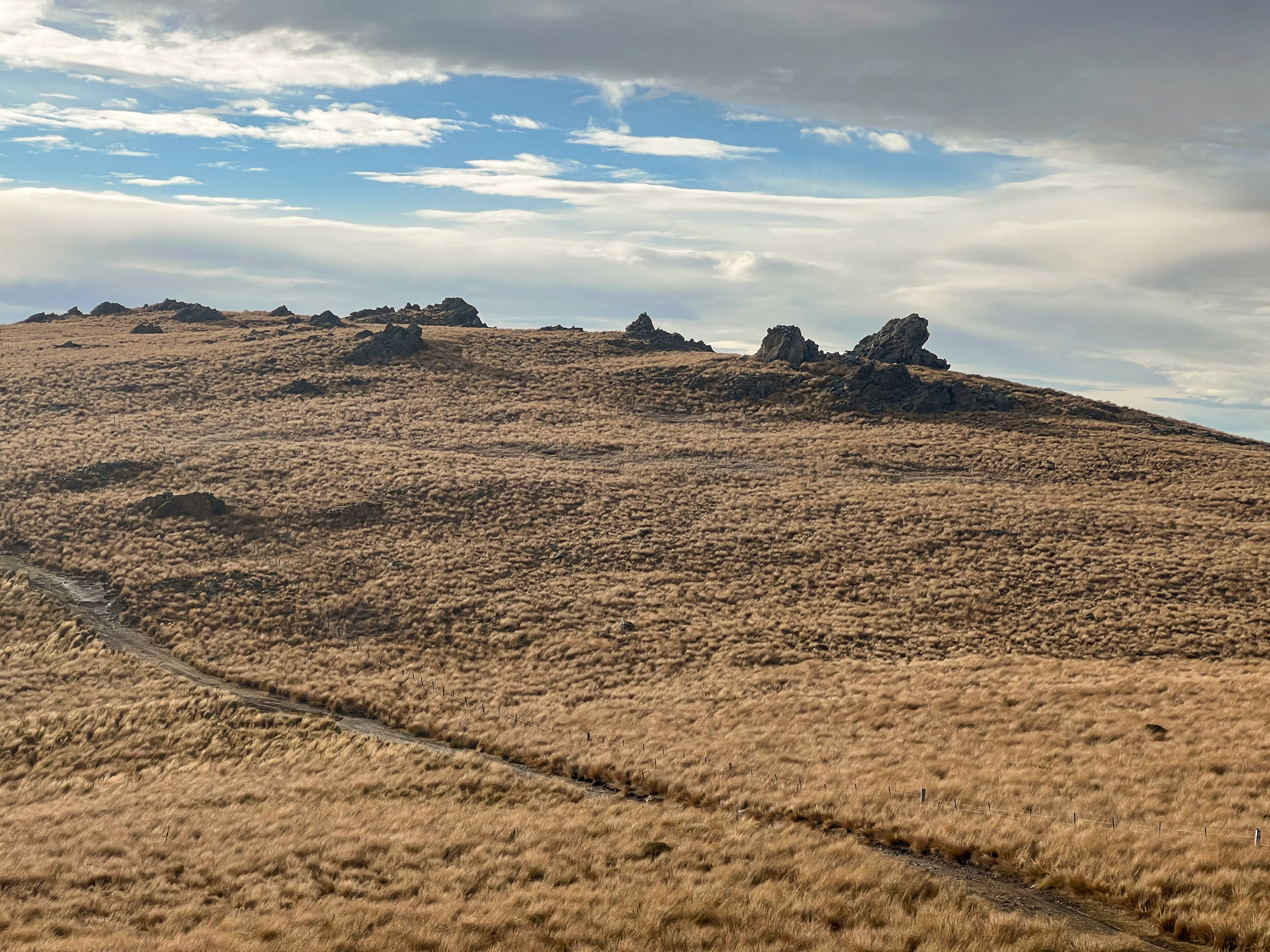
The track sidled high above the river and required a lot of attention to where you put your feet. Sometimes you couldn't see where your feet were due to the overgrown nature of the track. Mostly tussock, but quite a bit of bashing through matagouri as well. The track was well marked with poles, so quite navigable.
After a while I crossed to the true right and followed the river up further before a zig zagging climb uphill to Buster Hut. Once the steep bit was done it was mostly a gentle climb up, sidling along above a side stream, before crossing the wee stream and making my way up the final hill to Buster Hut.
 |
| frozen footprints |

Buster Hut is a tiny thing, just off the main 4WD track that heads up to Mt Kyeburn. It looked like two people were staying there as there were boots, cooking gear and blown up mattresses and sleeping bags laid out. There were also fairly fresh tyre marks in the mud outside the hut. There was nothing written in the hut book regarding the current occupiers, and since there was no pen and I'd forgotten to bring one, I couldn't write anything in the book either.

A couple of motorcyclists rode by but I saw no-one else as I made my way along the 4WD trail which climbed relentlessly upward towards Mt Kyeburn. It had taken 3.5 hours to Buster Hut so I decided not to detour to climb Mt Kyeburn. The views were stunning already. I saw another vehicle heading up to Mt Kyeburn but it had come from a different direction so it didn't pass me.


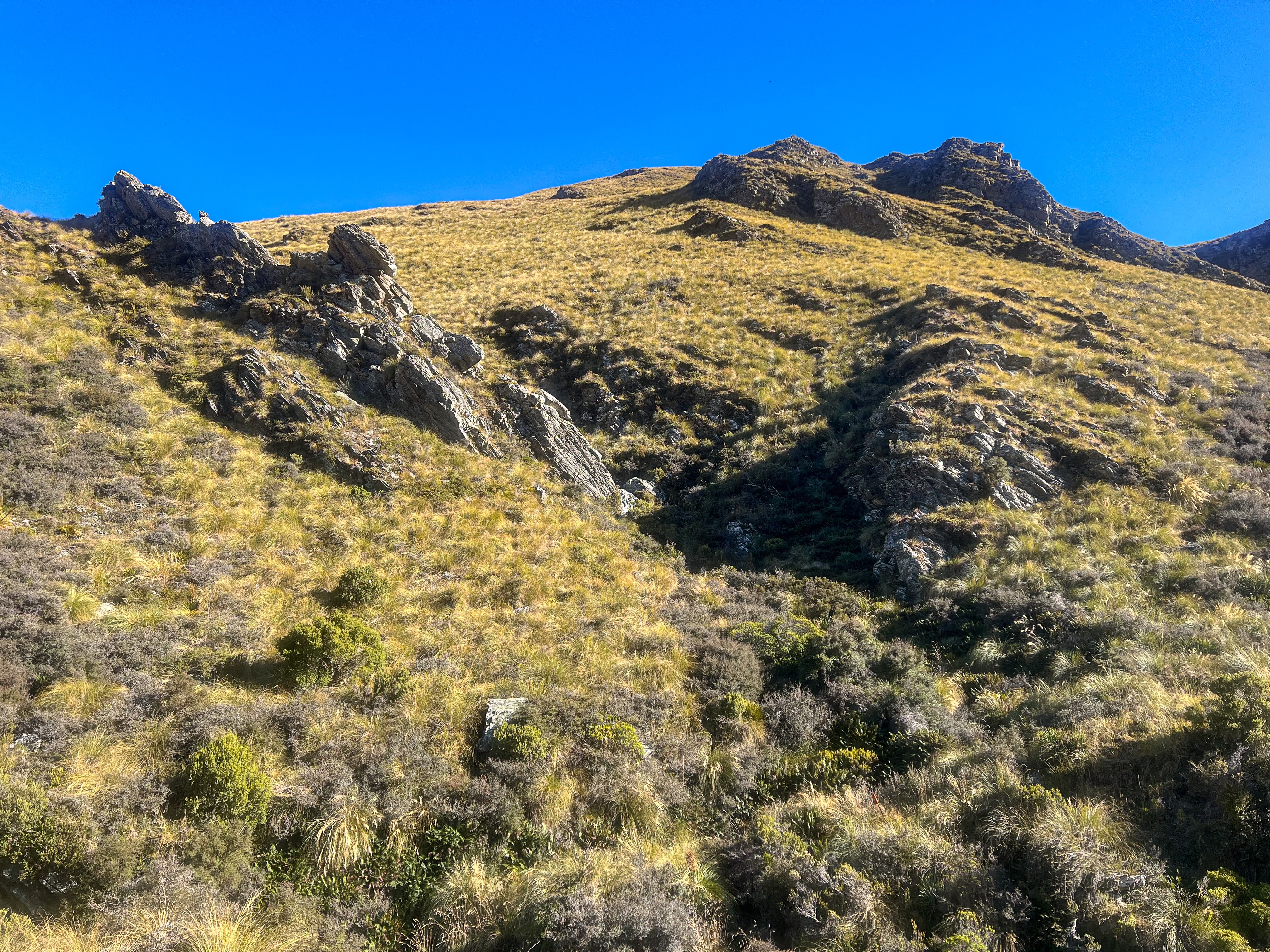
After a stop in the sun for a hard earned lunch I continued up the ridge to an intersection with the track to Mt Kyeburn. I turned left and headed back downhill, across onto another ridge where the views down to the east coast were spectacular. The distances as the crow flies aren't huge but it's a long way when following the high ridges around. I could see my destination most of the day, and when I stopped for lunch I could see Soldiers Hilton on Long Spur in the distance.

I turned off the eastern spur to descend another ridge all the way to Brown Hut. I passed a side track that would take me past the next hut on my list tomorrow, but I was planning to go cross country instead.

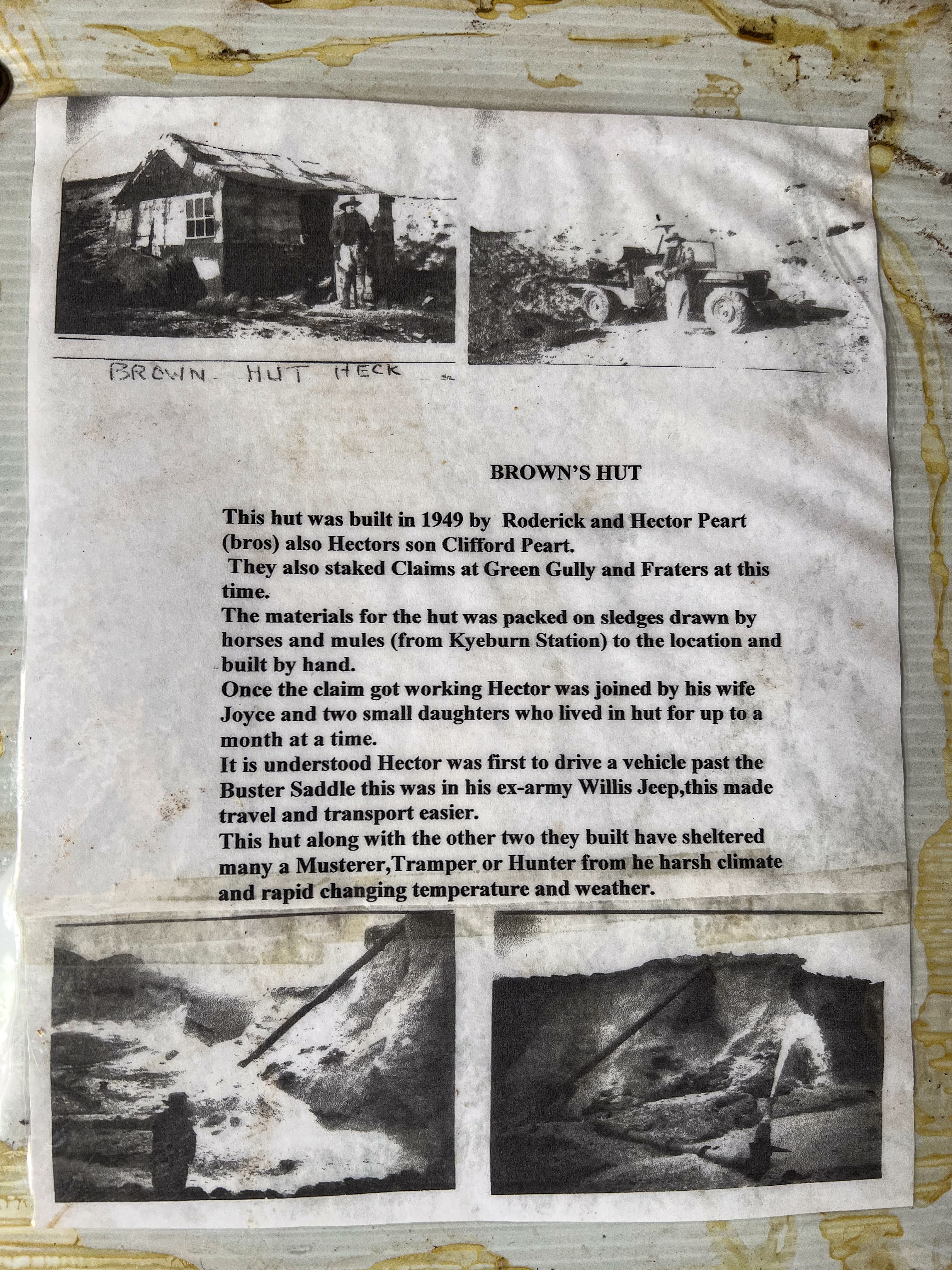
Brown Hut is hidden away in a tailings pit, but it's signposted from the trail. There's also a sign saying not to drive on the track I just walked on. Seemed everyone was ignoring that!


I was surprised to find bunks and mattresses in the hut. I had brought my tent expecting to camp, but I had the place to myself. I had arrived just before 3pm so I got to enjoy a cuppa and a lazy late afternoon watching the shadows on the hills and enjoying the serenity.
 |
| My intended route in the morning |


Day 2 Brown Hut to Green Gully Hut via Browns Creek 1.5 hours
Green Gully Hut to Pig Shit Inn via 4wd tracks 2.5 hours
Pig Shit Inn to Tailings Hut 3 hrs
My alarm woke me at 6:30, in time to see an amazing sunrise. There was a thick frost on the ground and over the hut and as the sun began to melt it, the condensation inside began to drip onto the mattresses below. I was already packed up by then, but I wouldn't recommend the place in a heavy downpour! Yet despite an unglazed window and minimal insulation I'd been perfectly snug and warm overnight.

Also lacking integrity was my Platypus water bladder. I'd noticed a leak yesterday but had thought it was merely a result of me not screwing on the tubing properly. Unfortunately the actual bladder wall was disintegrating, which was not a total surprise as I'd had it a long time. Since I had no spare I would need to try and find an empty drink bottle at one of the more frequented huts I would be visiting. I wouldn't have a drinking supply problem today, as my route would be crossing a lot of streams, but tomorrow I planned a ridge walk, where water would be scarce.
I headed off at 8, initially straight down from the hut and then crossed a gully over to the spur on the right and followed that down to Brown Creek. I passed some places where deer had been lying down, with very fresh poo and all. I didn't see any beasts though, and I also heard no roaring. Three weeks into The Roar I thought I might have heard something.


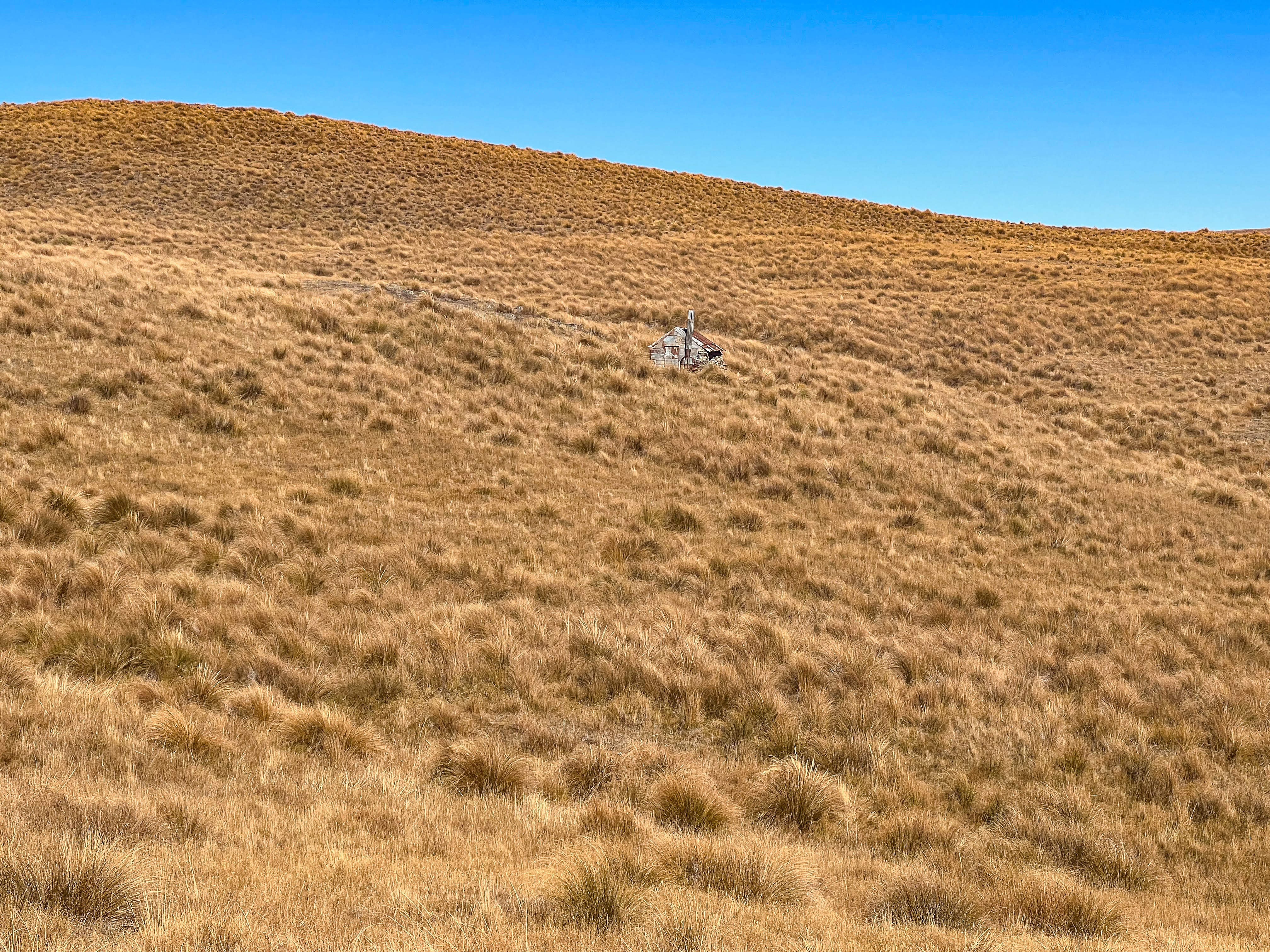
I crossed Brown Creek then followed a spur up to a 4WD track, from where I could see Green Gully Hut in a green gully below me. It's a cute wee hut with stone walls and a fireplace, though no wood anywhere to be found up there!! Someone had left a mattress hanging up inside a plastic bag which suggested you could probably make it quite habitable. I had a snack whilst enjoying the view of Aoraki revealed in a gap between the hills.


 |
| Is that Aoraki in the distance? |
I left Green Gully Hut to walk across to another 4WD track descending a spur to a substantial river crossing. It was a pleasant spot that would make a great campsite but I had many more kilometres to go.


It was now much warmer, so I took my shoes and socks off for the easy river crossing, taking the opportunity to remove my leggings and continue the day walking just in shorts. After my recent walk on the AAWT I'd needed to purchase new walking shoes, as the terrain had shredded the uppers of my Hoka Speedgoats. I had elected to replace them with Hoka Kahas, which have an all leather upper, but unfortunately they are also goretex lined which means they are waterproof until the water flows into the big hole where your feet go in! Once wet, they don't dry out, so if the river crossing is easy, I'm doing them in Crocs instead!!
Shoes back on, the track climbed out of the river valley and across to descend into a second valley, cross another river before climbing again and a long traverse to intersect with the trail down to Hut Creek Hut, previously known as Pig Shit Inn before DOC changed its name. The track was steep, but a second track next to the old one made it easier walking, though the last bit was just steep as, and rocky. In a 4WD you'd need low range first gear!


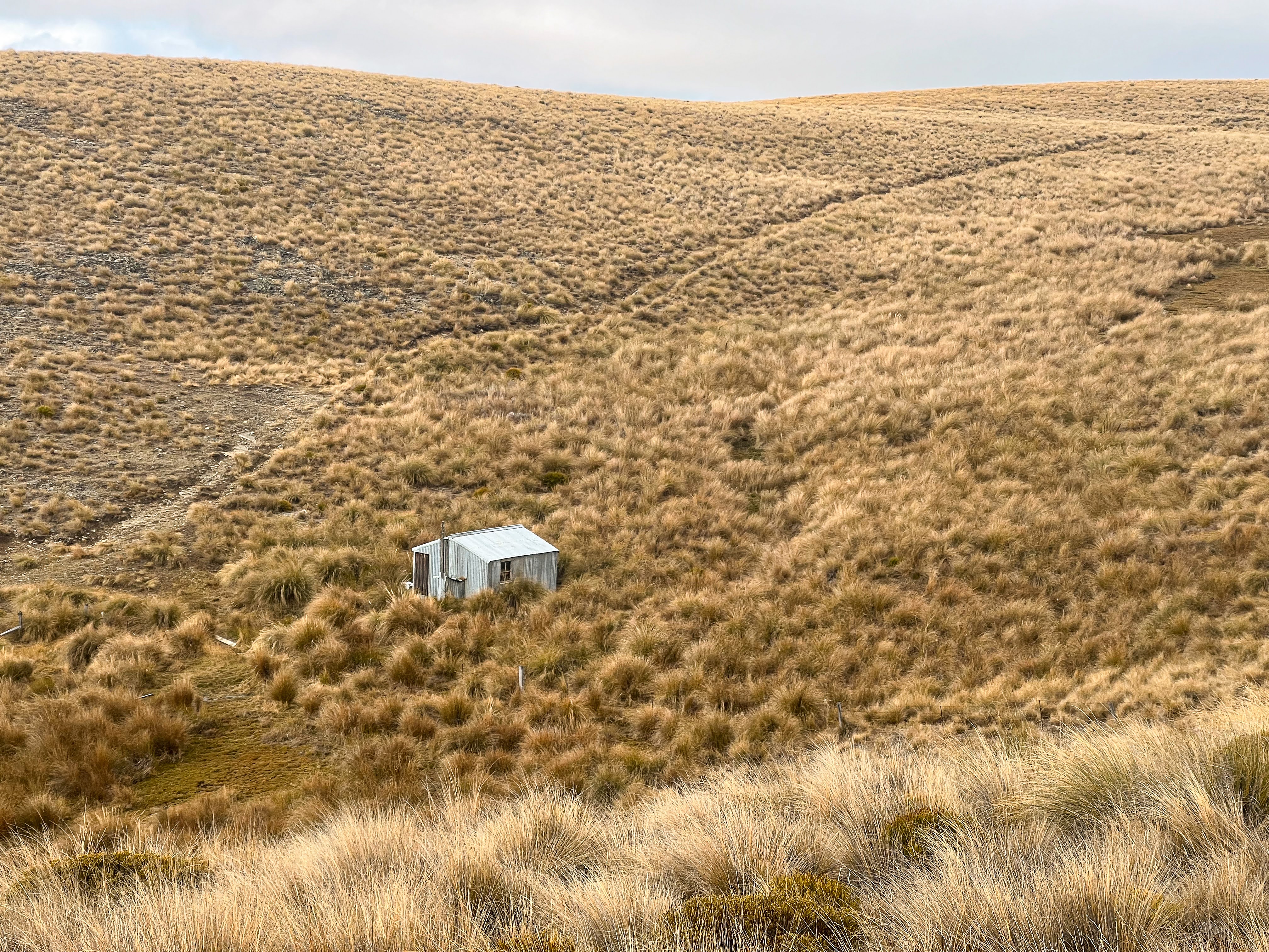
Pig Shit Inn was a pearler. Stone walls, flagstone floor, wood box, clean cooking bench, good bunks and mattresses, toilet and river out front. It even had a couple of folding chairs, one of which I took outside to sit in the sun and eat my lunch. It was too early to stop, so I reluctantly left to head to Tailings Hut.


Once the steep climb back to the intersection had been accomplished I headed straight on. Down to another river crossing and then a long climb up to the top of a ridge which I then followed along until the long descent to Guffies Creek. I could see lots of vehicles travelling up and down the road to the Hawkdun Range and even more vehicles down in the main valley as I descended. I would be joining the main route through the conservation area so I was expecting I wouldn't be alone. Especially at Easter!!
 |
| The steep rocky track to/from the hut |

It was a long winding descent and my feet started to feel sore. I crossed a tributary and then climbed back up a steep hill to descend into Guffie Creek itself, passed by two 4WDs heading to Pig Shit Inn. The final bit of track to Tailings Hut involved a number of river crossings, and despite my efforts all day to stay dry I ended the day with wet feet. I could have taken my shoes off but I was too tired by then.


I arrived at Tailings Hut about 4pm. A family group of six who had tramped from Ida Hut, and a group of four hunters on ATVs were already there. There was one bunk free in the hunters' room so I grabbed that rather than putting the tent up, though I was warned they snored. A few more 4WD groups came and went, electing to go elsewhere to camp the night.

The hunters were generous with their beverages, offering me a beer or a gin and tonic mixed drink. I went with the gin. They didn't seem all that keen to go looking for deer, saying it was too windy and the deer would just lie down in the tussock and you wouldn't be able to see them.
I had mentioned that I was planning to change my route for the next day as I not only didn't have a usable water bladder, but I hadn't checked how much gas was in my canister before packing it on the trip. I was concerned I wouldn't have enough gas to get me through another full day, so had decided to miss Long Spur and just walk up Guffies Creek and back to the car via Buster Diggings. This was the route the family of six were planning to take. There were a number of old water bottles at the hut so the water situation was solved, but my gas anxiety wasn't. To my surprise, and relief, one of the hunters gave me a small gas canister which was full, and surplus to his needs, and then gave me his water bladder as well. I protested, but he claimed he didn't drink much water anyway (just beer!) and he was planning on throwing it away when he got home. I gratefully accepted his generosity.
After dinner I headed early to bed. The hunters went out on their bikes but weren't gone all that long. I had put my earplugs in so the snoring wasn't too bad, and I slept fairly well.
Day 3 Tailings Hut to Blue Duck Creek Hut via Long Spur 5 hours
I got up at 6, and left at 8.
The hunters, who had initially got up before sunrise, had gone back to bed, claiming it was too windy and the deer just stay lying down in the tussock. They had offered to cook me a big breakfast but they didn't get going on their cooking until I was almost ready to leave, so it was just my usual coffee and on the road. I farewelled the family, who left a good 30 minutes before me.
I headed off up the hill and then began the long long climb up the spur. It was mostly not too steep, with even some flat bits and a few puddles to walk around and the views were stupendous. I got even better views of Mt Cook.


I popped over to see Long Promise Hut, then continued along on the track just above it.
There was a cold wind blowing so I stayed rugged up in rain trousers and jacket all day, climbing without feeling sweaty. My beanie came on and off, my liner gloves stayed on all morning yet my hands still felt a bit cold.
I surprised a Karearea gliding low along the track towards me. It veered off into the tussock just before he reached me. Pretty cool!


I got up to a large cairn with a stick in it, and could see the turnoff to Soldiers Hilton so I walked down to that and on to the hut. It wasn't locked so I had a look inside and wrote in the visitor book then ate lunch outside in the sun, even though it was only 11:30.


I walked straight up the hill behind the hut to rejoin the main track, continuing its relentless climb upward. The views were stunning but the wind seemed to be getting stronger. I'd put my waterproof gloves on over the glove liners and was much warmer.


From the end of the ridge the track sidled across under a peak to a saddle, with views down into the Maniototo. Below the saddle, in a wee gully, was Blue Duck Creek Hut. It was a steep descent to a pretty spot, but not as sheltered from the wind as I thought it would be. I arrived at 1pm and decided to call it a day. 5 hours walking in the cold wind was quite enough for one day.


The hut was in poor shape. The door was secured with a wire but you needed to lift the door to open it. A damp dirt floor, bunks in disrepair, kapok mattresses mostly buggered, but two decent one's hanging from beams, a partially glazed window, and a fireplace that had almost been burnt itself. And lots of rubbish. Not very salubrious at all!


I looked around for a flat tent site. The area was really boggy, and nowhere was totally flat, so I decided to make do with sleeping in the hut. I pulled down one of the good mattresses and threw it on top of one of the ruined mattresses. A bit lumpy, but surprisingly comfortable. I patched up the broken window with a large builders bag I found on one of the bunks and found a couple of biscuit tins to use for a cooking platform. I'd brought my camping chair so I now had a fairly weather tight and comfortable place for the evening and night. I sat out in the sun to read for a while, but the cold wind had me retreating inside once the sun left the valley.


Even after a cuppa, soup, a cooked dinner, then heating some water to get burnt food off the bottom of my pot I still had some gas left!! Perhaps my gas anxiety was unwarranted....
I was in bed by 6pm, reading a while before getting some sleep.
Day 4 Blue Duck Creek Hut to Mt Buster Rd 3.25hrs
I slept okay considering my accommodation! The mattress was lumpy but not musty or damp and I got a reasonable amount of sleep. There were a few rain showers overnight but I stayed perfectly dry in the hut.
It was a much warmer morning, and though the rain cleared it remained overcast. It was still windy but the wind direction had changed so it wasn't cold like the day before. I walked in shorts and my rain pants, leaving at 7:40 for the big climb back up to the saddle and then a further climb from the saddle up to the next ridge.


The ridge track went up and down and then across to Mt Buster, with great views across to the diggings, and down into the Maniototo. I saw no-one, and no vehicles either. I joined the main track where it began its descent to the Kyeburn River. The clouds were clearing, with more blue sky appearing, and once I was heading downhill I was out of the wind and able to remove my rain pants and just walk in my shorts. It was grand to be walking downhill, on an admittedly steep track and enjoying those massive vistas that are unique to the Maniototo.

It was only when I was removing my shoes at Kokonga Hut to cross the Kyeburn River that I saw my first 4WD vehicle of the day. Once over the shallow crossing I walked the couple of hundred metres back to the car in my Crocs.


There was no problem crossing the fords back to Danseys Pass Rd. I headed back to Naseby for a well earned Eggs Benedict with bacon and avocado, then drove home to Wanaka.

No comments:
Post a Comment